
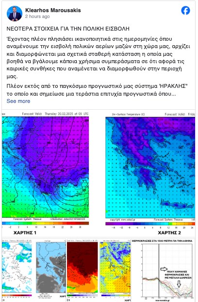
For yet another Sunday, the excitement surrounding the weather forecast is reaching its peak, with predictions of extremely cold conditions and the possibility of polar air masses affecting Greece in the coming days. Klearchos Marousakis indicates that we are getting close to the dates when we expect a polar invasion of air masses, and a relatively stable weather situation is starting to form, allowing for more accurate predictions.
Sunday (16/2) and Monday: A late autumn-like weather pattern will dominate, with rainstorms prevailing, snow falling at higher altitudes, and relatively mild temperatures due to southern winds. The intensity of the weather phenomena will be stronger in the western, central, and southern regions, and the eastern Aegean, as the meteorologist points out.
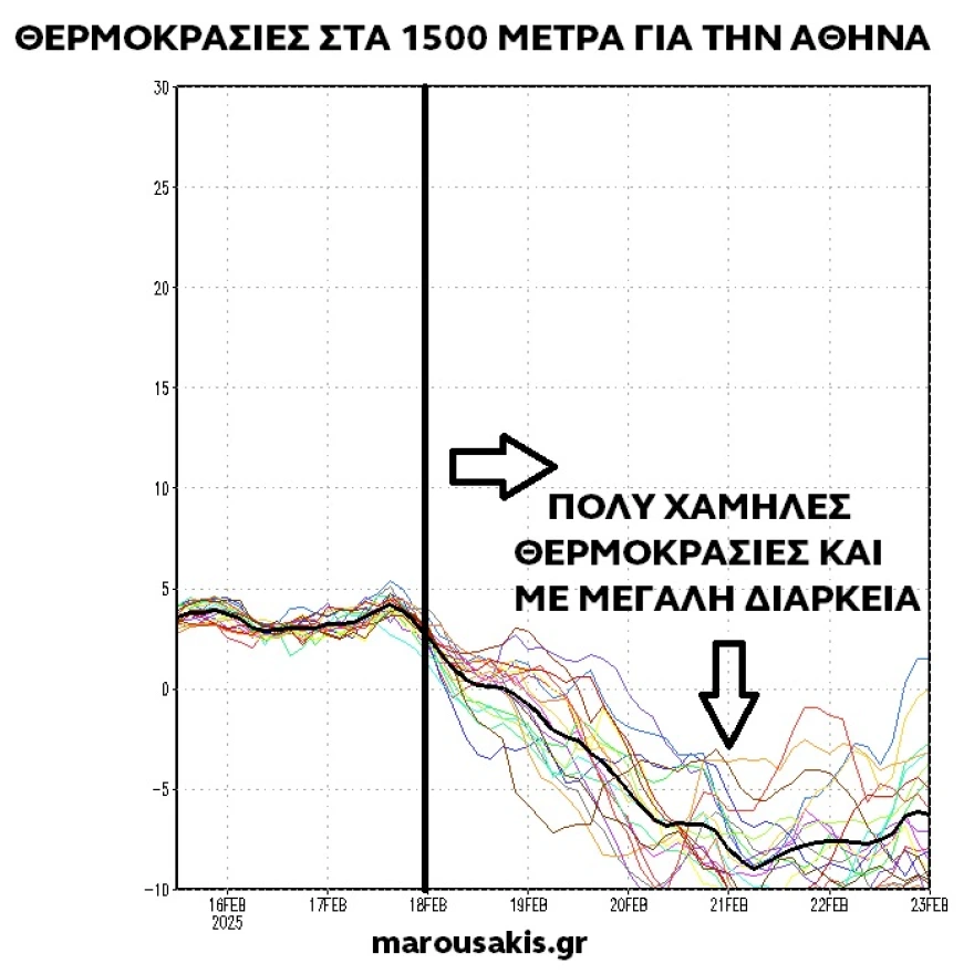
From Tuesday onwards (for at least a week): A change in atmospheric circulation is expected, bringing weather from the northern and northeastern parts, with polar air masses engulfing Greece. As a result, extremely low temperatures are anticipated, potentially reaching -12° to -14°C in some areas, with a focus on the far north, northwest, and northeast. These areas will also experience clear skies for extended periods.

The meteorologist also warns of the possibility of a total freeze (sub-zero temperatures for 24 hours), which may lead to significant issues for farmers. They will need to prepare accordingly.
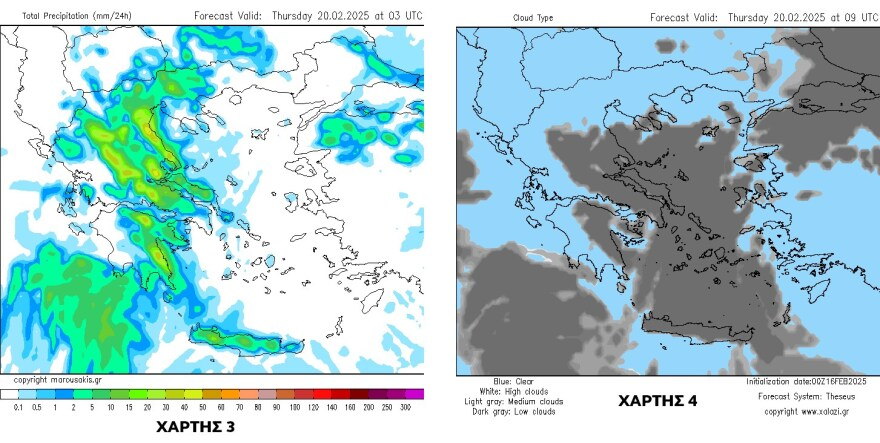
Tsiknopempti (Clean Monday): The movement of the polar air towards Greece will bring bad weather, with intense phenomena likely to occur on the Wednesday-Thursday period (Clean Monday). This will primarily affect regions to the east of the Pindus mountain range, including Attica, with very high chances of heavy snowfall even in semi-flat and low-lying areas.

Strong Winds: The clash between the polar air and warmer air masses will lead to strong, locally stormy northern winds, especially in the Aegean region. Southern Crete will be particularly affected by these winds.
By Friday, we expect the phenomena to weaken, but the eastern areas, influenced by the Aegean, may continue to experience smaller intensity weather. As for the days following Friday, the forecast remains uncertain, but it is expected that the cold will persist, with freezing conditions likely to continue.
There are also indications that another snowstorm may form by Sunday, potentially more intense and affecting a wider area. We will revisit the forecast as we approach the weekend for more detailed information from the regional forecasting system “THESEAS”.
Have a lovely Sunday to all!
Ask me anything
Explore related questions