The Risk Assessment Committee was convened this morning by the Minister of Climate Change and Civil Protection, Giannis Kefalogiannis in view of the worsening weather, according to the Extraordinary Weather Bulletin of EMY.
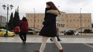
According to the Commission’s scientists, from tomorrow Tuesday until Wednesday the temperature drop will be significant (averaging 15°C) and there will be heavy rain, thunderstorms and snowfall in the mountains, semi-mountainous continental areas. The phenomena will be intense in Thessaly, Fthiotida, Sporades, Central and Northern Evia and gusty northerly winds of 8 and locally 9 Beaufort will prevail in the Aegean.
As the Ministry of Climate Crisis and Civil Protection said in a statement, the Civil Protection Operations Center has contacted the local authorities, security forces, highway concessionaires, etc., in order for all stakeholders to be fully informed about the impending weather phenomena and to be in operational readiness.
It is noted that according to the Emergency Weather Bulletin issued today by the National Meteorological Service (EMY), a deterioration of the weather in our country is predicted on Tuesday 18-03-2025 and Wednesday 19-03-25 with a significant drop in temperature (by a total of 12 to 15 degrees), with heavy rains, thunderstorms and snowfall in the mountains, the semi-mountains and in some areas of the eastern mainland with lower altitude. Gusty northerly northeasterly winds of 8 and locally 9 Beaufort will blow in the Aegean and eastern continental areas from Tuesday afternoon until the evening hours of Wednesday.
From the evening to the evening and from Wednesday to Wednesday from noon to noon.
More details:
Α. Heavy showers and thunderstorms are forecast:
1. Heavy rains in Thrace from the morning hours of Tuesday 18-03-25 until the afternoon of the same day.
2. Heavy rain and thunderstorms in Halkidiki, Thessaly (mainly Magnesia), Sporades, Evia, Fthiotida and Boeotia from early afternoon on Tuesday 18-03-25 until the early hours of Wednesday 19-03-2025.
Β. Snowfall will be locally dense:
1. From midday on Tuesday 18-03-25 until the evening of the same day in the mountains, the semi-mountains of Macedonia, Thrace and Epirus, while in Macedonia and Thrace it will snow in areas with lower altitude.
In Macedonia and Thrace, in Macedonia and Thrace, in regions with lower altitudes and lower altitudes.
2. From the late afternoon of Tuesday 18-03-25 until the early hours of Wednesday 19-03-25 in the mountains, the semi-mountains and in areas with lower altitude in Thessaly, Evia, Evritania, Fthiotida and Boeotia.
3. On Wednesday 19-03-25 until midday in the mountains and semi-mountains of the eastern Peloponnese and until the evening in the mountains of Crete.
Citizens can be informed daily about the development of extraordinary weather phenomena in the regular weather bulletins of EMY and on the EMY website at www.emy.gr (www.oldportal.emy.gr)
Civil Protection recommendations to citizens due to the worsening weather conditions
The Civil Protection recommends citizens to be particularly careful, ensuring that they take measures to protect themselves from the risks arising from the occurrence of severe weather phenomena.
The General Secretariat of Civil Protection (civilprotection.gov.gr) of the Ministry of Climate Crisis and Civil Protection has informed the relevant government departments involved, as well as the regions and municipalities of the country, in order to be in increased readiness for civil protection, in order to deal immediately with the effects of the outbreak of severe weather phenomena.
In particular, in areas where heavy rainfall, thunderstorms or gusty winds are predicted, the GIS recommends that citizens:
-To secure items which, if carried away by severe weather, may cause damage or injury.
-To make sure that gutters and downspouts of residences are not clogged and are functioning properly.
-Avoid crossing streams and creeks, on foot or by vehicle, during storms and rainstorms and for several hours after they have ended.
-Avoid outdoor work and activities in marine and coastal areas during the onset of severe weather events (risk of lightning strikes).
-Take shelter immediately during a hailstorm. Take shelter in a building or car and do not leave the safe area until they are sure the storm has passed. Hail can be very dangerous for animals as well.
-Avoid crossing under large trees, under posted signs, and generally from areas where light objects (e.g., pots, broken glass, etc.) can become detached and fall to the ground (e.g., under balconies).
-Follow strictly the instructions of the local authorities, such as traffic police etc.
In areas where snowfall and frost is predicted:
If they are going to travel by car:
-To be informed about the weather and the condition of the road network
-Have anti-slip chains and a full tank of fuel in their vehicle
-To travel, if necessary, preferably during the daytime, preferably on main roads
-To inform their relatives of the route they are going to take
-Change their travel schedule to avoid the peak weather conditions
-Follow strictly the instructions of the relevant local authorities, such as the traffic police, etc.
If they move on foot:
-Dress in several layers of light clothing instead of one heavy garment and wear appropriate shoes to avoid injuries due to slipperiness
-Avoid unnecessary travel during peak weather conditions (heavy snowfall, freezing conditions).
Ask me anything
Explore related questions


