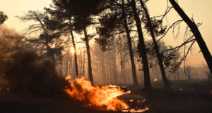
A significant increase in soil temperature in areas where forest vegetation has been destroyed by fire, confirms satellite data analyzed by the Meteo unit of the National Observatory of Athens.
Specifically, the meteo unit of the National Observatory of Athens analyzed satellite data from two consecutive warm periods: 17 July 2024, before the devastating Varnavas/Penteli fire, and 26 June 2025, about eleven months later. Comparison between the two dates reveals temperature differences of 1-2°C in many areas, which can be attributed to natural variations in weather conditions.
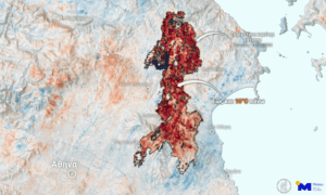
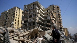
However, of particular interest is the area affected by the Great Fire of August 2024, as a map of this area shows that within the boundaries of the burned area, ground temperature values in June 2025 appear elevated by up to 10°C compared to those in July 2024, before the fire. Despite the passage of a significant period of time, as the METEO unit points out, the loss of vegetation still has a strong impact on the energy balance of the area, leading to significant surface warming.
As meteo notes, among other things, the measurements are for surface ground temperature. However, it stresses that it is reasonable to expect similar – albeit smaller – differences in near-surface air temperature.
“In conclusion, the satellite data confirm that the destruction of forest vegetation due to fire involves a significant increase in ground temperature, with potential impacts on the microclimate, and the general ecological balance of the region.”
Meteo concludes.
Ask me anything
Explore related questions