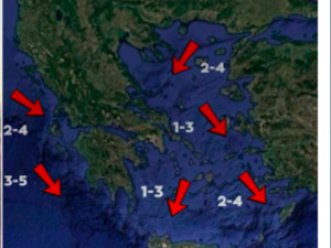
After the weekend highs of 27°C, the weather is expected to turn more autumnal in the coming days, with clouds, rain, and thunderstorms beginning on Wednesday, while temperatures will fall to 20–24°C. Winds will strengthen again toward the end of the week, mainly in the Ionian.
🎯ΑΠΟ ΤΑ ΜΕΣΑ ΤΗΣ ΕΒΔΟΜΑΔΟΣ ΚΑΙ ΜΕΤΑ, ΠΡΟΒΛΕΠΟΝΤΑΙ ΟΥΣΙΑΣΤΙΚΕΣ ΒΡΟΧΕΣ ΚΥΡΙΩΣ ΣΤΑ ΔΥΤΙΚΑ ΚΑΙ ΒΟΡΕΙΑ
— Theodoros Kolydas (@KolydasT) October 13, 2025
✅Ξεκινάνε λίγες βροχές σήμερα και αύριο στα δυτικά και νότια και την Τετάρτη στα ανατολικά ηπειρωτικά, τα νησιά του βορείου Αιγαίου, τις Σποράδες και την Εύβοια. Αρκετές βροχές… pic.twitter.com/JnM0qe2tfR
According to Thodoris Kolydas, “from midweek, significant rainfall is forecast, mainly in the west and north.” The Star Channel meteorologist stated in a post:
“A few showers will start in the west and south, and by Wednesday in the eastern mainland, the northern Aegean islands, the Sporades, and Evia.
On Thursday, we’ll see more rainfall, while on Friday the weather phenomena will intensify, affecting the Ionian, Epirus, western Central Greece, and northwestern Peloponnese, gradually extending to central and northern regions.
Temperatures will drop slightly by 2–3 degrees, and winds will not exceed 5–6 Beaufort.”
“An Autumn from the Past”
Meteorologist Giorgos Tsatrafilias wrote in a post:
“With scattered light rain (except in the Aegean islands and Thrace) and cloudiness, the weather will progress until Thursday, October 16, 2025.
Temperatures throughout the week will remain near seasonal norms, providing thermal comfort.
A ceiling of 22°C in lowland areas and single-digit lows overnight and early morning in mountainous regions of central and northern Greece.”
He adds:
“From early Friday, a well-organized weather system affecting neighboring Italy seems likely to bring more rain and strong southerly winds to western Greece. This system will be evaluated in the coming 24 hours.”
In a postscript, Tsatrafilias notes:
“In Attica, I don’t expect anything significant. Temperatures will range between 11–23°C.”
Today’s Weather
Clouds will gradually increase, with local showers expected in the southern Ionian, Peloponnese, western Crete, and in mainland mountainous regions during midday and afternoon.
Isolated thunderstorms may occur in southeastern Peloponnese early in the morning.
During the night and early morning, visibility will be locally limited, and fog will form in mainland areas.
Temperatures:
- Western Macedonia: 4–18°C
- Rest of Macedonia & Thrace: 10–22°C
- Thessaly: 10–23°C
- Epirus: 9–21°C
- Other mainland regions: 9–23°C
- Ionian Islands: 12–21°C
- Aegean Islands: 12–23°C
- Crete: 10–24°C
Winds: North to northwest at 2–3 Beaufort, up to 4 Beaufort in the Aegean.
Attica Forecast
Clear skies with local cloudiness at midday and in the afternoon.
Winds: Northerly, gradually turning variable at 2–4 Beaufort.
Temperature: 12–23°C
Thessaloniki Forecast
Clear skies with intermittent light cloud cover.
Winds: Variable, 2–4 Beaufort.
Temperature: 9–21°C
Weather on Wednesday, October 15
In eastern mainland, Sporades, Evia, and Crete: Cloudy with local showers, and by afternoon, isolated thunderstorms, especially in the north.
Elsewhere: Partly cloudy, becoming denser in western mainland, with showers or rain in the afternoon.
Fog is expected in the west during early morning hours.
Winds:
- West: Variable, 2–3 Beaufort
- Elsewhere: Northerly, 3–4 Beaufort, locally 5 in the Aegean
Temperature: Slight drop in the north.
- North: 19–21°C
- Rest of the country: 22–24°C
- Dodecanese: Up to 25°C
Weather on Thursday, October 16
In the Ionian and mainland: Cloudy with showers or rain.
From late evening, rain will intensify in the west, with scattered thunderstorms.
Elsewhere: Mostly light clouds.
Winds:
- West: E/SE winds, 4–5 Beaufort, gradually reaching 6 Beaufort in the Ionian
- East: Northerly, 3–5 Beaufort
Temperature: Slight further drop in central and northern regions.
Weather on Friday, October 17
In the Ionian, Epirus, western Central Greece, and northwestern Peloponnese: Cloudy with rain and scattered thunderstorms, possibly locally intense in the northwest.
Rest of mainland: Cloudy with rain from midday.
Elsewhere: Partly cloudy, becoming denser at times.
Winds:
- West: E/SE winds, 5–6 Beaufort, up to 7–8 in the Ionian
- East: Initially northerly, 4–5 Beaufort, turning SE in the afternoon with same intensity
Temperature: No significant change.
Weather on Saturday, October 18
In the west, north, and eastern Aegean islands: Cloudy with rain and isolated thunderstorms.
Rain will weaken in the west by late afternoon.
Elsewhere: Light clouds, occasionally denser, with chance of local showers.
Winds:
- West: S/SW, 4–6 Beaufort, gradually turning W/NW with same intensity
- East: S/SW, 4–5 Beaufort
Temperature: Slight rise in southern regions.
Ask me anything
Explore related questions


