U.S. President Donald Trump insists that Washington must obtain ownership of Greenland for reasons of national security, at a time when—despite objections in both the United States and Europe—there is broad agreement on the strategic importance of the Arctic island for the defense of the West.
Although many Americans and Europeans believe that the U.S. does not need to acquire the Arctic island to strengthen its northern defenses, it is widely acknowledged that Greenland plays a decisive role in the naval and missile defense of North America, as well as of the entire North Atlantic.
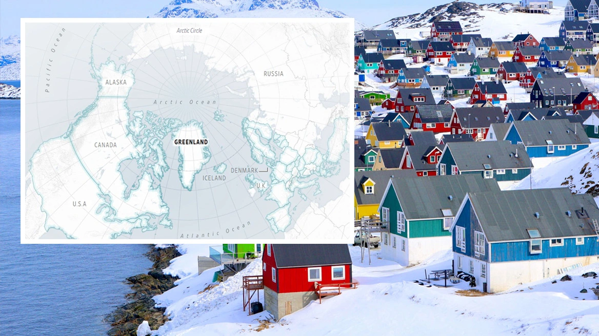
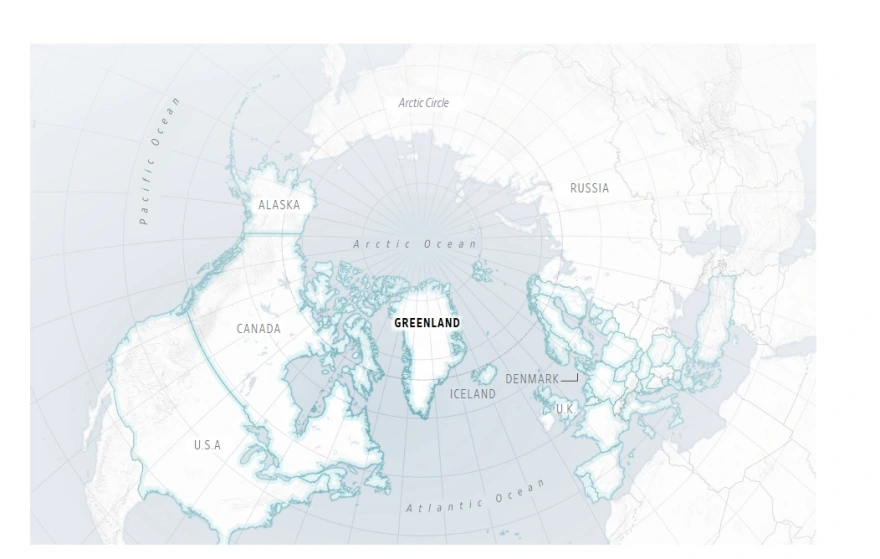
Greenland’s Position Between the Atlantic and the Arctic Oceans
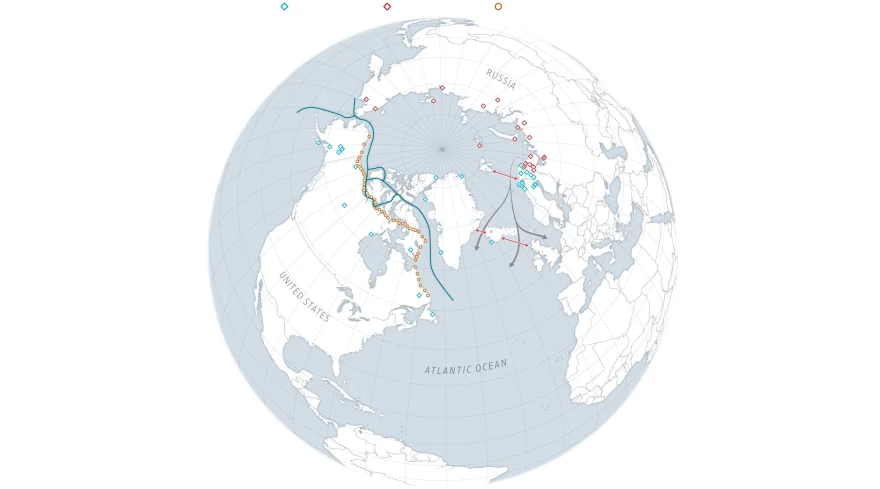
As the Wall Street Journal notes, on many maps Greenland appears remote and disproportionately large. This is partly due to the way the spherical Earth is projected onto flat maps. When the island is shown with accurate size proportions, however, it appears smaller than it is usually depicted and much closer to North America, positioned squarely at the center of NATO’s geographic territory.
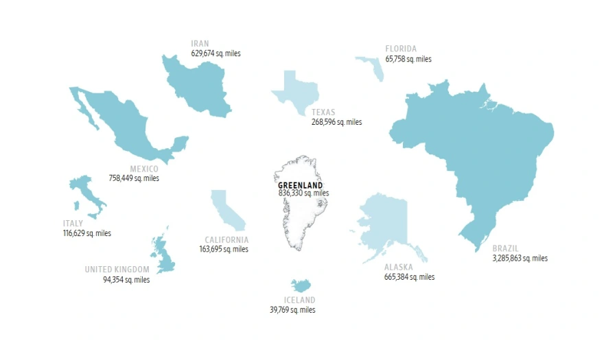
Larger Than California and Mexico, Nearly Four Times the Size of Texas
Even in more realistic depictions, Greenland remains enormous. It is larger than both California and Mexico and nearly four times larger than Texas. Beyond its size, however, the island occupies an exceptionally strategic position: it lies between NATO territories in North America and Europe, between NATO and Russia, and at the eastern edge of the Arctic.
This geographic reality explains why the United States has repeatedly attempted, for more than a century, to acquire Greenland.
NATO and Russian Bases in the Arctic
Greenland sits at the point where the Atlantic Ocean meets the Arctic Ocean. Russian ships and submarines traveling south from bases across the wider Arctic region pass through maritime zones between Greenland, Iceland, the United Kingdom, and Norway. All of these areas belong to NATO and are considered critical defensive chokepoints for the Alliance.
Following Russia’s invasion of Ukraine in 2022, NATO has strengthened air and naval patrols in these waters.
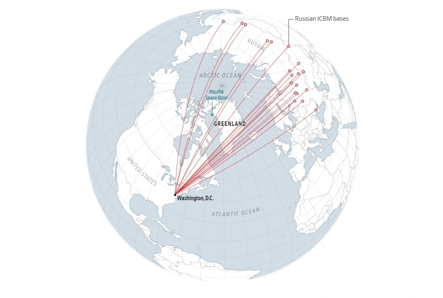
A Key Role in Missile and Air Defense
The island also plays a crucial role in NATO’s air defense. Along the shortest air route between Moscow and Washington—an arc known as the “great circle route”—Greenland lies roughly at the midpoint. For this reason, it is considered the first line of NATO’s defense across much of the Arctic.
If Russia or China were to launch intercontinental ballistic missiles against the United States, many of them are believed to pass over Greenland. This is why the U.S. maintains a Space Force base on the island, which continuously monitors the skies for potential threats.
At the same time, the United States and NATO are considering installing additional missile-detection equipment in Greenland and nearby areas.
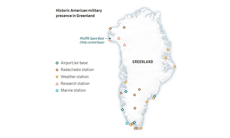
From the Cold War to Today
During the Cold War, the United States and its allies maintained military bases across Greenland. Forces stationed there monitored Soviet ships and submarines and were prepared to defend the island in the event of an invasion or attack.
Today, the U.S. military presence has been significantly reduced, with approximately 150 troops remaining on the island—a sharp decline from the peak of around 15,000 troops deployed in the past.
Ask me anything
Explore related questions