





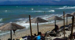
The weather today will be generally clear, with temporary cloud cover in Crete, where there is a chance of light local rain in the north. During the midday and afternoon hours, clouds will develop over the mountainous mainland areas, with local showers in the mountains of Epirus.
However, the winds will remain strong, with variable winds in the west gradually becoming westerly northwesterly at 3 to 4 Beaufort. In the east, winds will be northerly at 4 to 6 Beaufort, and in the Aegean at 6 to 7 Beaufort.
Temperatures will rise slightly, mainly in the east, reaching 29 to 32 degrees Celsius in the Cyclades and the Ionian Islands, 32 to 34 degrees across the rest of the country, and locally 35 degrees Celsius on the mainland and in the Dodecanese.
Based on these conditions, the General Secretariat for Civil Protection has placed 7 areas under Red Code for wildfire risk, specifically: the Region of Attica (including the island of Kythira), the Regional Units of Boeotia and Evia in the Region of Central Greece (including the island of Skyros), the Regional Unit of the Cyclades in the Region of South Aegean, and the Region of Crete.
Weather forecast by region
MACEDONIA, THRACE
Weather: Generally clear, with temporary cloud cover during the midday and afternoon hours in mountainous areas.
Winds: Northeasterly 3 to 5 and temporarily up to 6 Beaufort in the east during the morning. In central areas, easterly at 3 to 4, gradually becoming southerly with the same intensity.
Temperature: 18 to 34 degrees Celsius.
IONIAN ISLANDS, EPIRUS, WESTERN CENTRAL GREECE, WESTERN PELOPONNESE
Weather: Generally clear, with temporary cloud cover over the mainland, mainly in mountainous areas, during the midday and afternoon hours, when local showers and possibly isolated thunderstorms will occur in the mountains of Epirus.
Winds: Variable 3 to 4 Beaufort, gradually becoming westerly northwesterly with the same intensity.
Temperature: 21 to 32 degrees Celsius, locally 34 to 35 degrees on the mainland.
THESSALY, EASTERN CENTRAL GREECE, EVIA, EASTERN PELOPONNESE
Weather: Generally clear, with a few temporary clouds during the midday and afternoon hours in the mainland mountainous areas.
Winds: Northerly northeasterly 4 to 6, locally temporarily reaching 7 Beaufort in the east, weakening from midday.
Temperature: 21 to 34 degrees Celsius, locally 35 degrees in the eastern Peloponnese.
CYCLADES, CRETE
Weather: Generally clear in the Cyclades, with a few temporary clouds in the morning. In Crete, temporary cloud cover with a chance of light local rain in the north.
Winds: Northerly 6 to 7 Beaufort, weakening from the evening.
Temperature: 23 to 29 degrees Celsius, locally 33 to 34 degrees in southern Crete.
EASTERN AEGEAN ISLANDS – DODECANESE
Weather: A few clouds, temporarily increasing, with a chance of isolated thunderstorms.
Winds: Northerly 6 to 7 Beaufort, weakening in the evening.
Temperature: 23 to 34 to 35 degrees Celsius.
ATTICA
Weather: Generally clear, with a few temporary clouds in the morning.
Winds: Northerly northeasterly 4 to 6 and temporarily up to 7 Beaufort in the east, gradually weakening from midday.
Temperature: 23 to 32 to 33 degrees Celsius.
THESSALONIKI
Weather: Generally clear.
Winds: Variable 3 to 4 Beaufort, becoming southerly from midday with the same intensity.
Temperature: 22 to 33 degrees Celsius.
Weather forecast through Wednesday
Tomorrow, Monday, the weather will be generally clear, with temporary cloud cover over the mainland during the midday and afternoon hours, when local showers and possibly isolated thunderstorms will occur, mainly in the western mountainous areas.
Winds will be westerly at 3 to 4 Beaufort in the west, northerly at 4 to 5 in the east, and locally 6, temporarily reaching 7 Beaufort in the southeastern Aegean.
Temperatures will not change significantly, reaching 30 to 33 degrees Celsius in most areas and locally 34 to 35 degrees Celsius on the mainland and in the southeastern islands.
On Tuesday, the north will initially have generally clear weather, while from midday clouds will develop and local rain or showers and possibly isolated thunderstorms will occur, mainly in mountainous areas. Elsewhere, the weather will be generally clear, with a few temporary clouds over the mainland mountains and the mountains of Crete during the midday and afternoon hours, when local rain or showers are possible.
Visibility may be locally reduced in the western mainland areas during the morning.
Winds will be variable at 3 to 4 Beaufort and westerly at 4 to 5 Beaufort over the southern seas. Gradually, winds in the west will turn westerly northwesterly, reaching up to 5 Beaufort.
Temperatures will not change significantly.
On Wednesday, temporarily increased cloud cover in the northeast will bring local rain and possibly isolated thunderstorms, followed by rapid improvement. In the rest of the country, the weather will be generally clear, with temporary cloud cover during the midday and afternoon hours over the mainland mountains and the mountains of Crete, when local rain or showers will occur.
Visibility may be locally reduced in the western mainland areas during the morning.
Winds will be northerly at 3 to 5 Beaufort and locally 6 Beaufort in the Aegean.
Temperatures will fall slightly in the east and north.
Ask me anything
Explore related questions




