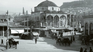
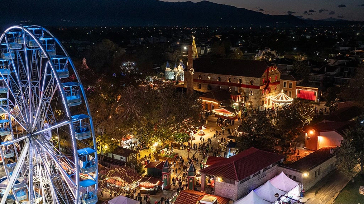
Koukaki, Rouf, Gyzi, Patisia, Maroussi, Faliro, Filothei. Neighborhoods of Athens and areas around it where thousands of people live permanently or visit daily. How many people know that they owe their names respectively to Koukakis, Rouf, Patis Aga, Agia Filothei? Who were they all, when did they live and how exactly were they associated with these areas? The journey through time for the answers to these questions reveals important truths and some surprises.
From the beginning.
Athens owes its name to the goddess Athena. Athena dueled with Poseidon to see who could offer the best gift to the city, with the prize being its naming. She planted an olive tree on the rock of the Acropolis, while Poseidon used his trident to open a stream from which water flowed. According to one version, the sole judge was the then King Kekropas, who chose as the best gift that of the goddess of wisdom. According to another, the citizens voted and by one vote they made the same choice. In any case, the name of Athens is attributed to an ancient deity.
In contrast, many of today’s districts and surrounding areas and suburbs of Athens owe their names to a real person, closely associated with each of them. They are the “godfathers” of these districts. In many cases, they are big landowners – owners of large tracts of land in them. Other regions owe their name to monks who lived in them, others to foreigners who for some reason were associated with them. There is also the direct transfer of names of Asia Minor towns to various areas where refugees settled after the Mikrashian Catastrophe in 1922.

Neighbourhoods in the centre
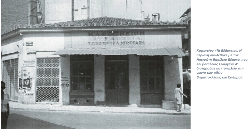
The notorious Exarchia, the iconic area in the heart of Athens, was named after the Epirus-born Basil Exarchos, who during the reign of George I kept a grocery store on the corner of Themistokleous and Solomou streets. During the 19th century they were called Pitharadika, because of the many pith workshops that existed there. At a young age, Exarchos left Staritsiani (now Pournia) in Ioannina and sought his fortune in Athens. With much effort and a bank loan he bought a property in what is now Exarchia. Apart from his own grocery store, there was still a bakery and a kitchen. Very quickly his shop became a favorite of the residents.
The Chaitia, the small but historic area of a few blocks next to Omonia, has as its “godfather” the 1821 fighter Dimitrios Chautas, owner of the “Café of the Elders” on Aeolou Street. However, according to the writings of Gregory Xenopoulos in 1913 in the “Gazette” about this area, “it is indeed the centre, the heart of Athens… The old name, which was left over from the hotel or the horseshoe factory -I don’t remember it well- of a man named Hautas, has been reworked and extended throughout the whole area”. Therefore, the question remains whether Hautas was ultimately running a café, a shoe mill or a hotel. But it matters little.
The district of Gyzi owes its name to a street which was given the name of the painter from Tinos, Nikolaos Gyzi, in 1901, the year of his death, by the Municipality of Athens as a mark of honour. The paraphrase from Gyzi to Gyzi is due to the way the name is pronounced, as he lived from 1865 until he died in Munich, signing his works in Latin characters. The name Gyzi was established in 1925, from the signage of the first city buses that served the growing new district by following the street of the same name that ran through it.
Georgios Koukakis, a manufacturer of iron beds at the height of the old Fix factory, was the first to build a house in the area southeast of the Acropolis, on the corner of Dimitrakopoulou and Georgaki Olympiou streets. This was demolished in the middle of the 20th century. Koukakis gave the name to the area around 1900.
Once upon a time in Patissia
The Probona area at the end of Patisia, between Podonifti, the electric railway lines and the homonymous grove, was first inhabited around 1870 by the family of Michalis Anagnostou. It owes its name to the Naxian pharmacist D. Probonas (1874-1949). He had a large garden there, about 40 acres, which he donated to the Municipality of Athens. Today the famous flower market operates there.
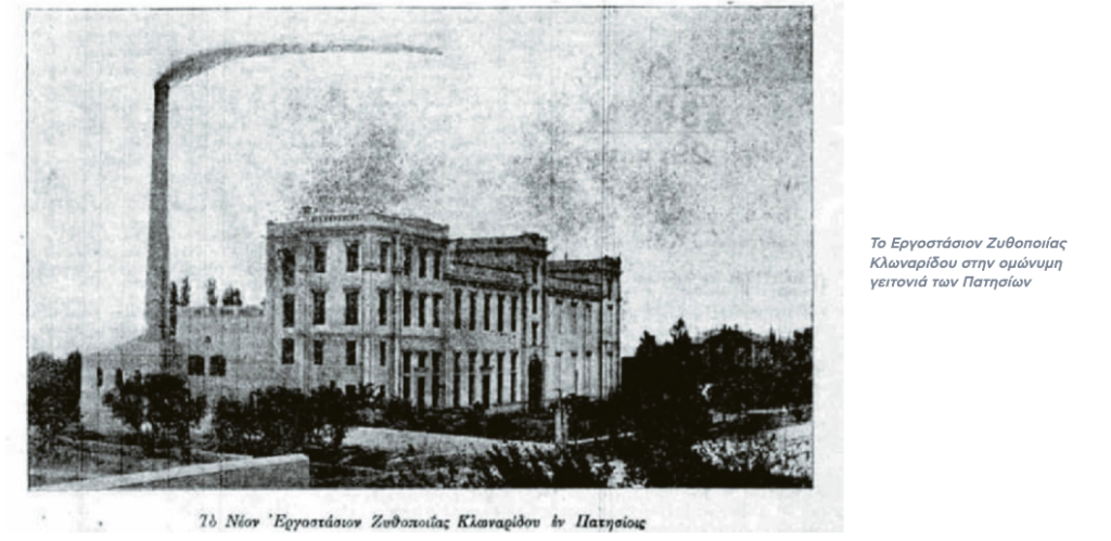
In the square formed by Ionia Avenue and Kautantzoglou, Patision and Sarandaporou streets, the area of Klonaridou is delimited. At the intersection of Patision and Kautantzoglou, the brewery and ice-cream factory of the Asia Minor brothers Miltiades and Errikos Klonaridis was built around 1900, as well as the family’s villa designed by Ernst Chiller. Not, however, in the model of the neoclassical houses designed by Chiller, but of a rural residence.
The area owes its name to them. Later the factory was sold to Charles Fix who used it as a warehouse and for ice production. Its operation ceased in 1982. The building was bought by the Municipality of Athens in the mid-1990s, was demolished amidst opposition and today the Klonaridou-Fix Park has been developed on the site.
In the area where the park was built in the late 19th century, it has now been replaced by the Park of Klitnon-Klindaron and Park of Klitnon-Klindon.
The Koliatsos Square and the surrounding area were named after the mid-19th century after Stylianos Koliatsos, who had many estates there. Members of the Koliatsos family were active in the 1821 Revolution and later became involved in politics.
The Lambrini, the large area between Ano Patissia, Galatsiou and Perissos, was named by the owners of the land in honor of their ancestor, the Souliot chieftain Lambros Veikos, who was killed in the battle of Analatos in 1827. The lord of the area had formed a relationship with a servant girl, Lambrini, whom he fell deeply in love with. And he dedicated the district to her so that after his death their love would remain engraved in time.
The Kypriadou district, between Galatsiou, Lambrini, Rizoupolis, and Ano Patission, one of the most beautiful in Athens, with an increased green factor, parks, squares, and several neoclassical buildings, was founded and named after the agronomist-engineer Epaminondas Kypriadis. In 1919 Kypriadis founded the company Kypriadis – Kyriazis and Sia and built the “Kypripriadis Garden” on a large area of land purchased in Patissia by his father Minos. He was the one who realized the ferry connection between Rio and Antirio in 1947.
Goudis, Painter
The name Goudi, which refers to the area between Abelokipi and Zographos, comes from a large family of Spetses, who lived there and distinguished themselves during the 1821 Revolution.
The area of Papagos was named after the marshal and later Prime Minister Alexandros Papagos. It is the creation of the Autonomous Officers’ Building Organization (AOOA), established in 1950 by the government of Sophocles Venizelos for the housing of officers of the Armed Forces.
The area of Zographou owes its name to Ioannis Zographos, a member of the party of Theodoros Diligiannis. He bought a large area of land from the widow Vournazou in 1902. He then rented it out in plots, which he sold in instalments of 112 drachmas per month. Zographos kept only one section at the junction of the present-day Al. Papagos and G. Zographou. The first houses were built in 1919. The first president of the Zographos Community was Sotirios Zographos, son of Ioannis, in 1929.
Sion Zografos, who was born in 1926, was the first son of John Zografos, who was born in 1932.
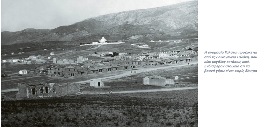
The name Galatsi comes from the Galaki family, who owned large tracts of land there. It was named in a report by Dionysios Sourmelis in 1842, but earlier it was also mentioned in various dowry contracts. The words Galati, Galaki, and Galatzi were used simultaneously and interchangeably for the same place. Even Simeon Galakis, an important figure in Athenian society at the time, signed sometimes as Galakis and sometimes as Galatzis. This was due to ‘zittakism’: the Athenians pronounced the ‘k’ as ‘t’ when the word was followed by ‘e’ or ‘i’. Thus the spelling “Galakis”, “Galatsis” and “Galatzis” were read in the same way.
The name of Agios Ioannis Renti is due to the church of the same name in the central square of the city, which belonged to the Renti family. In the 14th century, when the notary Dimitrios Rentis settled in the area helping the Catalans against Nerio Atzagioli, he received a large area of land as a reward.
Haidari seems to owe its name to the Turkish landowner Haidar Pasha, who lived in the area where the present-day Palataki is located. The tower that dominates there was located on a large fenced farm, which in ancient times was called Acherdarion. During the Turkish occupation, it came under the ownership of Haidar Pasha, who named it Haidari, with the name gradually being attributed to the whole area. It is unknown whether Haidar Pasha’s name was real or a nickname derived from the Arabic word “Haidar” meaning lion.
Discussions
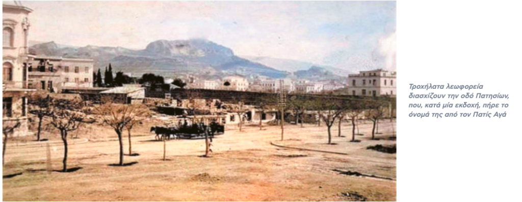
From Patis Agha or Vatisi? The reason for where Patissia owes its name. There are, in other words, two versions. According to K. Biri and G. Kairoφύλα, it comes from the ancient municipality of Vati. The adverbial type Vatisi is found in an inscription found in the Stoa of Attalos. This view has been put forward by the German archaeologist Conrad Boursian. According to D. Kaburoglou, however, it comes from a Turkish official and landowner of the area called Patis Aga.
And for Pangrati there are two versions. The strongest says that it was named after Pangratios Hercules, whose temple was in the area. This version was reinforced when in 1953 the archaeologist Ioannis Miliadis, in excavations he made amidst the construction of a pipeline in the Ilisos riverbed, at the junction of King Constantine and King George II, found reliefs and inscriptions of the post-classical period, dedicated to the sanctuary. A less convincing version, however, wants the name to come from a monk Pagratios who lived in a temple in the area during the Turkish occupation.
And there are two theories about the origin of the name of Kerameikos. The first is traced by Pausanias to the hero Keramos, son of Dionysus and Ariadne, the eponymous hero of the Athenian municipality of Kerameon. The other comes from an ancient settlement of potters, who had found an ideal place to set up their workshops on the banks of the river Heridanos.
Two theories for the area of Kolokynthos. Either it is due to the Kolokynthi family, owners of the Monastery of Agion Anargyroi of Athens, whose metochion was the Virgin Mary on the bridge of Kolokynthos. Until the middle of the 19th century, there was only the house of the priest Dimitrios Kolokynthis in the area. At the time when the area was purely agricultural, there were many orchards with pumpkin trees there. So it is more likely that the priest took his name from the area and not the other way round.
There is a similar disagreement about Dourgouti, as the part of the present-day New Cosmos, somewhere between Sygrou Avenue and Lagomitzi, Mitrou Sarcudinou and Kasomoulis streets, was formerly called. It is said that it took its name from the surname of a family (Dourgoutis or Douroutis), who bought the first fields there. Or from the name of a local Ottoman ruler during the Turkish occupation, Durgut Aga.
In 1908, by the decision of the Municipality of Athens, it was named Alopeki after the ancient Attic demos located on the same spot and with Socrates as its most prominent citizen. Later it was also called Armenika, because Armenian refugees had taken refuge there after the Genocide of 1915.
There is also a division about the origin of the name of Petrograd. One view refers to it as the “city of stone”, as it has developed on stony ground and several quarries operated there in the past. A more prevalent view, however, is that it was named in honour of Peter Yannaros, founder of the newspaper ‘Esperini’. In the early 1930s, when his son Alexandros was editor of the paper, the newspaper used to give out vouchers for the acquisition of land in the area. With 300 vouchers and by paying monthly instalments of 50 drachmas for 10 years, a total of 6,000 drachmas, one could acquire a plot of land.
And for Kamatero there are two versions. The first attributes its name to the Byzantine archon Kamatoros, a collector of state revenues in the late 12th century. The second to the first inhabitants of the area in 1816-1818, who had the surname Kamateros.
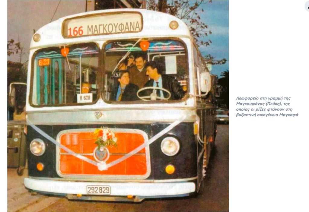
The same is true of Magoufana, today’s Pefki. The roots of its name go back to the Byzantine Maggafa family, specifically to Theodore Maggafa, a prefect in Asia Minor. His descendants in the 16th century arrived in Turkish-occupied Greece and settled in Attica. At that time, the agates of Athens granted the Magoufas bacoufas in the area of present-day Pefki. According to another version, travelers in 1843 claim that the name Magoufana comes from “Magoufa Anna”. A woman, deaf and sick with tuberculosis, rushed to the area to be cured and succeeded and lived there until her death.
Peristeri, Chalandri
There are several theories about Peristeri and the origin of its name. One that it came from the estates of the old Athenian family Peristeri. A second was that during the Turkish occupation, the area belonged to Perister Agha. It is unknown whether his name is real or comes from the wild pigeons that gathered in the area. The latter constitutes the third version, with the Arvanian word pelistare meaning pigeon.
Nor has the etymology of the name Chalandri been clarified. One theory suggests that it once had a population of 1,000 men, so it was called “Chalandrion”, “Chalandrion”. Another theory is that it originated from the Turkish landowner Chala who owned large tracts of land (in Turkish “dere”) at the site of the present-day Rematia Halandri during the Turkish occupation. Thus, Chala + dere = Chalandri.
A third states that it derives from the reduction of the place name in type from ravine to Chaladri. With the former, is a diminutive of the word haradra, due to the shape of the ground. And yet another is based on the fact that it arose from corruption. At the beginning of the 19th century, the area was called Kalandra, a name derived from the familiar galandra, a bird of the Corydalis family.
The Jewish Yusurum
Yousouroum in Monastiraki was named after the Jew Elias Yousouroum who opened the first antique shop there in the late 19th century. The Yusurum were originally from Spain, were deported by King Ferdinand just before 1500, and settled in Smyrna. In the 19th century, Isaac Yusurum settled first in Turkish-occupied Chios (1830) and then (1860) in Kythnos.
Bohor’s son, a tailor, came to Athens in 1863 and opened a clothing shop on the corner of Ermou and Karaiskaki at Monastiraki. He sewed and made clothes and every Sunday he sold them at the bazaar in Abyssinia Square. Thus the name Yusurum became identified with the bazaar, the open-air market of mainly old and second-hand items. Bearing in mind that the first synagogue of Athens was also housed in the house of Yousouroum.
Agia Filothei
Philothei is named after Agia Philothei (1522-1589), daughter of Angelos Benizelos, son of the noble Athenian family of the same name. Rigoula Benizelos, widow of Andreas Chilas at a young age, later became a nun under the name of Philothei. She developed a strong Christian and charitable activity. The Turks arrested her and tortured her horribly. From the many inhuman tortures she suffered, she died on February 19, 1589.
Much later, in 1934, the crypt of Agia Filothei was discovered during the extraction of Redstone intended for the construction of houses in the area, which, having been detached from the municipality of Halandri where it belonged, was called Nea Alexandria and in 1936 was renamed the Community of Filothei.
Apart from Philothei, Kalogreza, which borders it, seems to owe its name to the same Athenian nun. The inhabitants called her “Kyra”, but also “Kalogreza”, that is, Kalograia. She was transferred to the area by her relatives in 1588, after the torture she suffered at the hands of the Turks, and remained there until her death.
Ruff and Victoria
Roof owes its name to a Bavarian artesian wells entrepreneur who settled in the area during the Otto years and established a bush farm. He also built a small tower, which was named “Amalia’s Tower”, because Otto and Amalia used to park there during their walk in Elaionas.
The Victoria area, moreover, was named after the square of the same name, which was named in honour of the Queen of the United Kingdom, on the occasion of the cession of the Ionian Islands to Greece in 1864, as a gift for the accession to the Greek throne of her nephew, Prince William George of Denmark.
The “godfather” of the Byron area is the leading philhellene, Lord Byron. Originally the area was home to pastures and fields of Athenians, which were expropriated between 1920-1930 for the rehabilitation of Mikrasian refugees. It is the first urban refugee settlement. It was named in 1924, on the 100th anniversary of the death of Lord Byron in Messolonghi (19 April 1824).
Amarysia and Falireus
Today’s Maroussi, in the clear language Amarousion, owes its name to Amarousia. The name refers to the goddess of hunting Artemis and indicates the origin of the cult from Amarinthos in Euboea (Artemis the Amarinthian or Amarysia), which was also transferred to ancient Athmonon, a municipality in Attica. The first municipality founded in 1836 with its seat in Maroussi was called “Municipality of Amarysia”.
The area now known as Aghios Dimitrios owes its name to a Braham Pasha, a Turkish or Islamised Jewish Pasha of Attica. He had the whole area from Karea to Kavouri under his possession at that time. A huge estate with fields, streams and villages inhabited by several villagers and shepherds. Later the possession of the area from today’s Hellenic and up to Kavouri was donated by Braham to Hassan Pasha. In the area where the church of Agios Dimitrios is located today, a settlement was created which was called Brahami, as the land belonged to Braham.
The founder of Phaleros is referred to as the local hero Phaleros or Phalireos, son of Alcon and grandson of the king of Athens, Erectheus. Ancient Phaliro is mentioned as the first and oldest port of Athens before the port of Piraeus was formed, having a large area. Phalireos took part in the Argonautic Campaign, i.e. he was one of the Argonauts. And apart from Faliro, he is said to have founded Parthenope or Neapolis in Italy.
The famous Tatoi, formerly ancient Dhekelia, a municipality in the Mesogeia of ancient Athens, was an Ottoman siphile during the Ottoman occupation. The place’s name comes from the name of the Albanian-Black chieftain Tatoi. After the revolution, Tatoi was bought by the Fanariotic nobleman Alexandros Kantakouzenos, who gave it to his daughter Elpida.
The “vulture of Kypseli”
There are also some cases of naming areas of Athens with special interest, such as Plaka. According to K. Biris, this is a “medieval place name, which arose after the end of the 16th century when the settlement of Arvanite gagareans outside the so-called Valerian wall took place there, and signifying in their language Palaea (Athens)”. And Sicilianus considers it to be derived from the Arvanian ‘Pliaka’, meaning old, old. According to D. Kaburoglou, however, it is due to a large marble slab once found near the small church of St. George of Alexandria, on the eastern foothills of the Acropolis.
The Metz is named after the recreation center of the same name that was established in the area in 1872. It was owned by Charles Fix, a well-known brewery. Metz was named in honor of the conquest of the French town of the same name by the Bavarians in 1871 in the Franco-German war. At the end of the 19th century, the area was called ‘Pantramenadika’. It was the nymphaeum of the time, but also the place where Athenians lived their illicit love affairs. In 1908 it got the final name Mets.
For Kypseli, it seems that the vultures “responsible” were the vultures that nested in the neighbouring Turkovounia. Dionysios Sourmelis, in his “History of Athens during the struggle for freedom” published in 1834, states that “Gypseli… signifying vulture’s nest, from which Kypseli; the village was called Gypseli by the vultures who live in this area”.
Kolonaki, formerly called Katsikadika, because of the pastures in the area, one of the most emblematic areas of central Athens, was named after an old marble pillar 2 metres high and 30 centimetres in diameter found in the area and restored on the right-hand staircase of the Tank, next to the Adrianion Aqueduct. The ancients claimed that the pillar prevented diseases and natural disasters. The clothes of the sick were hung on it and tied with ribbons to cure them. They also buried twin calves or other animals to prevent epidemics and other disasters. The pole was finally “moved” to the square in 1938.
Ask me anything
Explore related questions
