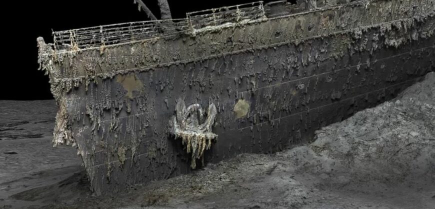

The world’s most famous shipwreck, the Titanic has been revealed as never seen before through a full-sized digital scan.
The Titanic, which lies 3,800m (12,500ft) down in the Atlantic, was scanned by using deep-sea mapping, a technique that provides a unique 3D view of the entire ship, enabling it to be seen as if the water has been drained away.
The hope is that this will shed new light on exactly what happened to the liner, which sank in 1912. More than 1,500 people died when the ship struck an iceberg on its maiden voyage from Southampton to New York.
“There are still questions, basic questions, that need to be answered about the ship,” Parks Stephenson, a Titanic analyst, told BBC News. He said the model was “one of the first major steps to driving the Titanic story towards evidence-based research – and not speculation.”
Underwater robots controlled by specialist teams spent 200 “hard” hours mapping the length and width of the wreck, which lies in two sections in the Atlantic Ocean off the coast of Canada.
Historians are hoping that the digital scan of the Titanic will provide new insights into exactly what happened on the fateful night of April 14.
Atlantic Productions chief executive Andrew Geffen told the BBC on Wednesday: “Great explorers have gone down to the Titanic… but they actually went with very low-resolution cameras and could only speculate about what happened. Now we have every piece of the Titanic in front of us, every detail, we can put it together, so for the first time we can really see what happened and use real scientific data. It will take a long time to go through all these details, but week by week there will be new findings.”