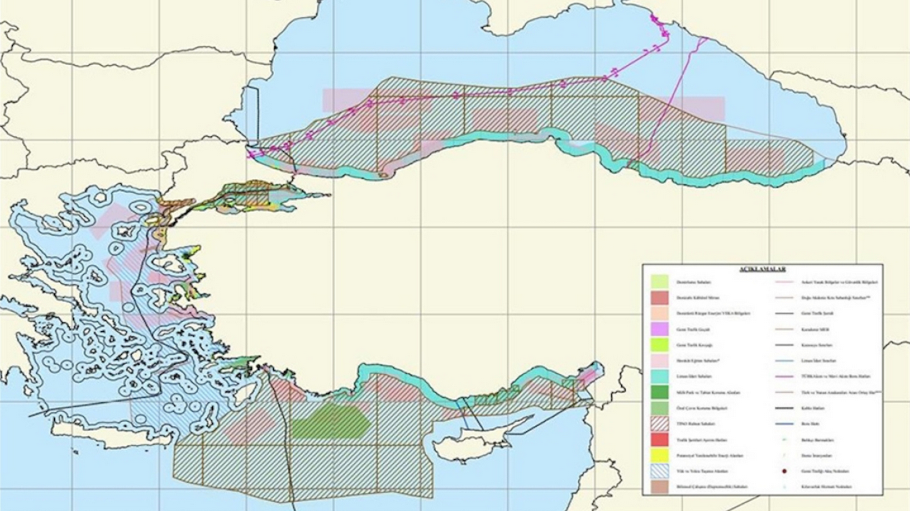
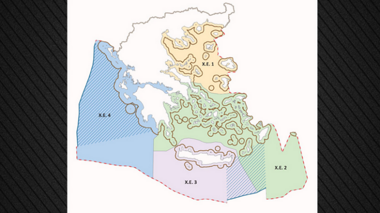
After Greece, Turkey also presented a map for maritime spatial planning – They are splitting the Aegean in two
‘Blue Homeland’ deepens, says Milliyet – The map was not published in the Turkish media until after the Greek announcement – According to the newspaper, Turkey chooses the median line of the Aegean as a border, claiming one side of the sea
The Maritime Spatial Planning was announced
For the first time, Greece's maritime zones are institutionally organised
The Commission is ready to support Greece for the delimitation of maritime zones, says Faradouris
In response to a question from a SYRIZA MEP, the Commission says it is committed to supporting Greece in addressing the challenges it faces from Turkey and is ready to provide technical and financial support