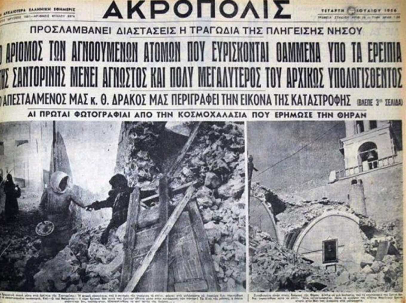
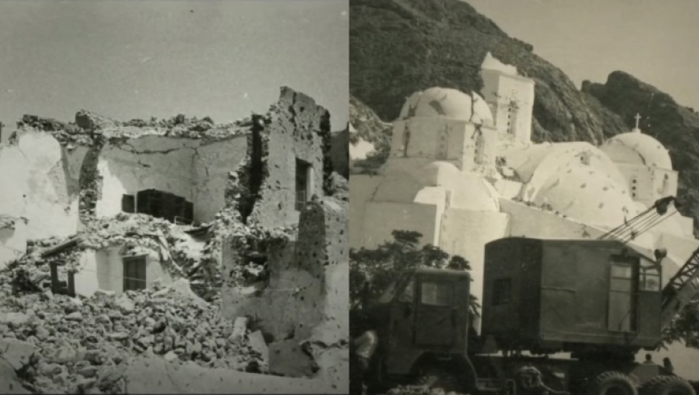
The tragic state of Santorini after the 7.8 magnitude earthquake dominated the front pages of the Athens newspapers on Tuesday, July 10, 1956. The reports of the time informed the Greek public that “another blow from Enceladus against the most picturesque island of the Aegean – A destructive earthquake reduced Santorini to ruins – Ash from the volcano covers the area and reaches as far as Syros – A very strong tsunami, moving in a spiral, reached from the Saronic Gulf to Crete and the Dodecanese,” etc.
Today, we know that the earthquake of July 9, 1956, centered in the sea area near Amorgos, was the third strongest in Europe from 1900 to today. The blow to Santorini was crushing, with 53 dead, dozens injured, and widespread material damage.
“Shortly after dawn yesterday, the residents of the capital, Attica, and large parts of the country,” continues the journalistic coverage the day after the shock, “woke up terrified from a series of strong seismic tremors, the epicenter of which was once again, after about 30 years, the often-stricken island of Santorini. The first seismic tremor, as recorded by the seismograph of the Athens Observatory, occurred at 5:12 AM and was quite strong.
“Three minutes later, a second seismic tremor was recorded, much stronger, causing the death of dozens of residents of Santorini and severe damage in the affected area and other islands. As the Observatory reports, from the eruption of the Thira volcano and the very strong seismic tremors, which continued with smaller intensity at intervals, a powerful tsunami was formed, which struck the coasts of the islands of Ikaria, Samos, Paros, Astypalaia, Amorgos, Milos, Kalymnos, Kos, as well as the northern coasts of Crete.”
According to an article published in September 2009 in the specialized scientific journal Geophysical Journal International, the area immediately affected by the main earthquake and its 34 aftershocks on July 9, 1956, is identified as a 75×40 km area. Additionally, it is highlighted that the tsunami created by the seismic surge was the largest recorded in the entire Mediterranean during the 20th century, with wave heights reaching 30 m on the coasts of Amorgos, 20 m on Astypalaia, and 10 m on Folegandros.
In the same article, the root cause of the 7.8 magnitude “monster” earthquake is attributed to underwater tectonic shifts—not to the eruption of Santorini’s volcano, as was incorrectly reported in the 1956 news coverage. However, this mistake is characteristic of the perception that prevails regarding Santorini, that is, that the earthquakes which regularly shake the island are due to the volcano. And this is the truth, although the last eruption of the volcano occurred in 1950.
Nevertheless, it is justifiably believed that the earthquakes on Santorini are directly or indirectly linked to the volcano, and the volcano is almost synonymous with Santorini. This is because Santorini itself was formed from volcanic lava, and what constitutes the island today is essentially what remains above the sea’s surface after the tremendous geological upheavals that took place over millions of years.
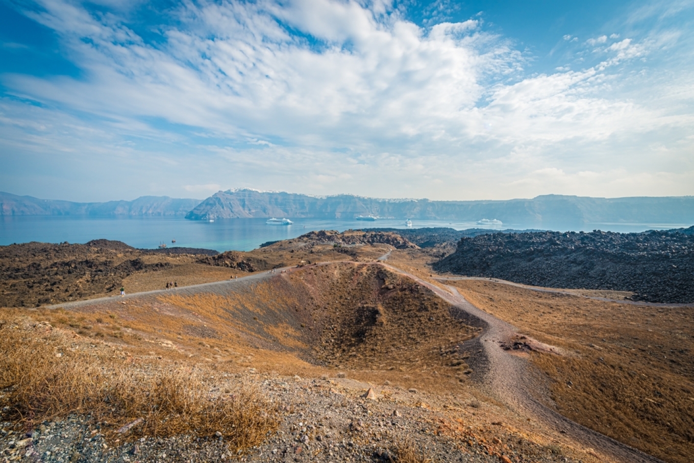
What remains, and is called Santorini, are the pieces of the original “Round,” an island whose shape approached a perfect circle. However, at its center, there was the volcano, which sank and turned into a “caldera,” that is, a terrestrial cauldron. The caldera of Santorini, a massive cavity in the earth formed when the summit of a volcanic cone collapses, is the largest in the world, covering an area of 32 square kilometers.
The history of earthquakes on Santorini is, in fact, double-fold. One branch involves the seismic tremors themselves, and the other concerns volcanic activity. In the past, the tremors accompanied by eruptions of the Thira volcano clearly formed pairs, two sides of the same phenomenon. However, as the volcano weakened, it was mainly the earthquakes that terrorized the residents and inhabitants of Santorini, as well as, naturally, the scientific community.
A Troubled History
Scientists consider it most likely that the Santorini volcano formed along with the Aegean islands towards the end of the Lower Pliocene, about 3 million years ago. In its first phase, the volcano was underwater. However, the large amounts of material it ejected eventually covered most of Thira, bringing the volcano above the sea surface. At that time, the island, called Stroggyle, was much smaller than the current island complex of Thira, Thirasia, and Aspronisi, but it was united.
The crucial milestone for the Santorini volcano is the year 1613 BC, when the most powerful volcanic eruption ever recorded in history occurred. Specifically, for this island, the entire magma chamber, that is, the body of the volcano, collapsed. The result was the formation of the three main islands of the complex: Thira, Thirasia, and Aspronisi, while between them now lay the caldera.
The representation of the sequence of events, as outlined in an interview by the renowned volcanologist Dr. Giorgos Vouyioukalakis, is staggering: “During the first phase, a large explosive column of ash rises to 35-36 km in height. It lasts about 4-6 hours and ejects about 2 cubic km (4.6 billion tons) of magma. The enormous energy released by the vaporization of water pulverizes large amounts of magma and launches them at great speeds (80-150 m/s) and temperatures of about 150-200°C, covering all of Santorini with white ash. These successive eruptions often create intense shock waves, the destructive effects of which have been recorded in parts of houses in the prehistoric settlement.
“During the second explosive phase, a cloud of steam and ash moves at high speeds, radiating out from the eruption site. In the third phase, the area is covered by massive amounts of volcanic ash. In the final phase, thick clouds of hot red ash are ejected, which eventually settle on the ground or sink into the sea. The entire event, from the first eruptions to the creation of the caldera, must have lasted no more than a few (2-3) days. The volume of material ejected is estimated at at least 60 km³ of magma or about 150 billion tons of rock!
“The power of the eruption in 1613 BC was enormous. It was the largest volcanic eruption ever experienced by humanity, akin to many atomic bombs, like those dropped on Hiroshima. The first 24 hours of the eruption stopped all life within a 100 km radius! And then the tsunamis began.”
Nea Kameni
After 1613 BC
After the “big bang” of Santorini, the volcano continued to erupt from time to time, although not with the same intensity. The main events after 1613 BC are as follows:
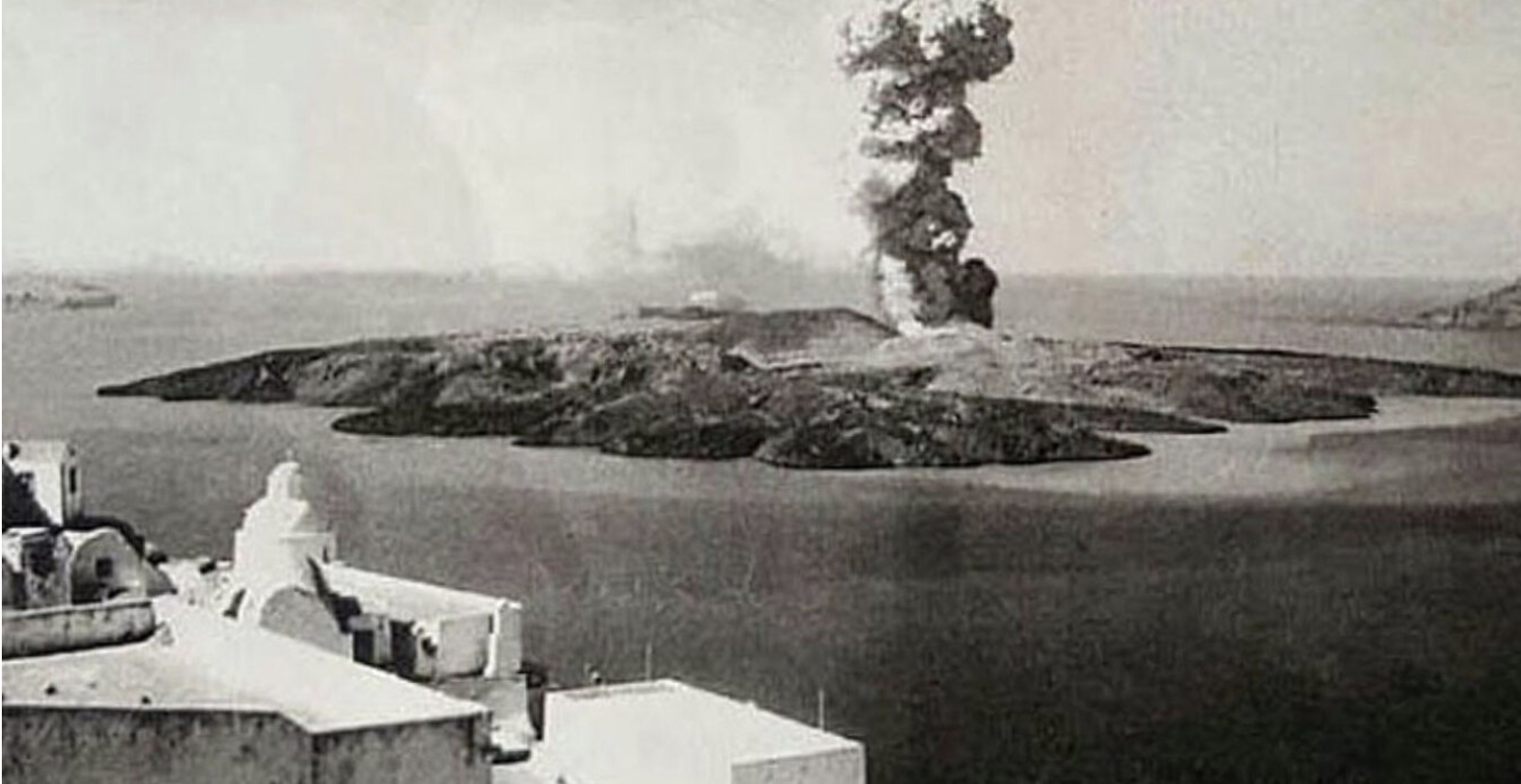
- In 46 AD, the lava of the volcano formed the island of Palai Kameni, then Mikri Kameni in 1570 AD, and finally Nea Kameni in 1707 AD. In fact, through successive eruptions and lava injections, these islands changed shape and size many times.
- On September 27, 1650, the underwater volcano Kolumbo (about 8 km northeast of Santorini) erupted. The powerful eruption triggered a strong tsunami and released toxic poisonous gases, causing the deaths of about 50 people.
- February 4, 1866 – October 15, 1870: A moderate volcanic activity unites Mikri Kameni and Nea Kameni.
- January 26, 1866 – Rocks falling cause damage to house walls, and after a few days, an increase in seawater temperature and smoke emissions are observed. In early February 1866, a volcanic cone called “George” formed.
- May 10, 1866: The “May Islands” formed, but they disappeared immediately after.
- August 11, 1925 – March 17, 1928: The temperature increases in the “Red Waters” bay, and the eastern coast of Nea Kameni subsides.
- May 1926: A new lava dome is formed and named “Nautilus.”
- August 20, 1939 – July 1941: Several lava domes form, named Triton, Ktenas, Fouke, Smith, Rek, and Nike. Between August 20, 1939, and July 1941, five eruptions occurred on Nea Kameni. In late August 1940, two major eruptions at the top of the island sent the old 1866 rock flying into the air and opened two large craters, each 50 meters long, but without lava. By the end of November of the same year, thick lava began to flow from a 100-meter fissure, forming the lava fields known as Nike, in honor of the Greek victory in Albania. The lava covered the eastern slopes of the island, stopping just before reaching the sea. This cycle of eruptions was completed in July 1941.
- January 10 – February 2, 1950: The volcano erupted for almost a month. A dome called “Liatsikas” was created, and lava flowed. The rock on the southern slopes of Nike’s dome exploded, opening a path for new magma to begin flowing out. The volcanic ash was ejected up to a height of 1,000 meters. Lava fragments fell within a radius of 850 meters in the surrounding area.
- On July 9, 1956, the aforementioned 7.
Kolumbo: A “Seismic Machine”
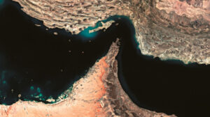
Located 6.5 km northeast of Santorini, Kolumbo is an active underwater volcano that has earned the nickname “seismic machine” due to its continuous volcanic activity. It is identified through the regular micro-earthquakes it triggers, the release of gases, and the deformation of the seafloor. Beneath the surface, it is believed that there is a chamber filled with intensely hot magma, possibly as large as 5 kilometers in diameter. Kolumbo’s volcanic activity never ceases, with frequent micro-seismic tremors, sometimes reaching up to 4 on the Richter scale, and a constant shifting of the seafloor around the crater.
During the period of 1649-1650, a prolonged series of eruptions occurred for three months, accompanied by tsunami waves and strong earthquakes. It is estimated that around 50 people lost their lives as a result of this activity. The cone formed by the eruption never emerged above the sea surface and remains to this day a submerged reef, sitting at a depth of approximately 18.5 meters.
The Jesuit priest Francois Richard vividly described the eruptions of Kolumbo in his writings: “On the night of September 27th, a new and more terrifying earthquake caused the houses to sway from side to side, like cradles, trembling as if they were reeds in the wind. After this tremor, we saw flames rising from the sea, four miles east of the islands, between Andros and Santorini, surrounded by dense clouds. Smoke ascended from the burning abyss into the sky. Then, the fiery clouds lowered, leaving an unbearable smell, so much so that it seemed as if the flames were emerging from hell itself.”
Kolumbo’s volcanic and seismic activity is a significant phenomenon in the region, contributing to the ongoing geological transformation of the area around Santorini and further shaping its history.
Ask me anything
Explore related questions