Heavy rain and thunderstorms are expected from today until Wednesday (April 2) in most areas of eastern Greece, with locally dangerous conditions in seven regions.
According to the emergency bulletin by the Hellenic National Meteorological Service (EMY), the weather phenomena will be locally hazardous in:
A. The Cyclades from Monday noon (March 31) until the early hours of Tuesday (April 1).
B. The Eastern Aegean islands (mainly Samos, Ikaria, Chios) from Monday night (March 31) until Tuesday afternoon (April 1).
C. The Dodecanese on Tuesday (April 1) from early morning to late evening.
D. Eastern Central Greece (including Attica) and Evia from Monday afternoon (March 31) until early Tuesday morning (April 1).
E. Thessaly and the Sporades from early Tuesday (April 1) until the evening.
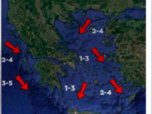
At the same time, meteorologist Klearchos Marousakis shared maps showing total rainfall expected on Monday and Tuesday, as forecast by meteorological models.
“These are beneficial rains, especially for areas in need, without extreme general effects,” the meteorologist noted.
⚠️ΕΚΤΑΚΤΟ ΔΕΛΤΙΟ ΠΡΟΓΝΩΣΗΣ ΕΠΙΚΙΝΔΥΝΩΝ ΚΑΙΡΙΚΩΝ ΦΑΙΝΟΜΕΝΩΝ
— Theodoros Kolydas (@KolydasT) March 30, 2025
✔️⚠️Κόκκινη Προειδοποίηση
✅Ισχυρές βροχές και καταιγίδες προβλέπονται από τις μεσημβρινές ώρες της Δευτέρας (31-03-25) έως και το πρωί της Τετάρτης (02-04-25) στις ανατολικές περιοχές της χώρας.
Τα φαινόμενα θα είναι… pic.twitter.com/1ZvJmne4E9
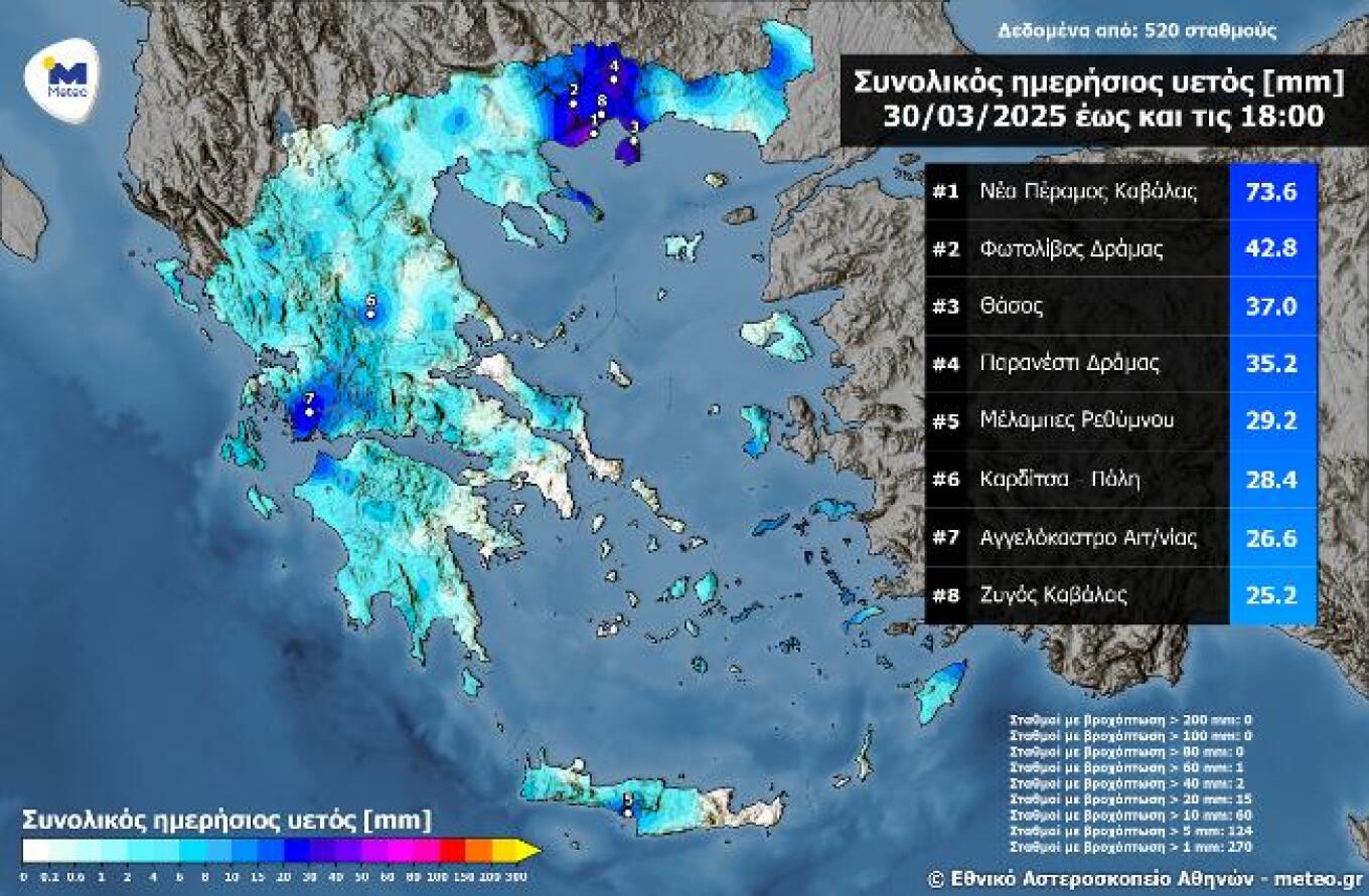
Significant local rainfall yesterday (March 30) – 74 mm in Nea Peramos, Kavala
Rain and scattered thunderstorms occurred across many regions on Sunday, March 30, 2025, with the most notable phenomena seen in western and northern mainland Greece and the Aegean islands. The highest daily rainfall recorded up to 18:00 was 76 mm at the National Observatory of Athens’ automatic weather station in Nea Peramos, Kavala, with 58 mm falling in just one hour (05:20–06:20 AM).
The accompanying map shows daily rainfall totals up to 18:00 on Sunday, March 30. A table presents the top 8 rainfall values recorded by 522 weather stations in the National Observatory’s automated network.

Detailed Forecast by Region (Monday, March 31)
MACEDONIA, THRACE
Increased cloudiness with local rains and scattered thunderstorms, mainly in the afternoon. Morning visibility may be limited.
Winds: Variable 3–4 Beaufort, later turning easterly up to 5 Beaufort.
Temperature: 7–18°C; in Western Macedonia: 4–13°C.
IONIAN ISLANDS, EPIRUS, WESTERN MAINLAND, WESTERN PELOPONNESE
Occasional clouds with local rain and afternoon thunderstorms. Evening improvement. Some snow in Epirus and Central Greece mountains.
Winds: Variable, gradually turning easterly 3–4 Beaufort.
Temperature: 10–18°C; in interior Epirus 3–4°C lower.
EASTERN MAINLAND, EVIA, EASTERN PELOPONNESE
Cloudy with rain and thunderstorms from the afternoon, locally strong.
Winds: Easterly 3–4 Beaufort, up to 5 Beaufort in the east.
Temperature: 9–18°C.
CYCLADES, CRETE
Cloudy with rain and thunderstorms. From midday, the Cyclades will see locally strong phenomena.
Winds: Easterly 4–5 Beaufort, southeast winds up to 8 Beaufort by afternoon in eastern Cyclades.
Temperature: 12–18°C; in Crete up to 21–22°C.
EASTERN AEGEAN ISLANDS – DODECANESE
Cloudy with rain and thunderstorms. From the evening, strong phenomena in the Samos–Ikaria–Chios region.
Winds: Easterly 4–5, increasing to 6–8 Beaufort in the southeast.
Temperature: 14–20°C; 2–3°C lower in the north.
THESSALY
Cloudy with rain and thunderstorms, locally strong from the afternoon.
Winds: Variable 2–3, turning easterly up to 4 Beaufort.
Temperature: 7–17°C.
ATTICA
Cloudy with local rain and gradually scattered thunderstorms. Locally strong phenomena from afternoon.
Winds: Variable 2–3 Beaufort, turning easterly up to 4 Beaufort.
Temperature: 9–18°C.
THESSALONIKI
Cloudy with rain and scattered afternoon thunderstorms.
Winds: Easterly 3–4 Beaufort.
Temperature: 9–16°C.
Tuesday, April 1
Heavy rain and thunderstorms expected in most eastern areas. Locally hazardous phenomena in Cyclades, eastern mainland (including Attica), and Evia in the morning; Samos–Ikaria–Chios until the afternoon; and Thessaly, Sporades, and Dodecanese until evening. In the west, occasional showers and isolated storms expected. Light snow in mountainous regions.
Winds: Easterly 3–4 Beaufort in the west. In the east, 4–6 Beaufort, and up to 7 in the southeast Aegean, weakening by night.
Temperature: No significant change, reaching 16–17°C widely, and up to 19°C in the southern islands.
Wednesday, April 2
In eastern regions, cloudy with rain and southern scattered thunderstorms. In Thessaly, Sporades, eastern mainland, Evia, and the Dodecanese, strong phenomena in the morning. Elsewhere, partly cloudy with occasional showers and isolated storms.
Winds: Light and variable in the west; northeasterly 4–6 in the north and southeast.
Temperature: No significant change.
Ask me anything
Explore related questions


