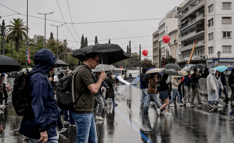
The National Weather Service (EMY) is warning of worsening weather today, with the peak of the weather in the afternoon hours. The strong storms, which will mainly affect Attica and the Aegean islands, are expected to be accompanied by hail, strong wind gusts and local flooding.
According to the emergency bulletin of EMY, from 15:00 at noon until 23:00 in the evening, Attica will face intense phenomena, with the possibility of strong thunderstorms. At the same time, the temperature in the area will range from 17 °C to 22 °C, with a gradual drop in the evening.
The National Weather Service estimates that rainfall will reach 30-40 mm in 12 hours, with the possibility of flooding in low-lying areas and transport problems. For areas close to the sea, winds will be more intense. After 11 p.m., the warning downgrades to yellow, with 10-20 mm of rain expected by dawn Wednesday.
More specifically, according to the Emergency Weather Bulletin issued by EMY, locally strong phenomena are forecast:
a. In Chalkidiki and the northern Aegean (mainly the area of Lemnos from tomorrow at noon until the evening hours.
b. In the Sporades and eastern Thessaly (mainly Magnesia) from tomorrow afternoon to Wednesday noon.
c. In eastern Sterea (including Attica) from tomorrow, early afternoon until the evening hours.
d. In the southern Ionian Sea, the western Peloponnese and Aitoloakarnania in the afternoon tomorrow.
According to meteorologist Thodoros Kolydas, particularly intense phenomena are forecast in Halkidiki, the northern Aegean, the Sporades, eastern Thessaly, Attica, western Peloponnese and northern Evia. Forecast models (ECMWF/Windy) estimate cumulative rainfall totals of 80-150 mm, with locally more than 100 mm in Pelion, Sporades and Magnesia, while 60-100 mm are expected in northern Evia.
For his part, meteorologist Giannis Kallianos said in his forecast that no unprecedented bad weather is expected over the Tuesday and Wednesday weekend, nor an organized system that could cause widespread problems. Localized flooding may occur and is reasonable, especially if a localized heavy rainfall or thunderstorm occurs. But I would not “christen” this system as bad weather and especially having already entered the rainiest month of the year. Unless we agree among ourselves that warm weather in the summer is unrealistic or snow in the winter in Kaimaktsalan is unprecedented.
Rain will therefore occur in most areas of the country especially tomorrow Tuesday and less so on Wednesday, with the exception of the southeastern Aegean where the weather will be generally mild, with occasional thunderstorms.
But that’s the way November is, it’s the rainiest month of the year, a month that traditionally gives us a lot of frequent rainfall.
Therefore, discussing hours and doing scientific analysis upon analysis on every rainfall in November is like talking about winter because it gets dark early. It’s like being surprised that it’s warm in the summer, it’s like being surprised that flowers bloom in the spring, it’s like considering it news that January brings cold weather.
To sum up :
The areas where this weekend will see – primarily – the strongest storms are :
– Eastern Thessaly, Northern Evia, Sporades (over 150 mm, special attention is needed there)
– Southern Halkidiki
– Central and Eastern Sterea (and Attica)
– Eastern and Southern Peloponnese
– Western Cyclades
– Western Crete (where the phenomena will persist on Thursday as well)
I have mentioned many times that it is one thing to say : “Weather Change Bulletin”, another to say : “Weather Emergency Bulletin” and another to say : “Weather Emergency Bulletin”. Within these categories of ‘Bulletins’, the accurate or correct transmission of information is often lost. Of course, one never talks about simple change of weather, we go straight to the “deep” and “difficult”.
Nearly freezing minimum temperature yesterday morning
Locally low temperatures were recorded in the morning hours of Monday 03/11 in the continental areas. The lowest minimum temperature was recorded at the weather station at Fort Neukopi and was equal to 0.5˚C.
Civil Protection instructions in view of the worsening weather
The General Secretariat of Civil Protection recommends citizens to be particularly careful, ensuring that they take measures for self-protection from the risks arising from the occurrence of severe weather phenomena.
The General Secretariat of Civil Protection (civilprotection.gov.gr) of the Ministry of Climate Crisis & Civil Protection, has informed the relevant government departments involved, as well as the regions and municipalities of the country, in order to be in increased readiness for civil protection, in order to deal immediately with the effects of the outbreak of severe weather phenomena.
In addition, as announced by the Fire Brigade, the operational plan for dealing with risks from the occurrence of floods and their accompanying phenomena is being implemented, while the Fire Services of the areas where the phenomena are expected to occur have been put in a state of increased readiness and further escalation, if required, in order to deal immediately with any problems from severe weather phenomena of this bad weather.
In particular, in areas where heavy rainfall, thunderstorms or gusty winds are predicted, the GIS recommends that citizens:
* Secure items that may cause damage or injury if carried away by severe weather.
* Ensure that residential gutters and downspouts are unclogged and functioning properly.
* Avoid crossing streams and creeks, on foot or by vehicle, during storms and rainstorms and for several hours after the event has ended. Particular attention is needed at road crossings where the road crosses streams and there is no bridge.
* Avoid outdoor work and activities in marine and coastal areas during the outbreak of severe weather events (risk of lightning strikes).
* Take shelter immediately during a hailstorm. Take shelter in a building or car and do not leave the safe area until they are sure the storm has passed. Hail can be very dangerous for animals as well.
* Avoid crossing under large trees, under posted signs, and generally from areas where light objects (e.g., pots, broken glass, etc.) can become detached and fall to the ground (e.g., under balconies).
* Follow the instructions of the local authorities, such as the traffic police, etc.
In areas where there is intense lightning activity:
If you are at home
*Do not hold electrical appliances or the telephone because lightning can pass through wires. Disconnect television sets from the antenna and power supply.
* Avoid touching plumbing pipes (kitchen, bathroom) as they make good conductors of electricity.
If you are in the car
*Park it on the side of the road and away from trees that may fall on it.
* Stay inside and turn on the warning stop lights (emergency lights) until the storm has passed.
* Close windows and do not lean against metal objects.
* Avoid flooded streets.
If you are outdoors
* Shelter in a building or car otherwise sit on the ground immediately without lying down.
* Shelter under solid branches of low trees in case you are in a forest.
* Never shelter under a tall tree in an open area.
* Avoid low ground for the risk of flooding.
* Do not stand next to pylons, power lines, telephone lines and fences.
* Do not approach metal objects (e.g., cars, bicycles, camping gear, etc.).
* Stay away from rivers, lakes or other bodies of water.
* If you are in the water get out immediately.
* If you are isolated on a flat area and feel your hair stand up (indicating that lightning will soon occur), sit deep with your head between your legs (to minimize your body surface and contact with the ground) by throwing away any metal objects you have on you.
It should be recalled that according to an Emergency Weather Bulletin (EDEC) issued today by the National Meteorological Service (EMY), locally heavy rain and thunderstorms are forecast from Tuesday (4-11-2025) at noon until Wednesday (05-11-2025) in areas mainly in the eastern mainland and the northern Aegean.
Citizens can be informed daily about the development of extraordinary weather phenomena in the regular weather bulletins of EMY and on the EMY website at www.emy.gr, (www.oldportal.emy.gr)
For information and announcements on the prevailing situation and the passability of the road network due to the inflow of flood waters into it, citizens can visit the website of the National Police (www.astynomia.gr).
For more information and instructions on self-protection from severe weather phenomena, citizens can visit the website of the Ministry of Climate Crisis and Civil Protection at civilprotection.gov.gr
The weather today
Local showers and thunderstorms are expected in the Ionian Sea, the mainland and the North Aegean. Possibility of local rain in the mountains of Crete.
The temperature will range in Western Macedonia from 3 to 16 degrees Celsius, in the rest of Macedonia and Thrace from 4 to 18-20 degrees Celsius, in Thessaly from 7 to 21-22 degrees Celsius, in Epirus from 8 to 21 degrees Celsius, in the rest of the continent from 7 to 23-24 degrees Celsius, in the Ionian Islands from 13 to 20 degrees Celsius and in the Aegean islands and Crete from 12 to 24-25 degrees Celsius.
In the Aegean Sea and the Ionian Sea, the winds will be generally northerly, initially light with intensities up to 3-4 Beaufort with gradual strengthening to intensities up to 5 and locally 6 Beaufort.
Clouds with local rain and possible thunderstorms are expected in the prefecture of Attica from the afternoon hours. Winds will initially blow from various directions, light and from the afternoon hours north winds with intensities up to 4-5 Beaufort are expected. The temperature will range from 16 to 22-24 degrees Celsius.
Cloudy weather with occasional showers is expected in Thessaloniki. Winds will blow from the north-northwest with intensities up to 4-5 m
The weather on Wednesday, November 5
In the west, partly cloudy with localized showers, which will quickly stop in the north, while from midday hours in the south isolated thunderstorms will occur. In the islands of the East Aegean and the Dodecanese a few clouds, partly cloudy with local showers in the north in the morning hours. In the rest of the regions increasing clouds with showers and mainly in the sea – coastal areas sporadic thunderstorms. The phenomena will be strong in some places until the midday hours in eastern Thessaly (mainly Magnesia) and in the Sporades and until the evening hours in central and northern Evia.
Winds will blow north northeast, in the west 3 to 5 Beaufort, in the east 4 to 6 and in the north Aegean locally 7 Beaufort and only in the southeastern Aegean will be variable and light.
The temperature will drop slightly mainly in the central and northern parts of the country. It will reach 17 to 18 degrees Celsius in the northern mainland, 19 to 20 degrees Celsius in the eastern mainland and 21 to 23 degrees Celsius in the western mainland and the island country and 24 degrees Celsius locally in the Dodecanese.
The weather on Thursday, November 6
In the east and south increasing clouds with local rain and in the Cyclades (mainly in the west) and Crete sporadic thunderstorms. In the remaining areas a few local clouds, partly cloudy, partly cloudy in the north.
Winds will blow north northeast, in the west 3 to 5 and in the southern Ionian Sea locally 6 Beaufort, in the east 4 to 6, in the Aegean Sea occasionally locally 7 Beaufort and only in the southeastern Aegean Sea will be variable light.
The temperature will drop slightly further.
The weather on Friday, November 7
In the east, partly cloudy with local showers and in the southeastern Aegean Sea until noon with occasional thunderstorms. In the west, almost clear weather with a few clouds. Visibility in the morning and evening hours mainly in the west will be locally limited and fog will form on the mainland.
Winds in the west will be variable, light and in the east will blow from the north 3 to 5 Beaufort and in the Aegean Sea occasionally up to 6 Beaufort in the morning hours.
The temperature will not change significantly.
The weather on Saturday, November 8
In the west, central, north, Crete and the eastern islands, partly cloudy with local showers. Sporadic thunderstorms will occur in the north in the morning hours and from midday in the Ionian Sea. In the rest of the regions a few clouds, occasionally and at times increasing. Visibility in the morning and evening hours mainly in the west and north will be locally limited and in the mainland, mainly in the mountains, fog will form.
Winds in the west will blow south southeast 4 to 5 and in the Ionian Sea from noon locally 6 Beaufort. In the east it will blow from the north 3 to 4 Beaufort, gradually becoming east southeast with the same intensity.
The temperature will not change significantly.
Ask me anything
Explore related questions