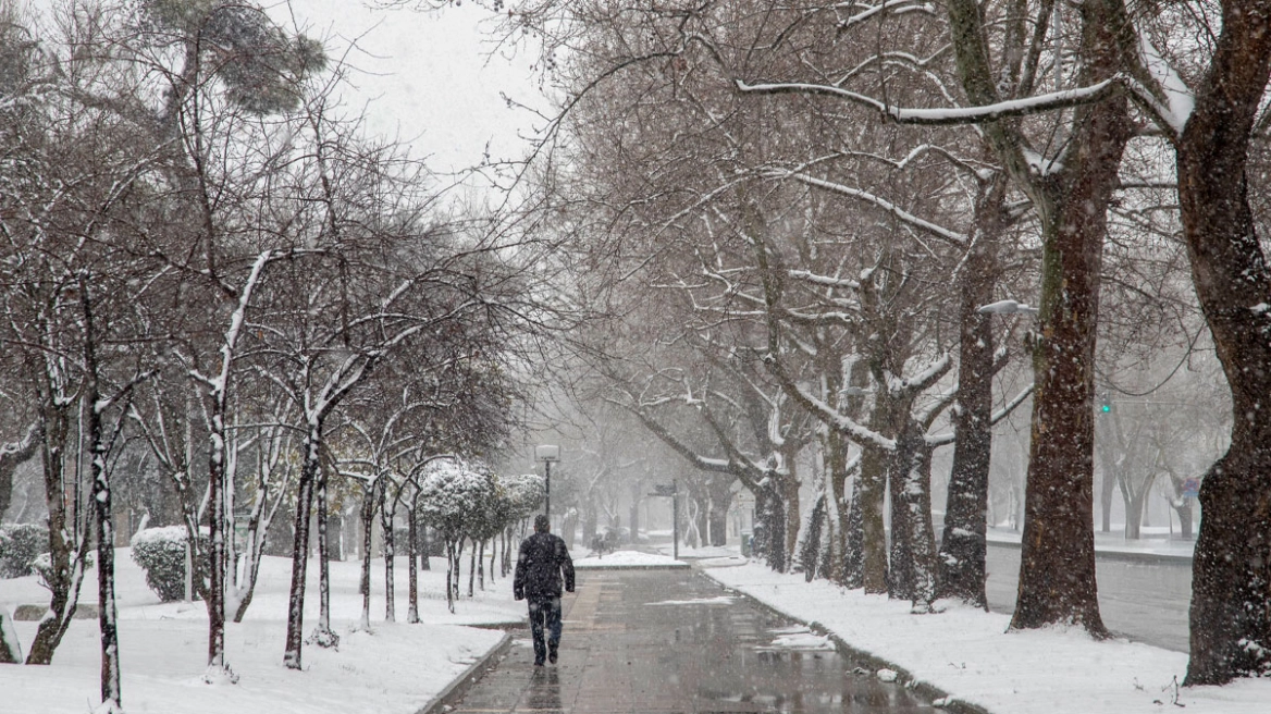
With clear and cold weather, along with local snowfall in several parts of the country, the change of the year will take place, according to meteorologists’ forecasts. Although extreme phenomena are not expected, the cold, frost and local snowfalls require increased caution, especially for New Year holidaymakers, whose travel is also made more difficult by farmers’ road blockades on major highways.
Calm but wintry weather on New Year’s Day
In his posts, meteorologist Thodoris Kolydas describes a “simple and wintry” weather pattern, with few clouds, a clear atmosphere and temperatures lower than normal for the season.
According to the forecast, cloud cover will be denser in the eastern and southern parts of the country, with local rain mainly in the Cyclades and Crete, while light snowfall will occur in mountainous areas. Winds will blow mainly from northerly directions, without significant intensity, maintaining the cold.
During the night and early morning hours, frost will occur in many mainland areas, mainly in the north.
Temperatures 4–5°C below normal
As Kolydas notes, on New Year’s Eve and New Year’s Day temperatures will be about 4 to 5 degrees Celsius below the climatological average. However, this is a perfectly normal situation for the season, without extreme phenomena that would cause widespread problems.
“The change of the year will take place without weather-related problems,” he notes, adding that conditions are not expected to affect festive activities.
Where snow is possible – What Yiannis Kallianos says
Meteorologist Yiannis Kallianos provides a detailed analysis of areas where local snowfall may occur around the turn of the year.
For Attica, there is an increased chance of brief snowfall on Wednesday evening, mainly in the northern and northeastern parts of the prefecture and at elevations above 400 meters, with the possibility of the snowline locally dropping to 250–300 meters in northern areas. These phenomena are expected to affect mainly higher elevations, including inhabited areas at the foothills of Mount Penteli and Mount Parnitha, parts of the remaining northern and far-northern suburbs not directly at the foothills, and, naturally, even higher zones around the respective mountain masses. He clarifies that these will be light to moderate phenomena, not widespread snow cover.
In the rest of the country, local snowfalls may occur in parts of central-eastern Evia, Central Greece, northern Peloponnese, Thessaly, as well as islands of the northern Aegean—even at very low elevations—such as Skyros, Lemnos, Thasos and Samothrace.
Such low New Year temperatures last seen 10 years ago
Meteorologist Kostas Lagouvardos writes that “there will definitely be a chill,” explaining that “a strong cold outbreak will affect our country on the last day of 2025 and the first day of 2026.”
He also presents a map showing cold air masses (dark blue shades) covering most of central and eastern Europe on New Year’s Eve night.
As he notes, “the last New Year with such low temperatures was 10 years ago, on New Year’s Day 2016, with minimum values of -15°C in Nevrokopi, Florina, Grevena and Paranesti.”
Holiday travel and transportation issues
At the same time, the New Year holiday exodus is underway, with increased traffic on national roads and at ports. Although the weather is not expected to cause serious problems, low temperatures, nighttime frost and local snowfalls require caution, especially on mountainous and semi-mountainous road networks.
In addition, transportation difficulties are caused by farmers’ road blockades set up at key points of the national and regional road network, with periodic traffic stoppages or diversions further burdening holiday travel.
Increased caution advised for drivers and travelers
Meteorologists and authorities recommend that drivers be especially careful, stay informed about weather conditions and road status before traveling, and carry snow chains where required.
New Year’s Day will greet the country with a wintry scene and low temperatures, but without extreme phenomena—provided, as emphasized, that travel is carried out with proper planning and increased caution.
Strong frost locally on the mainland on Monday 29/12 – Minimum temperature -8°C at Ochyro Nevrokopi
Frost, locally strong, occurred during the morning hours of Monday 29/12, mainly in central and northern mainland areas, with the lowest minimum temperature recorded at the Ochyro Nevrokopi meteorological station at -8.1°C.
Today’s weather
Local rain and thunderstorms are expected over much of western Greece, especially in parts of the Ionian, Western Central Greece and Western Peloponnese, as well as Crete, the Cyclades and the islands of the eastern Aegean. Thunderstorms in parts of the Ionian and eastern Aegean may be accompanied by small hail.
Temperatures will range:
- Western Macedonia: -7 to 7°C
- Rest of Macedonia and Thrace: -7 to 11°C
- Thessaly: -4 to 14°C
- Epirus: -4 to 10°C
- Remaining mainland areas: -2 to 14°C
- Ionian Islands: 5 to 13°C
- Aegean islands and Crete: 4 to 16°C
In the Aegean and Ionian Seas, winds will initially blow from the southwest at up to 5–6 Beaufort, turning northerly in the evening at 6–7 Beaufort.
In Attica, clouds will increase at times with a chance of local rain in the evening. Winds will be southwest 3–4 Beaufort, turning northerly in the evening. Temperatures 7 to 14°C.
In Thessaloniki, intermittent cloudiness is expected. Winds from the northwest 3–4 Beaufort. Temperatures 2 to 12°C.
Weather on Wednesday 31 December (New Year’s Eve)
In Macedonia, Thrace, Epirus and the northern Ionian, generally clear with few clouds, locally increased in the morning. Elsewhere, increased cloudiness with scattered rain. In Crete and the Dodecanese, thunderstorms until midday. Light snowfall in mountainous and semi-mountainous areas of the mainland and Evia.
Winds from northerly directions 4–6 Beaufort, locally 7 Beaufort in the northern Ionian and briefly in the northern Aegean in the morning. In the south, westerly winds of similar strength until midday.
Temperatures will drop noticeably across most of the country: 6–8°C in the north, 10–12°C in eastern mainland areas, 13–15°C in the west and northern Aegean islands, and 16–17°C in Crete and the Dodecanese. Frost will occur morning and evening on the mainland, locally strong in the north.
Weather on Thursday 1 January (New Year’s Day)
Few clouds, locally increased in the east and south. Local rain in Crete and the Cyclades, with temporary snowfall in mountainous areas.
Northerly winds 3–5 Beaufort, locally up to 6 Beaufort at sea.
Temperatures will show no significant change and will remain low. Frost will occur morning and evening on the mainland, locally strong in the north.
Weather on Friday 2 January
Generally clear with some cloudiness mainly in the west and south. From afternoon in the northwest, clouds will increase with local rain, isolated thunderstorms and snowfall in the mountains of Epirus.
Winds will be southerly to southwesterly 3–5 Beaufort, up to 6 Beaufort in the northern Ionian from afternoon. Only in the Dodecanese will winds be northwesterly 3–5 Beaufort.
Temperatures will rise in terms of maximum values, though early morning frost will occur in northern mainland areas.
Weather on Saturday 3 January
In the west, clouds with local rain and isolated thunderstorms. Elsewhere, generally clear with some cloudiness, locally increased in the eastern Aegean, where light local rain may occur.
Winds southerly to southwesterly 4–6 Beaufort, 7 Beaufort at sea, with a strengthening trend in the Aegean.
Temperatures will rise further.
Ask me anything
Explore related questions