





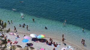
The week begins with the Meltemi winds easing, a slight rise in temperatures, but also an increased fire risk. Today, Monday, August 17, the weather will be generally clear across most parts of the country, with temperatures locally reaching 35 to 36 degrees Celsius inland, while northerly winds in the Aegean will reach up to 6 Beaufort in some areas.
At the same time, vigilance remains heightened for wildfires, as 20 areas of the country are in Category 3, meaning high fire risk. These include Attica, Evia, Boeotia, parts of the Peloponnese, Crete, the Cyclades and the eastern Aegean islands.
The weather will nevertheless show some local variations during the day. In mainland areas, temporarily increased cloud cover is expected during the midday and afternoon hours, while local showers and isolated thunderstorms will occur, mainly in the western mountainous areas. In Attica, sunny weather is forecast with temperatures reaching 34 degrees, while in Thessaloniki temperatures will reach 33.
MACEDONIA, THRACE
Weather: Generally clear, with temporarily increased cloud cover over the mountainous areas of Macedonia during the midday and afternoon hours, when local showers will occur.
Winds: From easterly directions at 3 to 4 Beaufort.
Temperature: From 18 to 34 degrees Celsius.
IONIAN ISLANDS, EPIRUS, WESTERN CENTRAL GREECE, WESTERN PELOPONNESE
Weather: Generally clear, with temporarily increased cloud cover during the midday and afternoon hours, when local showers will occur in mainland areas and isolated thunderstorms, mainly in mountainous areas.
Winds: From westerly directions at 3 to 5 Beaufort.
Closing
Temperature: From 21 to 33 degrees Celsius, locally reaching 35 degrees inland.
THESSALY, EASTERN CENTRAL GREECE, EVIA, EASTERN PELOPONNESE
Weather: Generally clear, with temporarily increased cloud cover over the mainland mountainous areas during the midday and afternoon hours, when local showers will occur, along with isolated thunderstorms in the mountainous areas of the Peloponnese.
Winds: From northerly directions, shifting from midday to southerly directions, at 3 to 5 Beaufort.
Temperature: From 20 to 36 degrees Celsius.
CYCLADES, CRETE
Weather: Generally clear.
Winds: From northerly directions at 4 to 5 and locally 6 Beaufort. From the afternoon, winds will shift to westerly directions at 4 to 5 Beaufort.
Temperature: From 24 to 30 degrees Celsius, locally reaching 33 to 34 degrees in southern Crete.
EASTERN AEGEAN ISLANDS – DODECANESE
Weather: Generally clear.
Winds: From northerly directions at 4 to 6 Beaufort.
Temperature: From 24 to 34 degrees Celsius.
ATTICA
Weather: Generally clear.
Winds: From northerly directions, shifting from midday to southerly directions, at 3 to 5 Beaufort.
Temperature: From 24 to 34 degrees Celsius.
THESSALONIKI
Weather: Generally clear, with temporarily increased cloud cover over the surrounding mountainous areas during the midday and afternoon hours.
Winds: Variable at 3 to 4 Beaufort, gradually becoming southeasterly at the same strength.
Temperature: From 21 to 33 degrees Celsius.
High fire risk in Attica, Evia and other areas of the country
A high risk of wildfires is forecast for Monday, August 17, in a total of 20 areas of the country, according to the Fire Risk Forecast Map released by the General Secretariat for Civil Protection of the Ministry of Climate Crisis & Civil Protection.
In the high-risk category, Level 3, are Attica, Evia, Boeotia, Phocis and Phthiotis, as well as Aetolia-Acarnania.
Also included at the same risk level are Argolis, Corinthia, Elis and Zakynthos, while a high risk is also forecast for Evros and Rhodope.
The forecast also covers Crete, the Cyclades, the Dodecanese and the eastern Aegean islands.
Areas of Magnesia, Achaia, Arcadia and Laconia are also included in Category 3.
FORECAST FOR TOMORROW, TUESDAY 18-08-2026
In the north, the weather will initially be generally clear, while from midday cloud cover will develop, bringing local rain or showers and isolated thunderstorms in mountainous areas. In the rest of the country, the weather will be generally clear, with temporarily increased cloud cover over mainland areas and the mountains of Crete during the midday and afternoon hours, when local rain or showers and isolated thunderstorms in mountainous areas are expected.
Visibility may be locally reduced during the morning hours in the Ionian Islands and western mainland areas, and during the evening hours in the Aegean.
Winds will be variable at 3 to 4 Beaufort and westerly at 4 to 5 Beaufort over the southern seas.
Temperatures will rise slightly further, reaching 31 to 35 degrees Celsius in most areas and locally 36 to 37 degrees inland.
FORECAST FOR WEDNESDAY 19-08-2026
In the northeast, temporarily increased cloud cover will bring local rain and possibly isolated thunderstorms, followed by rapid improvement. In the rest of the country, a few clouds, temporarily increased during the morning in the southern Aegean and during the midday and afternoon hours over mainland mountainous areas and the mountains of Crete, when local rain or showers are expected.
Visibility will be locally reduced in the morning.
Winds will initially be variable and light, gradually becoming northerly at 3 to 5 Beaufort and locally 6 Beaufort in the Aegean.
Temperatures will fall slightly in the east and north.
FORECAST FOR THURSDAY 20-08-2026
Generally clear weather, with a few temporarily increased clouds during the midday and afternoon hours over the western mainland mountainous areas, where local rain or showers may occur.
Winds will be northerly at 3 to 5 Beaufort and up to 6 Beaufort in the Aegean.
Temperatures will not change significantly.
Ask me anything
Explore related questions




