





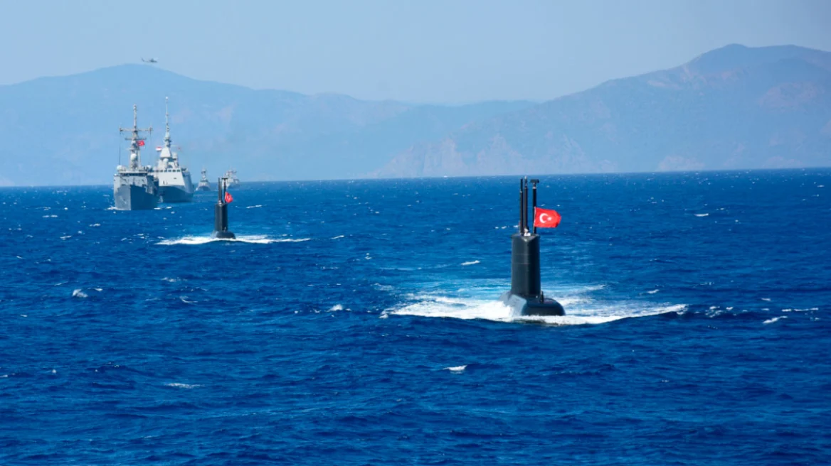
Turkey’s declaration of two marine parks marks the latest step in a process pushing Greek-Turkish relations towards a particularly difficult and sensitive turning point. The resilience and momentum behind the Athens Declaration have long been fading, and Turkey is gradually abandoning the calmer waters of recent years, meaning a new balance must now be sought in an extremely volatile international climate.
With its move on 15 August, Turkey, though it insists it is merely exercising rights that Greece has previously exercised itself, has sent a clear signal that the “Blue Homeland” doctrine remains national strategy, and that there is no willingness to retreat or compromise, even as a basis for agreement on maritime zones.
The initiative launched at a meeting on the sidelines of the 2023 NATO summit in Vilnius between Greek Prime Minister Kyriakos Mitsotakis and Turkish President Recep Tayyip Erdogan, aimed at resolving the delimitation issue through direct talks between the two countries’ foreign ministers, has failed to deliver. It simply confirmed the gap that separates the two sides’ positions. This showed that the problem does not lie in the format of the process, the exploratory talks, but is a matter of substance, rooted in Turkey’s consistent policy of revisionism.
Three years on, and despite progress on curbing migration flows (which reflects Turkey’s broader stance towards Europe rather than any “favour” to Greece) and, for a considerable period, a reduction in illegal Turkish air force activity over the Aegean, the latest signs suggest Ankara is now making different choices.
Turkey now feels considerably more confident, as regional developments that created major challenges have ultimately left it stronger, with an enhanced geopolitical role. This has boosted its confidence still further, a shift reflected across the whole range of its foreign policy, including how it handles maritime claims in the Aegean and the Eastern Mediterranean.
On maritime spatial planning and marine parks, Turkey followed Greece’s lead, believing this would prevent Greece from creating facts on the ground. But by formalising its own two marine parks through domestic procedures, Turkey is not simply reacting to Greek moves (which, in the case of marine parks, stopped short of extending beyond territorial waters or covering islands that Turkey regards as “grey zones”, with the exception of two islets in the south-central Aegean); it is actively advancing its own claims on the ground at Greece’s expense.
See the maps of the marine parks below
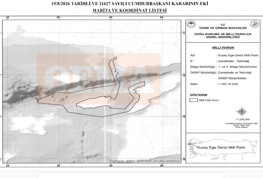
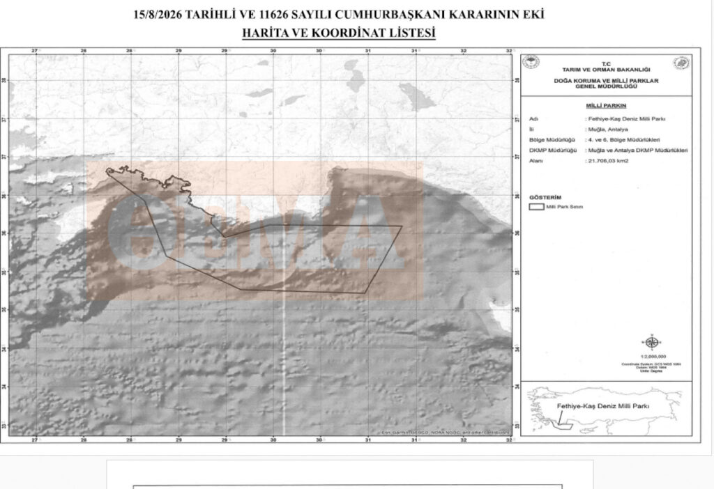
[Map: the boundaries of Turkey’s marine park in the Eastern Mediterranean]
Turkey’s marine parks have clearly not been designed around a scientific approach to marine environmental protection. Instead, they are being used as a tool to stake out its claims to maritime zones at Greece’s expense.
Through the two marine parks, Turkey is putting into practice a series of positions that fall outside the Law of the Sea and represent the main obstacle to reaching an agreement with Greece on delimiting maritime zones.
Turkey is reviving its position that the median line should run between the two countries’ mainland coasts, completely disregarding the islands and the maritime zones they are entitled to, so that the Turkish continental shelf would ultimately extend as far as the middle of the Aegean, even to the west of Greek islands.
It is also reasserting the position that islands are not entitled to any maritime zones beyond their territorial waters, and even then only the existing 6 nautical miles, effectively denying the right to extend territorial waters to 12 nautical miles where that is legally possible.
On Kastellorizo specifically, Turkey argues, among other things, that the island is cut off from the Dodecanese island chain and sits on the “wrong” side of the median line, and should therefore be treated restrictively, with rights only to 6 nautical miles of territorial waters. It also argues that there are no defined maritime borders in the Aegean, while unilaterally attempting to claim international waters that fall within the Greek continental shelf.
Earlier, prompted by Greece’s declaration of its own marine parks, Turkey had also revived its “grey zones” theory, referring to geographical features it says are of disputed sovereignty.
This context clearly highlights the huge obstacle standing in the way of any rapprochement between the two countries, creating a major, unresolved issue that is no longer purely theoretical but is now playing out on the ground, posing serious challenges for Greece.
Implementing the marine parks, which involves imposing restrictions on activities and on operations with an environmental impact, including surveys in areas now beyond Turkish territorial waters, will force Greece to respond on the ground, to stop this legally shaky Turkish move from creating facts on the ground that could affect the future delimitation of the continental shelf.
This process is set to become a permanent source of tension, one that could even escalate into direct confrontation, at a time when the international community may struggle, or be reluctant, to grasp how a seemingly “innocent” marine park could push two countries into conflict.
Athens has made its own moves in recent times, such as the cautious step of establishing the Marine Park of the Southern Cyclades, which stopped short of covering areas where Turkey disputes Greek sovereignty, or islets close to the Asia Minor coast. By delineating and licensing two offshore blocks south of Crete to the US energy company Chevron, Greece challenged the Turkey-Libya memorandum, but only on the Libyan side, where Turkish claims are not directly affected.
It will now have to confront the implementation of Turkey’s marine parks in areas where Turkish attempts to encroach on Greek sovereign rights cannot be tolerated.
At the same time, Athens will soon have to manage an equally critical and sensitive issue: resuming survey work for the Crete-Cyprus electricity interconnector cable. Following the entry of the French company Meridiem into the corporate structure behind the Great Sea Interconnector (GSI), pressure to resume the surveys will be considerable, even though the problem that halted them two years ago, when Turkish frigates intervened, has still not been resolved. That intervention did not take place in international waters, but within Greece’s delimited Exclusive Economic Zone (EEZ), as defined under the international agreement between Greece and Egypt.
Turkey’s demand that a Turkish NAVTEX (a maritime safety notice) also be issued for the surveys appears, on the surface, to simply challenge Greece’s area of responsibility for issuing such notices, but in reality conceals a challenge to Greece’s delimited EEZ itself.
The fact that the scheme is now controlled by foreign, and specifically French, companies may offer the chance to adopt the model previously used for similar surveys, such as those carried out by Google. But even if it is ultimately a French company that requests NAVTEX clearance from Turkey, the underlying political issue will remain, and will be difficult to manage, since the project concerns Greece directly and Greece’s power grid operator, ADMIE, is also an active participant in the scheme.
The choice will therefore soon become extremely difficult: how to continue the surveys for a significant, internationally backed project, without this leading, even indirectly, to accepting or entrenching Turkey’s challenge to Greek sovereign rights. That question will be settled on the ground, with all that implies for the risk of direct confrontation.
This is not a development Athens wants, particularly at a moment when Washington, at least, appears keen to avoid further problems in the region on top of those already caused by the wars in Gaza and Iran, and as Turkey appears to be gaining growing access to decision-making circles in the White House.
Ask me anything
Explore related questions




