




Cloudy skies, rain and, above all, a noticeable chill at night and in the early morning will mark October’s departure, according to protothema.gr meteorologist Giorgos Tsatrafilias. However, from Sunday onward, the weather pattern will change significantly, as a three-day spell of bad weather will move in from the west, bringing severe thunderstorms and strengthening southerly winds.
In more detail:
Today, Friday, October 30, 2026, clouds and occasional showers are expected from the morning hours across most parts of the country. The showers will generally be light and short-lived, with the exceptions of Thrace and the northern and eastern Aegean.
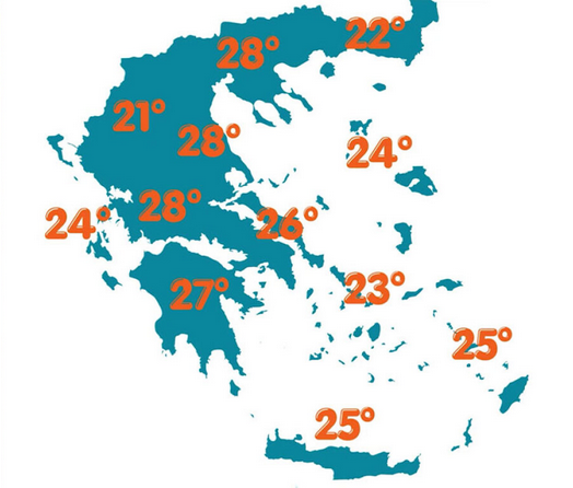
Temperatures will reach 21 to 22 degrees Celsius in western Greece, Crete and the Dodecanese. It will feel noticeably chilly at night and in the early morning.
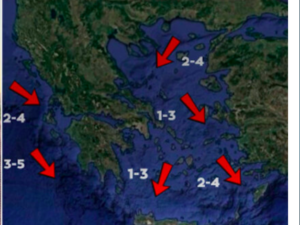
Winds in the Ionian Sea will blow from various directions, reaching force 4 on the Beaufort scale, while northerly winds in the Aegean will locally reach force 6.
In Attica, a little rain is expected until midday. Temperatures will range from 13 to 20 degrees Celsius, while northerly winds will reach force 4.
In Thessaloniki, cloudy skies and occasional local showers are expected. Winds in the Thermaic Gulf will be light, while temperatures will reach 15 degrees Celsius.
On Saturday, the weather will remain unsettled, although no significant rainfall is expected, and temperatures will not change substantially.
From Sunday, November 1, a low-pressure system from Italy is expected to bring a three-day deterioration in the weather, initially in western Greece and subsequently across most parts of the country, with rain, severe thunderstorms and strengthening southerly winds.
Ask me anything
Explore related questions