Google has temporarily disabled tools that provide live information about traffic conditions in Ukraine, the company confirmed to VICE World News, following reports that people around the world were using the service to track the movements of troops and civilians during the Russian invasion.
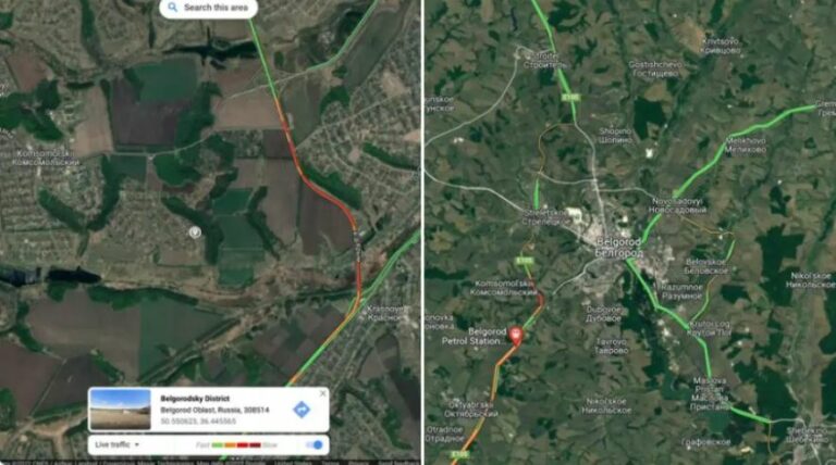
Google Maps’ live traffic data works by incorporating location and speed information from smartphones with the app, then using it to show in real-time how dense traffic conditions are in certain places, or how busy those areas are overall. When Russian President Vladimir Putin launched an attack on Ukraine last week, however, some spectators realised the feature could also be used to provide open-source insights regarding the whereabouts of military operations.
“I think we were the first people to see the invasion. And we saw it in a traffic app,” Jeffrey Lewis, an open-source intelligence expert and professor at Middlebury Institute, told Motherboard, after he noticed an unusual traffic jam developing around the Russian border town of Belgorod on Thursday morning.
source vice.com
also read
Ukraine Crisis – Wheat Prices to rise (infographic)
Ask me anything
Explore related questions


