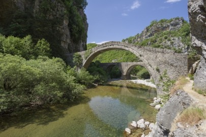
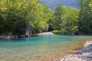
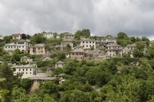
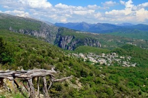
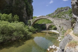
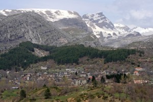
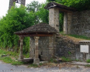
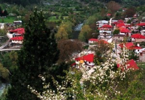
A cluster of 48 traditional picturesque villages (Epirus), built amphitheatrically in the wider area of Timfi, Pindos and Mitiskeli (Zagori region). Zagori’s natural environment is exquisite and perfect for many outdoor activities. The local architecture is defined by stone, wood and slate rock.
The name “Zagori” is Slavic and means “beyond the mountains”. During Ottoman rule, the area reached its economic and intellectual peak. However, Zagori declined after Ali Pasha’s death (1822) when it lost the benefits it enjoyed. The wars of the 20th century also had devastating effects. Zagori is divided into Western, Central and Eastern Zagori.
Western Zagori (west of Timfi)
Ano Pedina. A well-preserved traditional village, built near a plateau (altitude 960 m). Home to a number of eminent thinkers and national benefactors. The Monastery of Evagelistria (1793), contains icons from the 17th-19th century. It is located 35.5 km NW of Ioannina.
Vitsa. A traditional Epirus village which consists of Ano (Upper) and Kato (Lower) Vitsa. As the birthplace of important historical figures, the village has many wonderful mansions. Skala of Vitsa leads to the double-arch bridge of Misios, while archaeological digs on route to Monodendri have unearthed a settlement and two graveyards. It is located 36 km NW of Ioannina.
Kato Pedina. Known for its stone threshers and ostrich farm. Kato Pedina is built atop a plateau (altitude 940 m) where ancient graves have been discovered. The chapel of Aghios Nikolaos Vastanion-Kalivion dates back to the 15th century. It is located 37.5 km NW of Ioannina.
Monodendri. A designated traditional settlement (altitude 1,060 m), with stone houses and picturesque cobble roads, where the Rizario Centre of Handicrafts, with traditional broidery weavings operates. It is located at the entrance of the Vikos gorge. The cobblestone trail leading to the Monastery of Aghia Paraskevi (15th century) and continuing through the gorge is wonderful. It is located 39 km NW of Ioannina.
Elafotopos. Elafotopos stands out from the rest of Zagorochoria for its wonderful traditional architecture, its elaborate town planning and the impressive location it is built in (altitude 1,100 m). The churches of Aghios Georgios and Kimisi tis Theotokou contain gold-plated rood screens and old icons. The location “Kastro” contains traces of the fortified settlement of the Molossians. It is located 40.5 km NW of Ioannina.
Aristi. A gorgeous traditional Epirus village, where findings from the Paleolithic period have been discovered. The “Stamatis Mansion” is an exceptional sample of the local architecture. The Monastery of Panagia Spileotisas (16th century), built in a beautiful location near the banks of the Voidomatis river. “Kastraki”, with its panoramic view, contains ancient findings. The route at “Kagelia” from the Voidomatis bridge towards Papigo, is charming. It is located 48 km NW of Ioannina.
Vikos. This traditional Zahori village is built on the edge of the Vikos gorge (altitude 770 m) where the national part of Vikos-Aoos begins. After 30 minutes of hiking along the trail, you arrive at the springs of the Voidomatis river, an ideal place for excursions and mountain sports. It is located 53 km NW of Ioannina.
Papigo – Mikro Papigo. Designated traditional villages of Zagori, with a developed tourism infrastructure and woodcraft workshop. They are two of the most popular villages of the Zagori region and are located within the national park of Vikos-Aoos (altitude 960 m). The two villages which are the starting point for excursions in wonderful natural scenery are connected by a trail.
The trail passes by “Ovires” or “Rogova”, two small, natural lakes suitable for swimming in the summer. They also offer a view to Astraka, the peak of mount Timfi, while the underground cave “Provatina” in the area is the second deepest in the world. The elementary school in Papigo houses the well-organized Zagori Nature and Culture Information Centre. They are located 59 and 61.5 km NW of Ioannina respectively.
Central Zagori (between Timfi and Mitsikeli)
Asprageli. Base of the Municipality of Central Zagori, Asprageli was one of the most prosperous villages of Zagori during the 19th century (altitude 1.000 m). Shooting competitions are organized at the nearby plateau and a paragliding field operates at “Kanavistria”, the highest point of the village. The Monastery of Panagia dates back to the 16th century. It is located 29 km NW of Ioannina.
Dilofo. It is named Dilofo (meaning Two Hills in Greek) because it is built amphitheatrically on the foot of two hills (altitude 880 m). The grand mansion “Arhontiko Makropoulou” at the entrance of the traditional village is imposing. This is the starting point for trails leading to the picturesque chapels of the village, to the Vikos gorge and to Vitsa. It is located 34 km NW of Ioannina.
Kipi. A traditional village which is extremely popular with fans of alternative tourism and mountain sports. It is built in the centre of Zagori (altitude 800 m). The rivers Vikakis and Bagiotikos have wonderful single and triple arch stone bridges. It is located 37.5 km NW of Ioannina.
Koukouli. A traditional village with large mansions and fountains of exceptional popular architecture, birthplace of national benefactors and intellectuals, such as folklore scientist and herb collector Kostas Lazaridis (1904-1987), whose large herb collection is on display at the Rizario Museum of the Ecclesiastic School “Kostas Lazaridis”. It is located 38 km NW of Ioannina.
Dikorifo (Dikorfo). A classic example of an Epirus village, Dikorfo (meaning Two Peaks in Greek) received its name because of its location between two lush peaks of Mitsikeli (altitude 1.000 m). The village Kaloutas with its old churches, triple arch bridge and the Despotis Spring which is located nearby. The Monastery of Vivikou, 4.5 km N of Kaloutas, was established in 1114 and hosts the large fest of August 15th. It is located 38 km NW of Ioannina.
Kapesovo. A beautiful village and birthplace of many important hagiographers of the 18th century and other prominent figures such as Alexios Noutsos (1769-1822) who participated in the Filiki Eteria during the Revolution of 1821. Remains of Pelasgian walls can be seen atop the Gradistas hill. One of the original copies of Rigas Fereos’ “Charta” is kept inside the building of the Pashalios School. It is located 42 km NW of Ioannina.
Negades. – A traditional village of Zagori (altitude 1,060 m). The triple-naved basilica of Ag. Georgios was founded in 1792. It is located 44.5 km N of Ioannina.
Tsepelovo. A traditional Epirus village with a picturesque cobblestone square. Built on a slope of mount Timfi (altitude 1,080 m), it is the ideal starting point for excursions to the surrounding areas. – The church of Aghios Nikolaos (18th century) contains frescos and a gold-plated rood screen. It is located 49 km N of Ioannina.
Vradeto. Skala tou Vradeto, a cobblestone trail from the 18th century is the village’s famous landmark. Vradeto is built on a rugged slope (altitude 1,340 m). You can enjoy the wonderful view of the Vikos gorge just 2 km away from the village, at the “Beloi” location. It is located 51.5 km NW of Ioannina.
Skamneli. A traditional village (altitude 1,160 m), with ruins of Pelasgian walls near the Monastery of Aghia Paraskevi. 10 km away is “Sarakatsaniki Stani”, a replica of a Sarakatsanian settlement which extends on an area of 16 hectares and operates as an exhibition space. It is located 52.5 km N of Ioannina.
Fragades. A traditional village (altitude 960 m), with a wonderful view of the mountains and unique architecture. Don’t forget to visit the stone arch bridge of Petsionis (1830) and the village of Leptokaria. It is located 54 km N of Ioannina.
Vrisohori (altitude 940 m). The village received its name from its numerous springs and plentiful running water. This is the starting point of the trail leading to the peak “Tsouka Rosa” of Timfi at 2,377 m. The age-old sycamore at Iliohori has a diameter of 11m. It is located 75.5 km N of Ioannina.
Eastern Zagori (between Pindos and Mitsikeli)
Tristeno. Three narrow passages between hills which are traversed by streams gave their name to this beautiful mountain village (altitude 940 m), with its plentiful running waters, springs and stone houses. The watermill from the 19th century operates and mills grains the traditional way. The steeple of the Aghios Georgios church (18th century) hangs from an adjacent strong age-old sycamore. It is located 40 km NE of Ioannina.
Greveniti. A mountain village (altitude 980 m) with running waters, near which operates a trout aquaculture. The frescos in the church of Panagia (18th century) where drawn by hagiographers from Kapesovo. 6.5 km NW, near the Vardas river, is the old Monastery of Voutsas or Votsas, which according to rumors was built by the Byzantine emperor Konstantinos IV Pagonatos (7th century). It is located 41.5 km NE of Ioannina.
Doliani. A traditional village (altitude 920 m) built on the border between Eastern and Western Zagori, containing houses of typical Epirus architecture and masterly crafted stone bridges. The view from “Kouri”, the stone atop the hill with the chapels of Ag. Paraskevi and Ag. Gerogios, is breathtaking. It is located 43 km NE of Ioannina.
Vovousa. A traditional village (altitude 1,000 m) traversed by the Aoos river and built in a lush location containing rare animals and plants. The stone arched bridge dates back to 1748. Vovousa is very near the national park of Pindos (Valia Kalda). It is located 71.5 km NE of Ioannina.
Source: visitgreece.gr
Ask me anything
Explore related questions
