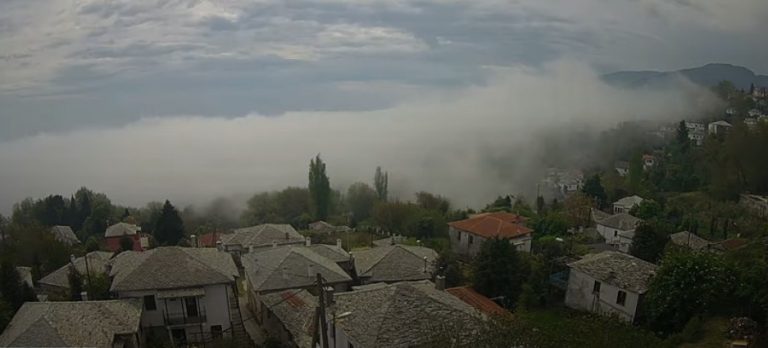
On the morning of Wednesday, April 29, the weather camera in Zagora, Pelion, recorded the creation of fog-like low level clouds.
The cold air masses that are transported from the mountain slopes and come down (denser) and cool the moist air masses above the sea. This creates a temperature reversal, with the coldest air masses at the foot of the mountain, on the shores. The cooled water vapour creates clouds that are transported under the influence of local circulation.
They are called stratus clouds and are low-level layers with a fairly uniform grey or white colour. Often the scene of dull, overcast days in its ‘nebulosus’ form, they can persist for long periods of time. They are the lowest-lying cloud type and sometimes appear at the surface in the form of mist or fog.
Stratus clouds form in calm, stable conditions when gentle breezes raise cool, moist air over colder land or ocean surfaces. These clouds can exist in a variety of thicknesses and are sometimes opaque enough to darken days, allowing for little light to pass through.
Ask me anything
Explore related questions


