Turkey continues its practice of challenging the jurisdiction and sovereign rights of Greece through the NAVTEX issuance system. For the third consecutive day, the Turkish authorities are attempting to assert their claims; yesterday, the attempt concerned the area of responsibility for issuing NAVTEX, and today it pertains to the continental shelf itself.
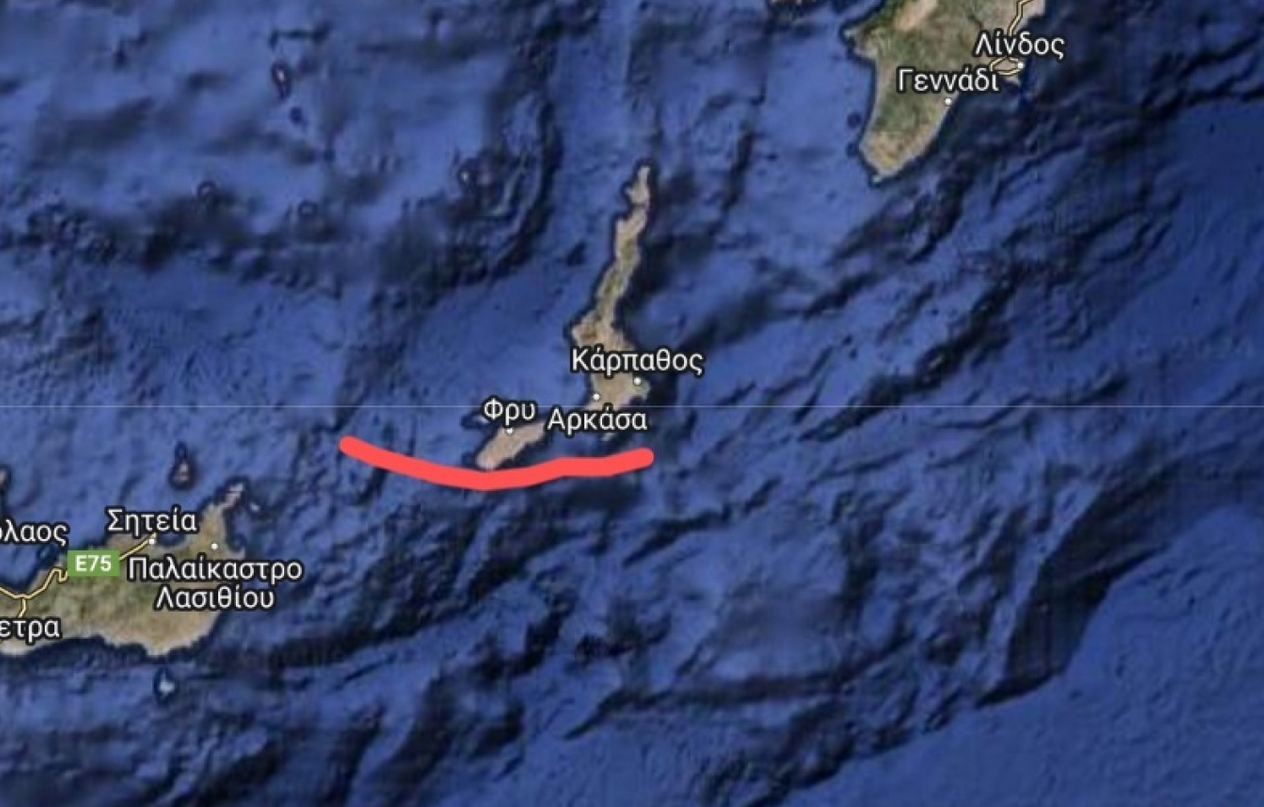
Yesterday, the Heraklion Station issued NAVTEX (693/24) for research related to the laying of an underwater cable by the vessel IEVOLI RELUME in the Carpathian Sea and the Kasos Strait for the period from July 17 to 29.
This afternoon, the Turkish authorities, through the Antalya station, issued their own NAVTEX (0671/24), stating that part of the research area concerns the Turkish continental shelf. They also referenced the letter Turkey sent to the UN on March 18, 2020, in which it unilaterally and arbitrarily declared the external boundaries of its EEZ.
This letter essentially marked the first official depiction of Turkey’s claim to the “Blue Homeland,” extending to the eastern boundaries of the territorial waters of the Greek islands in the area.
The Turkish authorities further assert that all research activities in the area of “Turkish maritime jurisdiction” must be coordinated by the competent Turkish authorities.
It is noteworthy that according to the coordinates of the research area of the specific vessel, the area is at the edge of Karpathos’ territorial waters, indicating Turkey’s persistence in finding reasons to establish faits accomplis on the field. Greece and other regional countries have rejected Turkey’s unilateral declaration of the supposed external boundaries of its EEZ, which flagrantly violates the provisions of the Law of the Sea.
The following map depicts in red the area reserved by the Greek authorities with NAVTEX for research related to the laying of the underwater cable by the vessel IEVOLI RELUME.
Ask me anything
Explore related questions


