The Hellenic National Meteorological Service (EMY) updated its emergency weather bulletin on Sunday afternoon, noting that a low-pressure system forming in the Western Mediterranean is causing storm “Atena” in the Central Mediterranean and is moving eastward. This system is expected to bring worsening weather to Greece from the evening of September 9th until Wednesday afternoon (September 11th), with strong rains and thunderstorms, especially in western, central, and northern mainland areas as well as the northern and eastern Aegean islands. The phenomena will include frequent lightning, hailstorms, and strong gusty winds.
More specifically:
From Wednesday morning until the afternoon (September 11th), Thrace and the northern and eastern Aegean islands will be affected.
From the evening of September 9th until Tuesday afternoon (September 10th), strong rains and thunderstorms will affect the Ionian islands, Epirus, western Sterea, and western Peloponnese.
From Tuesday morning (September 10th) until late afternoon, storms will impact western Macedonia, Thessaly, and eastern Sterea.
From Tuesday afternoon (September 10th) until Wednesday afternoon (September 11th), central and eastern Macedonia and the Sporades will experience severe weather.
Meteorologist Sakis Arnaoutoglou posted a video with the course of the bad weather Atena until tomorrow Tuesday.
For his part, meteorologist Giorgos Tsatrafyllias in his own post points out the six areas that will be most affected from today, Monday afternoon until Tuesday morning which are:
- Ionian Sea
- Europe
- Atoloakarnania
- Akhaia
- Ilia
- Messinia
Enhanced northerly winds in the eastern continental areas and the Aegean Sea on Sunday 08/09
According to the network of automatic weather stations of the National Observatory of Athens / meteo.gr, strong northerly winds were blowing yesterday in the eastern continent and in the Aegean Sea, with gusts reaching 84 km/h in Porto Tinos and 71 km/h in Amorgos.
The table below shows the eight highest wind gusts up to 17:00 on Sunday afternoon.
Severe weather hit areas of Greece on Saturday, September 7
The first signs of the bad weather did not take long to make themselves felt, as hail, heavy rains and strong winds occurred in many areas of the country.
More specifically, it was a difficult night in Ayina and Lamia as a storm swept through both areas with meteorologists predicting that next week will be an autumnal one with two passes of heavy rain affecting several areas.
The bad weather first struck the area of Lamia, where strong winds uprooted trees without fortunately causing any injuries, with the front then heading to areas of western Attica before breaking out again in Aegina and Salamis.
As seen in protothema.gr videos from Aegina, the rain fell almost parallel to the roadway with roads flooding.
In Salamina, impressive images were recorded with thunder and lightning striking the sky at the same time.
In Lamia, a violent storm hit late Saturday night (7/9) and caused significant problems in several parts of the city, with no injuries.
The downpour uprooted a tree at the height of the DEYAL, lamianow.gr reported.


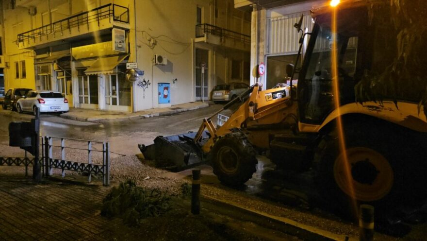
At the intersection of Othonos and Livaditou streets, rain “ate away” the pavement.
From the first moments, crews of the Municipality of Lamia, were on their feet at night while a coordination was made to assess the situation.
A heavy hailstorm also occurred in Velvento Kozani, on Saturday afternoon.
Once again the area was hit mercilessly, as described by residents and farmers of the area, who speak of “unprecedented situations”.
The hail, as reported by ertnews.gr, which fell for about 15 minutes with ferocity, combined with the rain and wind, created conditions of “hell” says the President of the Agricultural Association of Velventos, to the news medium.
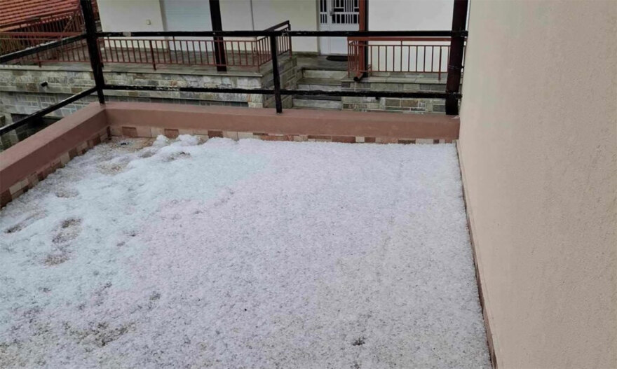
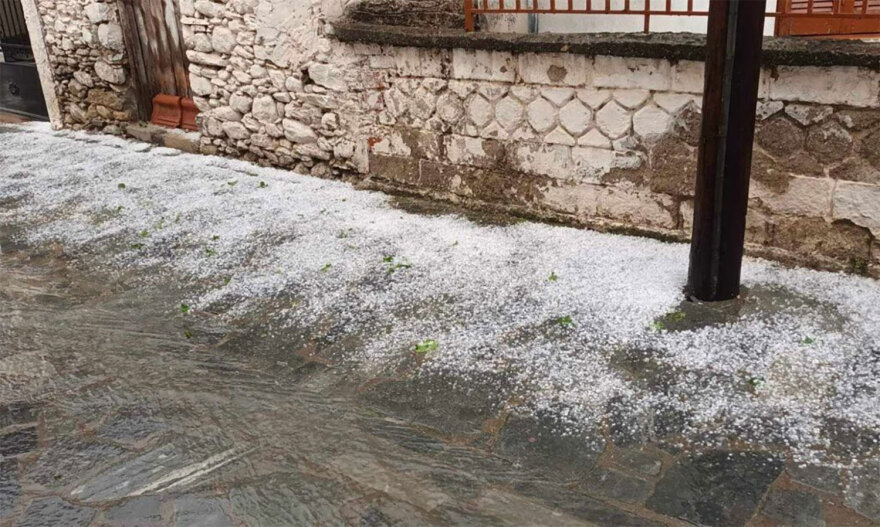
In parallel, there is great anguish among peach growers who are talking of total disaster.

Images from the area show a whitewashed landscape, with roads, yards and fields filled with hail.

Today’s Weather
Initially, there will be some cloud cover, which will thicken from the west, bringing rain and scattered thunderstorms to western mainland areas, the Peloponnese, and the Ionian Islands by afternoon. Strong weather conditions are expected overnight, and dust concentrations in the atmosphere will remain slightly elevated.
Temperatures will range from 13°C to 31°C in western Macedonia, 15°C to 32°C in the rest of northern Greece, and 17°C to 34°C in Thessaly. Other areas will see temperatures between 17°C and 33°C, while the Aegean islands and Crete will experience highs from 19°C to 31°C, with southern Crete possibly reaching 34°C.
Winds will be from the north-northwest in the Aegean, with strengths of 4-5 Beaufort, and up to 6 Beaufort in the southern seas. Southwest winds of 3-5 Beaufort, occasionally reaching 6, will blow in the Ionian.
FORECAST FOR THURSDAY 12-09-2024
In the eastern island country and Thrace cloudy with local showers until the afternoon. In the rest of the country generally clear weather with a few occasional clouds in the morning hours. Gradually in the Ionian Sea and from midday in the western mainland the clouds will increase and there will be local showers. Occasional rain is likely to occur in the midday and afternoon hours in the northern continental mountains and the mountains of Crete.
Visibility in the morning hours will be locally limited and fog will form in the western mainland.
Winds will initially blow from the west and gradually from the south at 3 to 5 Beaufort.
The temperature will rise slightly.
FORECAST FOR FRIDAY 13-09-2024
Initially in the west and gradually in the rest of the regions cloudy with local showers and occasional thunderstorms.
Visibility in the morning hours will be locally limited in the east.
Winds will blow south-southwest 4 to 5 and gradually in the sea up to 6 Beaufort.
The temperature will not change significantly.
Ask me anything
Explore related questions


