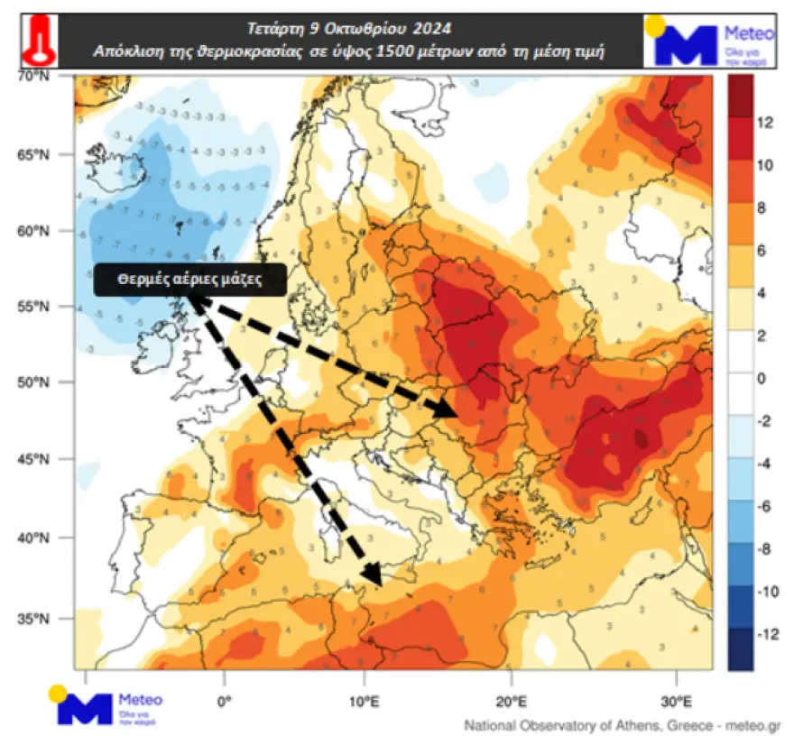
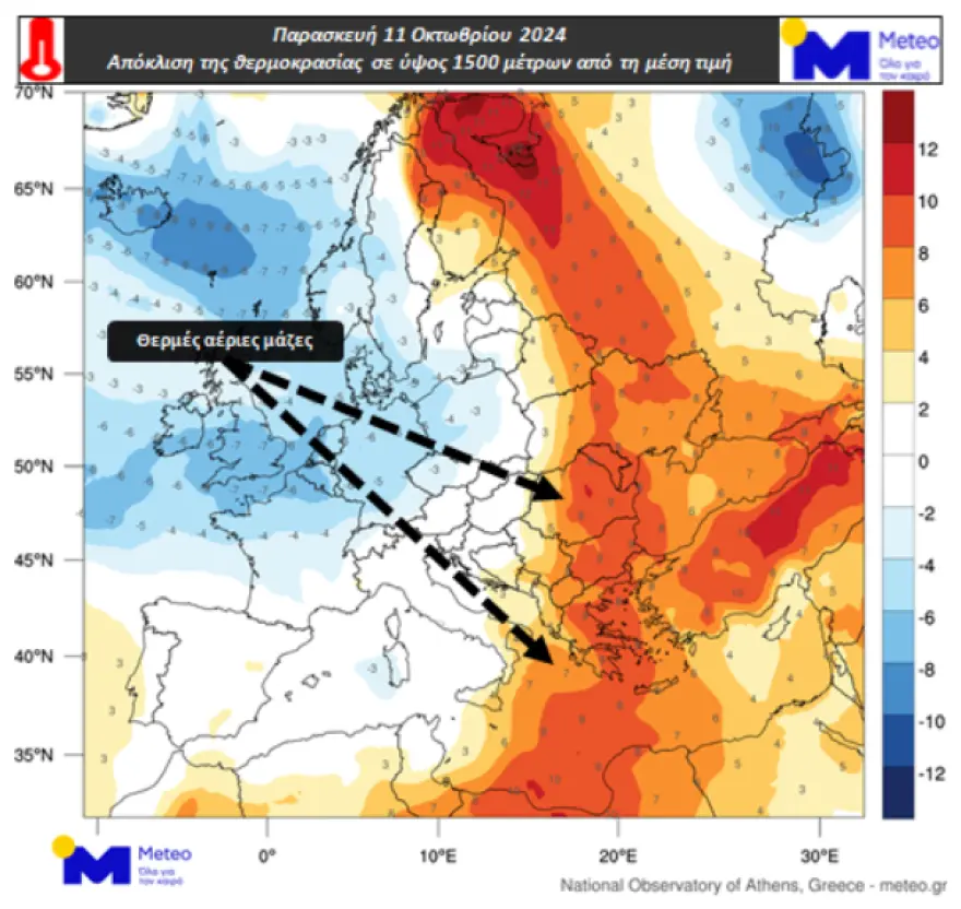
Temperatures are set to gradually rise over the next few days, with a mini heatwave peaking on Friday, October 11th. On that day, temperatures in some areas are expected to reach between 32-34°C.
According to meteorological maps, the warmest air masses will be concentrated over central and eastern Europe, including the Mediterranean region. The maps highlight temperature deviations at an altitude of around 1500 meters, showing how the current warmth compares to historical averages. While this heat is noticeable, factors like wind, cloud cover, and weather patterns will ultimately determine how hot it feels at ground level.

However, this burst of summer-like weather won’t last long. The Director of the National Weather Service, Thodoros Kolydas, has predicted that by Sunday, cooler weather will return, marking the end of what is often called an “Indian Summer” or “St. Demetrios Summer.”
Kolydas explains that October can sometimes offer these warm, dry spells, much like what is happening in parts of Europe now. This happens due to the positioning of high-pressure systems that bring clear skies and calm conditions.

Weather Outlook for the Week
- Today through Saturday: Expect sunny, summer-like weather with temperatures peaking 3 to 5°C above normal. Only a few localized showers may occur, mostly in the northwest on Wednesday and over the weekend in the northern regions. Winds will be light to moderate but may shift to stronger northerly winds by the weekend, signaling the change to cooler conditions.
- Sunday Onwards: A noticeable drop in temperature is expected, with temperatures falling just below seasonal averages next week. Winds will strengthen, especially towards the end of the week, helping to bring cooler air across the region.
For now, enjoy the warm weather while it lasts, as a more autumnal feel is just around the corner.
Ask me anything
Explore related questions


