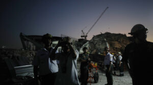
The 7.7 Magnitude Earthquake That Struck Myanmar
A powerful 7.7-magnitude earthquake hit Myanmar on Friday (March 28), with the epicenter located in the Sagaing region, near the city of Mandalay. The quake caused widespread destruction and was also felt in neighboring Thailand, triggering panic in Bangkok, where people fled buildings in fear.
Myanmar sits atop the boundary of the Indian and Eurasian tectonic plates. According to Joanna Faure Walker, a professor and earthquake expert at University College London, a tectonic fault runs through the country from north to south, allowing the plates to move horizontally at different speeds. This phenomenon generates “strike-slip earthquakes,” which are generally less destructive than those in subduction zones, such as the one in Sumatra. However, they can still reach magnitudes of up to 8.
Why Was This Earthquake So Destructive?
Although the Sagaing region has experienced earthquakes in the past—most notably a 6.8-magnitude quake in 2012 that killed at least 26 people—the earthquake on Friday is likely the strongest to hit Myanmar’s inland regions in the past 75 years, according to seismologist Bill McGuire from UCL.
Additionally, the shallow depth of the earthquake contributed to its devastation. The U.S. Geological Survey (USGS) reported that the quake had a focal depth of just 10 kilometers. As explained by Roger Mason of the British Geological Survey, “The seismic waves did not weaken as they traveled toward the surface, meaning buildings absorbed the full force of the quake.” He added, “It’s important not to focus solely on epicenters, as seismic waves do not originate from a single point—they radiate along the entire fault line.”
Myanmar’s Preparedness and the Scale of the Disaster
The USGS has warned that estimated fatalities could range between 10,000 and 100,000, while economic losses might reach up to 70% of Myanmar’s GDP. According to Mason, such projections are based on data from previous earthquakes, the country’s size, its geographic location, and its level of preparedness for seismic events.
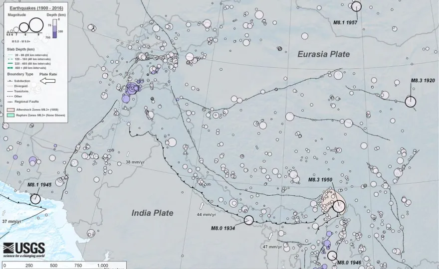
The relative rarity of strong earthquakes in the Sagaing region, which is near densely populated areas like Mandalay, means that local infrastructure was not designed to withstand such intense shaking. Mason noted that the last major earthquake in the area occurred in 1956, meaning many buildings may not have been constructed to modern seismic standards. “Most of Myanmar’s seismic activity occurs farther west, but this earthquake struck the heart of the country,” he emphasized.
As of now, at least 144 people have died, and 732 have been injured due to the massive earthquake, according to Myanmar’s state broadcaster MRTV. Junta leader Min Aung Hlaing has warned that the death toll could rise significantly.
Ask me anything
Explore related questions


