×
GreekEnglish

×
  • Politics
  • Diaspora
  • World
  • Lifestyle
  • Travel
  • Culture
  • Sports
  • Cooking
Saturday
06
Dec 2025
weather symbol
Athens 13°C
  • Home
  • Politics
  • Economy
  • World
  • Diaspora
  • Lifestyle
  • Travel
  • Culture
  • Sports
  • Mediterranean Cooking
  • Weather
Contact follow Protothema:
Powered by Cloudevo
> World

Turkey submits its own Maritime Spatial Planning map to UNESCO – Effectively dividing the Aegean sea in two

Turkey continues its revisionist approach and insists on the "median line" principle for areas designated for energy exploration. It has officially submitted its maps to UNESCO, potentially paving the way for submission to the United Nations as well

Newsroom June 16 09:11

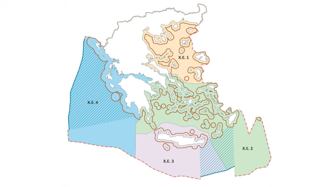
By sending its own maps to the relevant UNESCO agency, Turkey is responding to Greece’s recent completion of the first stage of its maritime spatial planning. This represents the initial official step toward delineating human activities within the marine environment — a plan that Athens has already announced will soon be submitted to the United Nations as well.

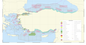
The Turkish maps reflect Ankara’s well-known revisionist stance, which challenges the legal effect of the Greek islands and promotes its theory of the “median line” between Turkey and mainland Greece. Notably, the red line on the map starts at the mouth of the Evros River and extends across the northern and southern Dodecanese, excluding the continental shelf of the islands and recognizing only their 6-nautical-mile territorial sea.

Details of the Turkish Map

The map, designed by Ankara University, was officially submitted to UNESCO as a so-called “scientific” document. In its southeastern section, covering the Eastern Mediterranean, the map shows, with diagonal lines, the offshore blocks assigned to the Turkish Petroleum Corporation (TPAO) for exploration. These areas overlap with Greece’s declared maritime claims and are directly linked to the so-called “Blue Homeland” doctrine.

Additionally, permanent military exercise areas — unilaterally designated by Ankara — are marked in pink.

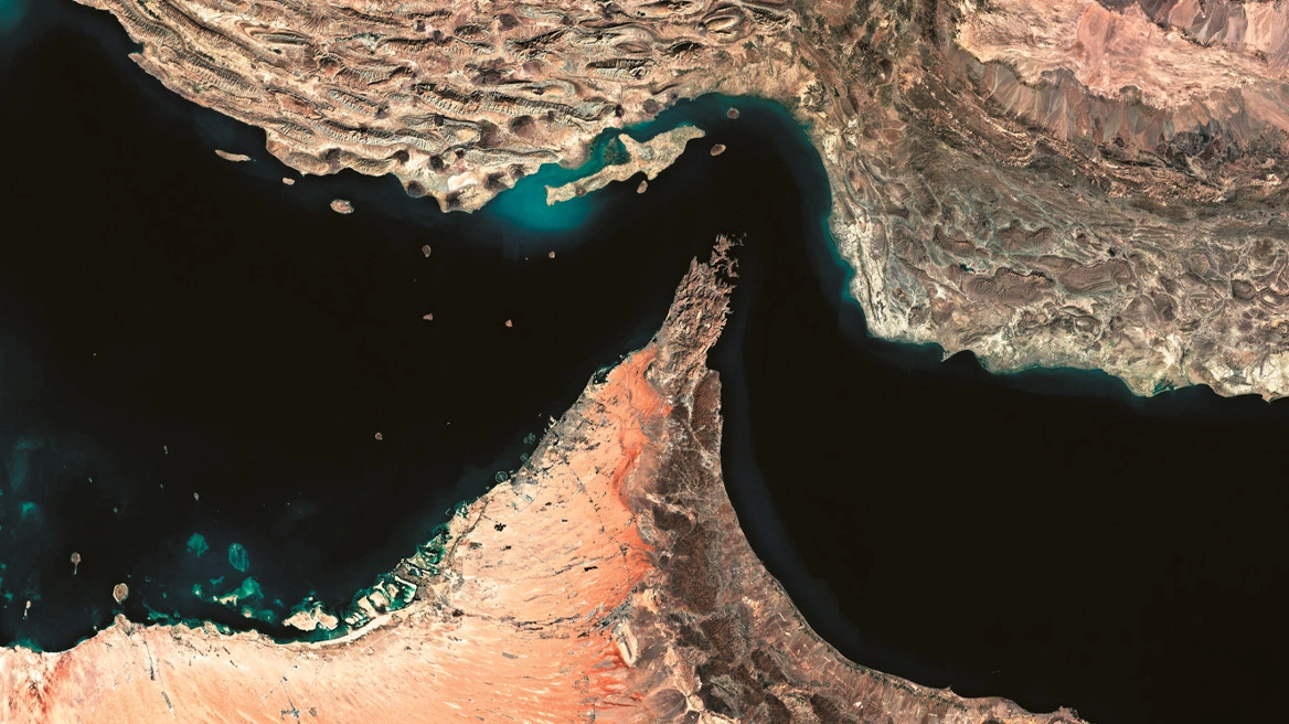
Of particular note is a black line crossing the international waters north of Crete and extending to the Dardanelles. The Turkish maps label this as a “cable” without providing any further explanation regarding its purpose or the nature of this infrastructure.

See the Map:

>Related articles

European Commission handbook depicts the East Aegean islands and the Dodecanese as Turkish

Bloomberg: Turkey nears rejoining F-35 program, says US ambassador Tom Barrett

The Greek village where residents “speak” in whistles — watch video

Reaction to the Greek Initiative

Greece’s announcement of its maritime spatial planning project triggered strong reactions from Turkey. For the first time, Greece has defined the geographical framework for its activities in the marine environment — a move fully grounded in European and international law and representing a significant step in asserting national sovereignty.

See the Greek Map:

Ask me anything

Explore related questions

#Aegean#aegean sea#Maritime Spatial Planning#turkey#UNESCO
> More World

Follow en.protothema.gr on Google News and be the first to know all the news

See all the latest News from Greece and the World, the moment they happen, at en.protothema.gr

> Latest Stories

Papastavrou: The ministerial meeting of the Greece, Cyprus, Israel and the USA group in Washington in April

December 5, 2025

European Commission handbook depicts the East Aegean islands and the Dodecanese as Turkish

December 5, 2025

Anger in Cyprus over the UN Secretary General’s envoy: She described the occupied territories as the “Turkish” side of Cyprus

December 5, 2025

From MAGA to Make Europe Great Again, with support for patriotic parties and a “stop” on mass immigration – How to stop the onslaught of China

December 5, 2025

Billionaire Andrej Babis reappointed Prime Minister of the Czech Republic on Tuesday

December 5, 2025

Axios: Trump will announce by Christmas the new governance structure for Gaza

December 5, 2025

Bolsonaro backs his eldest son as presidential candidate in the 2026 elections

December 5, 2025

US Ultimatum to the EU: Take on the majority of NATO spending by 2027

December 5, 2025
All News

> Politics

Papastavrou: The ministerial meeting of the Greece, Cyprus, Israel and the USA group in Washington in April

"The 3+1 format is the basis of a new regional architecture with countries that "respect the rules of the game and avoid confrontation", the Environment and Energy Minister said

December 5, 2025

European Commission handbook depicts the East Aegean islands and the Dodecanese as Turkish

December 5, 2025

Anger in Cyprus over the UN Secretary General’s envoy: She described the occupied territories as the “Turkish” side of Cyprus

December 5, 2025

Nicos Christodoulides reshuffles the government in Cyprus

December 5, 2025

Kyriakos Mitsotakis: Met with volunteers at the Maximos Mansion on the occasion of International Volunteer Day

December 5, 2025
Homepage
PERSONAL DATA PROTECTION POLICY COOKIES POLICY TERM OF USE
Powered by Cloudevo
Copyright © 2025 Πρώτο Θέμα