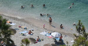
Summer normalcy returns to weather starting today, Sunday, with sunshine and pleasant temperatures through Monday. Maximum values will range between 32-34°C in the lowlands on the mainland and up to 30°C on the islands.
However, according to Giannis Kallianos, a gradual rise in temperatures will begin on Tuesday 24 June, with the thermometer reaching 35-37°C in mainland Greece and 30-34°C on the islands.
From Wednesday: a cold snap with warm air masses from North Africa
From Wednesday 25 June, warm air masses from North Africa will cover much of the Mediterranean, including Greece. The new heat wave is expected to last 3-4 days, based on the latest forecast data.
Indicative temperatures by city:
Attica
– Monday: 34°C
– Tuesday: 36°C
– Wednesday: 37-38°C
– Thursday: 38-39°C
– Friday: 39-40°C
Thessaloniki
– Monday: 33°C
– Tuesday: 34°C
– Wednesday: 37°C
– Thursday: 38-39°C
– Friday: 37-38°C
Patra
– Monday: 32°C
– Tuesday: 33°C
– Wednesday: 35°C
– Thursday: 37-38°C
– Friday: 37-38°C
Heraklion
– Monday: 28°C
– Tuesday: 31°C
– Wednesday: 33°C
– Thursday: 36°C
– Friday: 36°C
Larisa
– Monday: 33-34°C
– Tuesday: 36-37°C
– Wednesday: 38-39°C
Wednesday: 38-39°C
– Thursday: 40-41°C
– Friday: 41-42°C
Note that temperatures are indicative and based on current forecast data. There may be significant changes in the coming days.
Ask me anything
Explore related questions