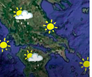
The severe weather system is currently affecting Western Greece, with meteorological forecasts indicating that the phenomena will continue until late tonight. The worsening weather conditions led the Hellenic National Meteorological Service (EMY) to upgrade its Emergency Weather Deterioration Bulletin to a Severe Weather Warning yesterday afternoon.
According to meteorologists, the intensity of the bad weather is expected to particularly impact certain regions, meaning residents need to take precautionary measures. The severe weather is characterized by heavy rainfall and strong winds, phenomena that can cause flooding and landslides, experts warn. The goal of local authorities is to minimize any potential negative effects on citizens and infrastructure.
EMY upgraded the weather deterioration bulletin to a Severe Weather Warning due to the barometric low coming from Italy, which is moving eastward and bringing rain and locally intense thunderstorms, mainly to the western parts of Greece.
More specifically, the Severe Weather Warning issued by EMY states:
Heavy rain and thunderstorms are expected through Sunday night (September 28, 2025) in the Ionian Sea (Zakynthos, Kefalonia, Ithaca, Lefkada), Aetolia-Acarnania, the western Peloponnese (Achaia, Ilia, Messinia), and the southern parts of Epirus (the prefectures of Arta and Preveza).
According to the available forecast data from the National Observatory of Athens / Meteo.gr, the phenomena will be locally intense in the Ionian Islands (Kefalonia, Zakynthos, Ithaca, Lefkada), Western Central Greece, and the Southern and Western Peloponnese. Gradually, from the morning hours of Sunday, September 28, they will weaken and move eastward, locally affecting central and northern mainland areas.
The estimated rainfall amounts for Saturday night (September 27, 21:00–00:00) (top), Sunday morning (06:00–09:00) (middle), and Sunday noon (12:00–15:00) (bottom), were calculated by the numerical weather prediction model of the National Observatory of Athens / Meteo.gr.
Yesterday afternoon, an 112 emergency alert was sent to residents of the Ionian Islands.
Specifically, the message warned residents of the Ionian Islands, as well as of Aetolia-Acarnania, Achaia, Ilia, Messinia, Arta, and Preveza, about the heavy rainfall expected in these areas.
“Be careful when traveling. Follow the instructions of the Authorities,” the message read, among other things.
Meteorologist Klearchos Marousakis had also warned since yesterday afternoon about dangerous weather for Western Greece, emphasizing that the bad weather will attempt to move further east and south today and Monday, though with significantly reduced intensity.
Meanwhile, Giorgos Tsatrafilias stated in a post that “forecast data continues to indicate strong thunderstorms and high rainfall amounts in southwestern Greece. The phenomena will begin early Sunday morning and last until late afternoon, in an ON-OFF pattern. The system shows persistence in these areas, which is why there’s even a signal for up to 100 tons of water per acre (≈1,000 m²).”
Weather Today
A few clouds are expected, locally increased at times, with scattered showers or thunderstorms over the mainland, the Ionian Sea, and possibly the northern Aegean. During the morning hours, intense phenomena are expected locally in the western and southern Peloponnese, the Ionian Islands (Lefkada, Ithaca, Kefalonia, and Zakynthos), and Western Central Greece.
Temperatures will range:
Northern Greece: 11–23°C (8–21°C in Western Macedonia)
Central & Southern Greece: 15–25°C
Western Greece: 15–27°C
Cyclades & Crete: 17–24°C
Eastern Aegean Islands & Dodecanese: 16–25°C
Winds:
In the Aegean, moderate northerlies at 4–5 Beaufort, gradually weakening.
In the Ionian, moderate east-southeasterlies at 4–5 Beaufort.
Weather on Monday, September 29
Clouds locally increased with scattered showers and isolated thunderstorms in the west and south, gradually extending to the rest of the country.
Winds: Northwestern in the west (3–5 Beaufort); Northeasterly in the east with similar intensity.
Temperature: Slight drop. Maximums between 21–23°C in most areas, reaching 25–26°C only in Crete and the Dodecanese.
Weather on Tuesday, September 30
Clouds locally increased, mainly over eastern mainland Greece and Crete, with local showers until the evening. Morning visibility will be locally limited, especially over western coastal and marine areas.
Winds: Northerly 3–4 Beaufort, locally up to 5 Beaufort in the southeastern Aegean.
Temperature: No significant change.
Weather on Wednesday, October 1
A few clouds, locally increased mainly over eastern mainland Greece and Crete, where brief local showers may occur.
Winds: Northerly 3–5 Beaufort, locally up to 6 Beaufort in the Aegean.
Temperature: Slight decrease.
Weather on Thursday, October 2
Clouds will increase rapidly from the west, bringing local rain and scattered thunderstorms initially in the Ionian and gradually in the rest of the country. Crete and the Dodecanese will only see temporarily increased clouds.
Winds:
West: Southeasterly 4–6 Beaufort, gradually shifting to northwesterly 5–7 Beaufort.
East: Initially northerly to northeasterly 4–5 Beaufort, up to 6 Beaufort in the northern Aegean, then gradually turning southerly to southeasterly 5–6 Beaufort; in the northern Aegean, easterly to northeasterly 6–7 Beaufort.
Temperature: A further slight drop, especially in the north.
Ask me anything
Explore related questions


