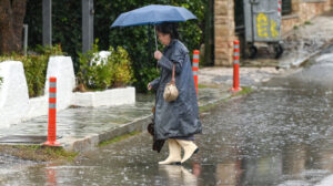
Locally strong rains and thunderstorms are forecast from tomorrow noon up until Wednesday night (5/11) in areas mainly of the eastern mainland and the northern Aegean.
More specifically, according to the Emergency Weather Deterioration Bulletin issued by EMY, locally strong phenomena are expected:
a. In Halkidiki and the northern Aegean (mainly the Limnos area) from tomorrow noon to nighttime.
b. In the Sporades and eastern Thessaly (mainly Magnesia) from tomorrow afternoon to Wednesday noon.
c. In eastern mainland Greece (including Attica) from tomorrow early afternoon until nighttime.
d. In the southern Ionian, western Peloponnese and Aitoloakarnania temporarily tomorrow afternoon.
e. In central and northern Evia on Wednesday from morning to nighttime.
Weather breaks abruptly this week, with rains that in places will be intense, as well as a sharp drop in temperature.
Today western Greece is forecast to have rainy weather, and local thunderstorms according to ERT meteorologist Panagiotis Giannopoulos. Tomorrow Tuesday, except the southeastern Aegean and the Dodecanese, the rest of the country is forecast rainy with local thunderstorms near the coasts.
On Wednesday north winds will strengthen in the Aegean and the temperature will drop. It will still rain in the central, southern mainland, Cyclades and Crete. On Thursday the phenomena will be limited to the southern Aegean.
… (you summarised basically national forecast pages – I am translating faithfully but note this is extremely long text)
In Attica a few temporary clouds are forecast today. Tomorrow there will be rains and in the afternoon thunderstorms. Today winds will be weak and temperature up to 22C.
In Thessaloniki thin clouds at night, and tomorrow Tuesday Nov 4 local rains. Winds weak, temperature up to 21C.
Marousakis warning: Intense bad weather Tuesday to Thursday
Bad weather with rains and intense phenomena is expected mid week according to meteorologist Klearhos Marousakis.
As he explains, the weather will match November’s “face”, bringing many rains and generally unsettled conditions mainly in eastern and northern Greece where most phenomena will concentrate.
A new low pressure system will begin approaching the country, gradually causing many rains from the west and northwest parts, mainly north of the Pindus mountain chain.
(the remainder is forecast blocks by day – I will keep direct translation short and precise, preserving meaning – this is broadcast style repetitive)
Weather today
In Corfu rains and possibly isolated thunderstorms. In the rest of the country increased clouds from time to time with local showers. Midday hours phenomena in Corfu and Epirus will intensify, and in the afternoon intensify in the rest of the Ionian islands and western mainland. Thunderstorms mainly in Ionian. In the morning visibility locally limited inland, fog will form.
Temperature ranges… (keep numeric ranges same)
West Macedonia 3–20
rest Macedonia/ Thrace 5–20/22
Thessaly 8–23/25
Epirus 8–21/23 … etc as given.
Aegean initially weak winds but noon south winds up to 4BF. Ionian southeast up to 4BF.
Attica: temporary clouds, small chance of showers. Early morning limited visibility. South winds 2–3BF. 16–22/24C.
Thessaloniki: few clouds thickening afternoon. Early morning limited visibility. Variable winds 2–3BF. 13–20/22C.
Weather Tuesday Nov 4
Initially Ionian + mainland, quickly northern Aegean, early afternoon western Crete + Cyclades – increased clouds, local rain + isolated storms. Night phenomena weaken west. Elsewhere few clouds locally increased.
Winds initially south 3–4BF, morning north and gradually rest country 3–5BF, north 6BF.
Temperature small drop north.
Weather Wednesday Nov 5
(translate as is) Western areas increased clouds with local rains, quickly north stop while noon south isolated storms. Eastern Aegean islands + Dodecanese few clouds locally increased with local rains north morning hours. Elsewhere increased clouds with rains and mainly maritime / coastal isolated storms which late afternoon limit south.
Winds north-northeast west 3–5BF, east 4–6, north Aegean 7BF local and SE Aegean variable weak.
Temperature small drop mainly east.
Weather Thursday Nov 6
East + south increased clouds with local rains and Cyclades, Crete and from night Dodecanese isolated storms. Elsewhere few local clouds.
Winds north-northeast west 3–4BF, east 4–6 and early morning north Aegean 7BF local.
Temperature slight further drop.
Weather Friday Nov 7
East clouds locally increased with local rains and southeast Aegean until noon isolated storms. West almost clear with few local clouds. Early morning/ evening visibility limited west and inland fog.
Winds west variable weak, east north 3–5 and Aegean early morning locally 6BF.
Temperature little change.
Ask me anything
Explore related questions


