Strong rains and thunderstorms are forecast today, Thursday (04–12–2025), lasting until the morning hours of Saturday (06–12–2025) in most areas of the eastern and southern parts of the country, as EMY has just updated its emergency weather bulletin.
It is emphasized that the rainfall will be not only intense but long-lasting. In many regions, the phenomena will be strong and accompanied by local hailstorms and at times very strong winds.
More specifically:
1. Today, Thursday (04–12–25), locally strong rains and thunderstorms are expected in:
a. the Ionian Islands (mainly Kefalonia and Zakynthos) until midday
b. Central Macedonia (mainly the regional units of Halkidiki, Pieria, Imathia)
c. Thessaly (especially the eastern parts) and the Sporades
d. Eastern Central Greece (including Attica, mainly the southern and eastern parts)
e. Evia (mainly the southern areas)
f. Peloponnese (mainly the southern and eastern parts)
g. Cyclades
h. Crete (mainly the southern parts)
i. the Eastern Aegean islands (from Chios and southwards) and the Dodecanese.
Storm Byron: Tsatrafyllias warns of “fast floods” — The 2 “red” danger zones
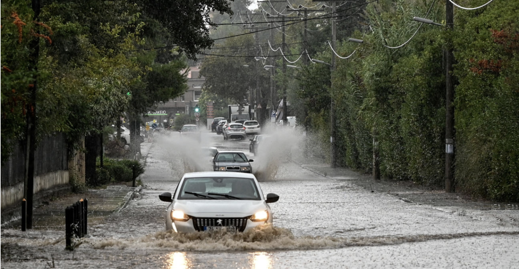
Storm “BYRON” is already affecting 60% of Greece, bringing strong rains and thunderstorms to many regions.
(Also read: A car “sank” and floated in mud in Heraklion, Crete, when the road collapsed due to the storm.)
According to meteorologist Giorgos Tsatrafyllias, today will unfold with relatively mild but persistent rainfall, but from the afternoon — and especially on Friday — the weather will worsen, with intense weather events capable of causing serious problems.
Two main danger zones have been identified, as shown in the forecast maps:
First zone:
Halkidiki, Imathia, Pieria, Thessaloniki, Thessaly, Sporades, Eastern Aegean, Dodecanese, Attica, and Boeotia.
Second zone:
Western and southern Peloponnese, Cyclades, and southern Crete.
Particular caution is required in Attica, where from Thursday night until Friday morning heavy rainfall is expected, mainly in the western and southern suburbs.
Rapid weather deterioration with extreme characteristics — What Lagouvardos says about Attica
Meteorologist and Research Director at the National Observatory of Athens, Kostas Lagouvardos, stated today that until now the rainfall has been mild and has not caused problems; however, as the low-pressure systems approach Greece, conditions of stronger instability will begin to develop.
Regarding Attica specifically, he said that from midday–afternoon there will be an intensification of the phenomena, which may last until midday on Friday. Lagouvardos mentioned that due to runoff issues in Attica, problems may occur, describing the situation as difficult and requiring attention in Athens as well.
A gradual weakening of the weather is expected from Saturday morning.
Attica will receive 50–60 mm of rain in two days, warns Kolydas
Attica is expected to receive significant rainfall over the next 48 hours, with total precipitation reaching 50–60 millimeters. Meteorologists warn of intense weather phenomena that could cause flooding and disruptions to traffic.
Ask me anything
Explore related questions