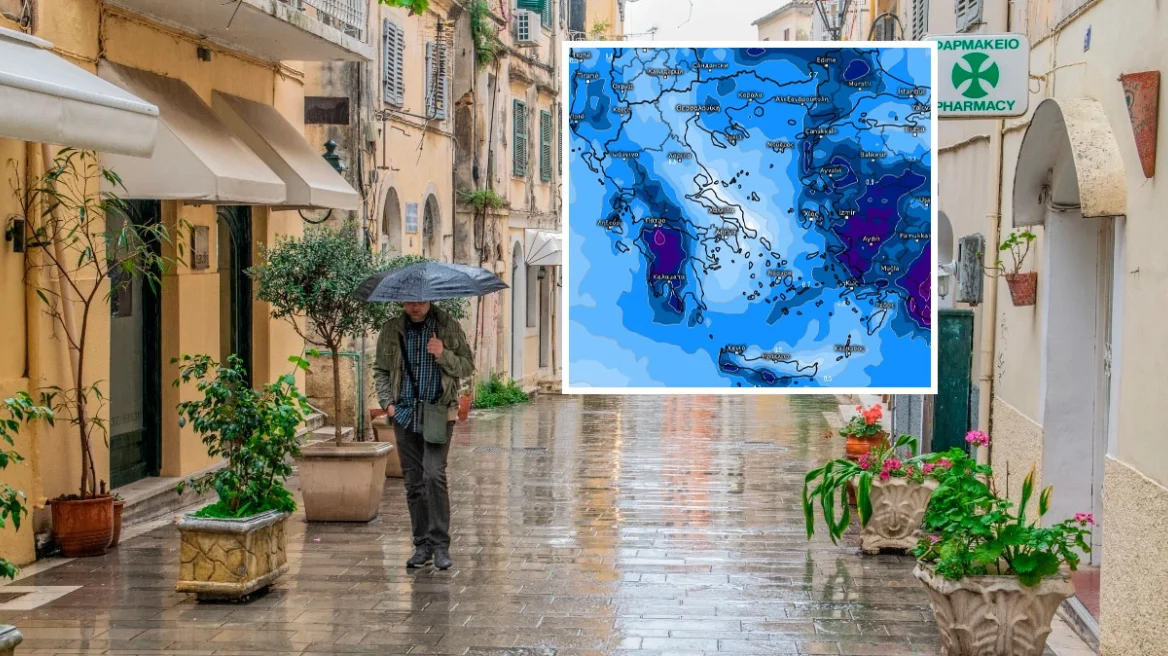
A new worsening of the weather is expected in Greece today, Tuesday, with locally heavy rain, thunderstorms, gale-force winds, and possibly hail.
On Tuesday morning, meteorologist Giorgos Tsatrafyllias posted a warning urging residents of eight regions to be particularly cautious.
“Over the next 24 hours, special caution is recommended due to expected heavy rainfall that may cause:
- Overflowing of streams and rivers
- Local flooding
- Landslides
- Ground subsidence
Especially in areas where the ground is already saturated from previous rainfall:
- Western and southern Peloponnese
- Western Aetolia-Acarnania
- Kefalonia
- Ithaca
- Zakynthos
- Southern Crete
- Eastern Aegean and the Dodecanese
Over the next 24 hours, locally gale-force northwesterly and southwesterly winds of 9–10 Beaufort are expected, which may cause:
- Trees and branches to fall
- Damage to roofs, awnings, and light structures
- Transportation disruptions
- Power outages
In the following areas:
- The Ionian Sea and regions washed by it
- The southern Aegean and the Thermaic Gulf area
- From tomorrow morning also in the central Aegean and the Chalkidiki area.”
When it will rain in Attica
Attica will also be among the regions affected by rainfall.
According to meteo, the first drops of rain will begin around midday.
The phenomena will intensify, peaking from around 2 p.m., when a thunderstorm is expected.
The EMY emergency bulletin
A new deterioration of the weather will occur today, Tuesday 17-02-2026, with locally heavy rain, thunderstorms, gale-force winds, and possibly hail.
More specifically:
1. Heavy rain and thunderstorms are forecast on Tuesday:
a. In Epirus and western Central Greece until the afternoon
b. In western and southern Peloponnese from late morning through the afternoon
c. In Crete (mainly the western and southern parts) during midday and afternoon hours
d. In the Cyclades (mainly the southern islands) temporarily in the afternoon
e. In the islands of the northern and eastern Aegean and the Dodecanese from early afternoon until evening
2. Very strong to gale-force winds will blow:
a. In the Ionian and the coastal areas of western mainland Greece (Epirus, western Central Greece, western Peloponnese) on Tuesday:
– until noon, westerly–southwesterly winds of 7–8 Beaufort
– from afternoon–evening until the early hours of Wednesday 18-02-2026, northwesterly winds of 9–10 Beaufort
b. In Crete, the Cyclades, and southeastern Peloponnese on Tuesday from the morning hours, southwesterly winds of 7–8 Beaufort, and from the evening through the morning hours of Wednesday 18-02-2026, westerly winds of 9 Beaufort.
Today’s weather
Rain and local thunderstorms are expected across most of the country. In the west, the phenomena will be locally intense, with significant rainfall totals. Thunderstorms, mainly in western and eastern areas, may be accompanied by hail. Snowfall is expected in mountainous inland areas. During the evening and the early morning hours of Wednesday 18/02, the phenomena are expected to gradually weaken.
Temperatures will range from 2 to 9°C in Western Macedonia, from 1 to 13°C in the rest of Macedonia and Thrace, from -1 to 14–15°C in Thessaly, from -1 to 12–14°C in Epirus, from 0 to 16°C in the rest of the mainland, from 9 to 13°C in the Ionian Islands, and from 9 to 17–18°C in the Aegean islands and Crete.
In the Ionian, westerly winds are initially expected at 6–7 Beaufort, gradually turning northwesterly from the afternoon with intensities up to 7–8 Beaufort. In the Aegean, southwesterly/westerly winds are initially expected at 7–8 Beaufort, turning northwesterly in the evening at 7–8 Beaufort.
In the prefecture of Attica, cloudiness with rain and possible thunderstorms is expected mainly during midday and early afternoon, with improvement later. Winds will initially blow from southerly/southwesterly directions at 4–5 Beaufort, and up to 6 Beaufort in southeastern areas. In the evening, winds are expected to turn westerly at 5–6 Beaufort, and locally up to 7–8 Beaufort in western and southern parts of the prefecture. Temperatures will range from 10 to 16–17°C.
In Thessaloniki, cloudiness with intermittent rain and a chance of local thunderstorms is expected, with improvement after the afternoon. Winds will initially blow from southeasterly directions at 4–5 Beaufort, turning northwesterly after the afternoon at 5–6 Beaufort. Temperatures will range from 10 to 13°C.
Weather on Wednesday 18-02-2026
In eastern Macedonia, Thrace, the islands of the northern and eastern Aegean, the Cyclades, the Dodecanese, and Crete, cloudiness with local rain and sporadic thunderstorms mainly in coastal and maritime areas, and light snowfall in northern mountainous inland areas. Improvement is expected from early afternoon. In the rest of the country, generally fair weather with temporary cloudiness early in the day in the west, where light local rain and light snowfall in mountainous areas are possible.
Winds will blow from west-northwest at 5–7 Beaufort, locally 8 Beaufort in the Ionian, Aegean, and central Macedonia, and up to 9 Beaufort in southern areas, with rapid weakening.
Temperatures will drop slightly, reaching 11–13°C in the north, 13–14°C in the west, and 15–17°C in the remaining areas. Early in the morning, frost will occur in northwestern inland areas.
Weather on Thursday 19-02-2026
In the west, a few clouds locally increasing with local rain, and from the afternoon in the northwest possibly isolated thunderstorms. In the rest of the country, few clouds that will increase late at night in the eastern Aegean, where a few local showers are possible.
Winds will blow from southerly directions at 4–6 Beaufort, and locally up to 7 Beaufort over the seas from the afternoon.
Temperatures will rise slightly.
Weather on Friday 20-02-2026
Initially in the west and the eastern Aegean, and gradually in the rest of northern and central Greece, cloudiness with local rain. Sporadic thunderstorms will occur initially in the northwest and gradually in the rest of the west, central, and northern regions. Snowfall will occur from midday in mountainous and semi-mountainous areas of Epirus, Macedonia, and Thrace.
Winds will blow from southerly directions at 5–7 Beaufort, and locally up to 8 Beaufort over the seas, gradually turning northerly in the west and north from the afternoon with the same intensity.
Temperatures will drop in the north.
Weather on Saturday 21-02-2026
Increased cloudiness with local rain and, mainly in the Aegean until midday, sporadic thunderstorms. Snowfall will occur in mountainous inland areas, in semi-mountainous areas of eastern Macedonia and Thrace, and in the mountains of the northeastern Aegean islands.
Winds will blow from northerly directions at 4–6 Beaufort, and locally up to 7 Beaufort over the seas; only during the morning hours in the eastern and southern Aegean will winds be southerly with the same intensity.
Temperatures will fall.
Ask me anything
Explore related questions