






A challenging 24 hours lie ahead, according to ProtoThema meteorologist Giorgos Tsatrafyllias, as a wave of severe weather is set to affect much of Greece, bringing locally intense and long-lasting conditions.
The storms are expected to be accompanied by frequent lightning, hail and very strong wind gusts that could bring down trees, branches and loose objects. There is also a significant risk of flash flooding, particularly in areas where thunderstorms are expected to remain intense for extended periods.
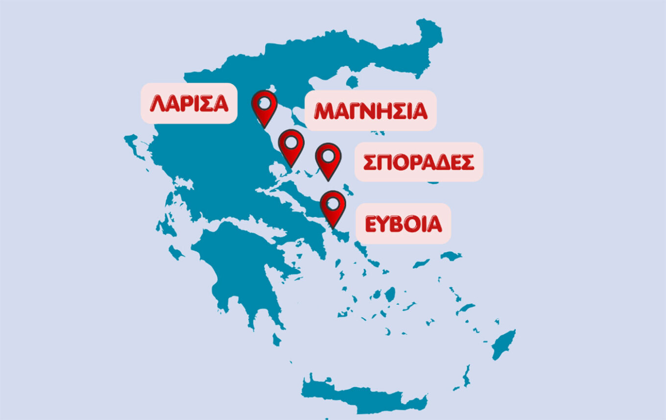
The highest-risk areas include Larissa, Magnesia (especially coastal areas), Evia and the Sporades islands, where the severe weather is expected to persist from Friday afternoon until Saturday morning.
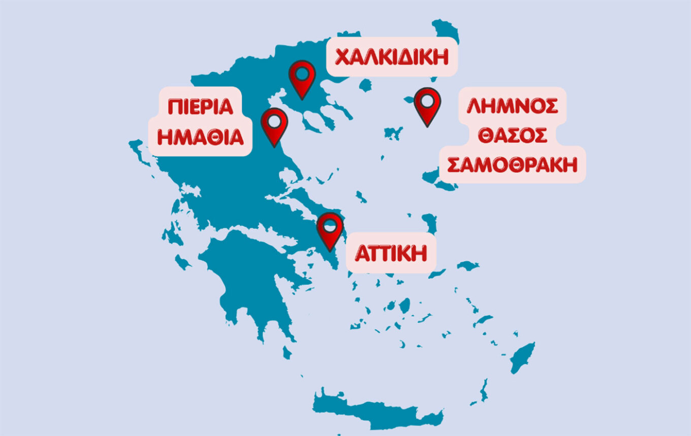
A second level of risk applies mainly to the coastal areas of Pieria, Imathia and Halkidiki, as well as the islands of Limnos, Thassos, Samothrace and Attica. In most of these areas, conditions are expected to ease during the early hours of Saturday, with the exception of Attica.
When will it rain in Athens?
For Attica, rain and periods of heavy thunderstorms are expected from the afternoon onwards, mainly affecting the northern and eastern parts of the region. The weather is forecast to improve during the early evening.
Temperatures will range between 20°C and 29°C, while northerly winds may reach 6 Beaufort.
Weather in Thessaloniki
Thessaloniki is also expected to experience unstable weather, with rain and locally heavy thunderstorms developing from midday onwards before easing later in the evening. Northwesterly winds in the Thermaic Gulf will reach up to 5 Beaufort, while temperatures will remain below 23°C.
Temperatures to fall
Temperatures will continue to decline, reaching 28–29°C across mainland Greece and 30–32°C in the Cyclades, Crete and the Dodecanese.
North to northwesterly winds will strengthen, reaching 7 Beaufort in the Ionian Sea and the southeastern Aegean.
Conditions are expected to improve gradually on Saturday, while summer weather will return from Sunday, accompanied by rising temperatures.
EMY updates severe weather bulletin
The Hellenic National Meteorological Service (EMY) confirmed that the Emergency Weather Warning issued on July 23 remains fully in effect, based on the latest forecast data.
Severe weather is forecast from Friday, July 24 through Saturday morning, July 25, affecting most parts of the country with heavy rain and thunderstorms. The storms may also bring strong wind gusts, frequent lightning and local hailstorms.
Friday, July 24
Heavy rain and thunderstorms are forecast for:
- Central Macedonia (Pieria, Imathia, Halkidiki and Thessaloniki) from late morning until late evening (orange warning).
- Eastern Thessaly (Larissa and Magnesia) from midday until late at night (orange warning), with red warnings for coastal and offshore areas.
- The Sporades and Evia (mainly central and northern parts) from midday onward (red warning).
- Eastern Central Greece, including Attica, from the afternoon until late evening (orange warning).
- Northeastern Aegean islands (Limnos, Thassos and Samothrace) from late evening (orange warning).
Saturday, July 25
Severe weather is expected to continue:
- In the Sporades until the morning (red warning).
- In Evia, especially central and northern areas, until late morning (red warning).
- On the northeastern Aegean islands (Limnos, Thassos and Samothrace) until the early morning hours (orange warning).
- In Magnesia, particularly eastern coastal and offshore areas, during the early hours of Saturday (orange warning).
Ask me anything
Explore related questions




