The seismic sequence in the sea area of Andros, between Santorini and Amorgos, as determined by the scientists of the two Commissions, shows a relative lull, namely the Standing Scientific Committee for Seismic Risk Assessment and Seismic Risk Reduction and the Standing Scientific Committee for the Monitoring of the Greek Volcanic Arc of the OASP, convened by the President of the OASP, Ethymis Lekkas.
According to the two committees, which met at the Ministry of Political Protection in the presence of Vassilis Kikilias, the current seismic activity in the area “is due to submarine faults with a NE-SW direction and is part of the broader geodynamic context of the region. According to the available data, this activity is due to a combination of tectonic and deeper magmatism.”
The scientists also say that “seismic activity within the caldron remains at the same levels, while there is increased ground deformation in the wider Santorini area, which is continuously monitored”.
A detailed statement issued by the Ministry of Civil Protection:
This morning the President of the OASP, Professor Efthimios Lekkas, reconvened a joint meeting of the two Committees (the Permanent Scientific Committee for Seismic Risk Assessment and Seismic Risk Reduction and the Permanent Scientific Committee for the Monitoring of the Greek Volcanic Arc of the OASP).
The meeting was held at the Ministry of Climate Crisis and Civil Protection, in the presence of Minister Vassilis Kikilias, Deputy Minister Evangelos Tourna and Secretary General of Civil Protection Vassilis Papageorgiou, the Secretary General for Natural Disaster Recovery and State Relief Petros Kabouris, the Commander of the Construction and Disaster Response Command (DIKAFKA) of the General Staff of the General Staff, Lieutenant General Michael Kluvas, as well as representatives of the Fire Brigade leadership.
After discussion among the members of the Committees and the presentation and examination of all the data so far, the following are unanimously formulated:
1. The seismic sequence in the marine area of Anydros between Thera and Amorgos is relatively subdued, with approximately 1,300 earthquakes since February 1 to date with magnitudes above 3.0 (and with a maximum recorded magnitude of M 5.3).
2. The current seismic activity in the Anudros Island area is due to submarine faults oriented NE-SW and is part of the broader geodynamic context of the region. According to available data, this activity is due to a combination of tectonic and deeper magmatism.
3. Seismic activity within the caldera remains at the same levels, while increased ground deformation is observed in the wider Santorini area and is continuously monitored.
4. The public buildings, based on the tests carried out so far, have shown a very good behaviour to seismic loads.
5. The Committees recall the following precautionary measures:
Citizens should:
-Avoid large gatherings inside buildings.
-Avoid approaching abandoned buildings.
.
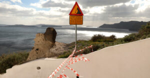
-Avoid accessing and staying in the ports of Ammoudi, Armeni, Korfos and the Old Port of Fira.
-To proceed to the removal of dangerous elements of non-structural vulnerability in their buildings (heavy overhanging objects, suspended ceilings, etc.) and the emptying of water in swimming pools.
-To choose safe routes when moving through the urban and rural road network, especially in places where there are steep morphological slopes and landslide phenomena are likely to occur.
-There should be immediate removal from coastal areas in the event of strong seismic tremors.
-Schools to remain closed until Friday 21 February 2025 in Thera, Ios, Anafi and Amorgos.
The Committees will meet again on Wednesday 21 February 2025 at 18:00.
Ask me anything
Explore related questions


