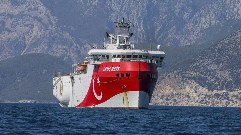
Turkey escalates tensions yet again as it issued a new NAVTEX for seismic surveys of the “Oruc Reis“.
The illegal NAVTEX concerns the period from September 2 to September 12 and was issued like the previous ones by the Antalya station.
It concerns an area which adjoins, to the north, the immediately preceding one, so it sends the Turkish research vessel closer to the islands of Kastellorizo and Rhodes.
Another critical aspect of the new Turkish provocation is that with the new announcement, Turkey is expanding its surveys to the limit of the Greek-Egyptian EEZ.
As can be understood from the relevant map of the Greek-Egyptian agreement for delimitation of the EEZ, the coordinates of the new Turkish NAVTEX are adjacent to point A, where the easternmost end of the maritime zones delimited by the Greece-Egypt agreement is located (Meridian 27,59).
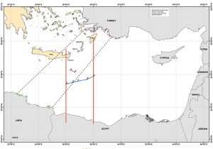
(The Greek-Egyptian EEZ delimitation agreement)
Game changer: Greek-French agreement for Rafale jet fighters?
Russia declassifies footage of “Tsar Bomba” – The most powerful nuclear bomb in history (video)
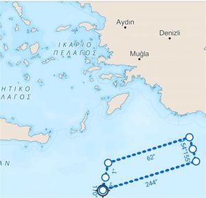
(The illegal Turkish NAVTEX)
In this way, Ankara not only seems indifferent to the threat of sanctions from Brussels, which was sent after the informal EU Council of Foreign Ministers, but for the first time tries with another pirate act to actually challenge its recent Athens – Cairo agreement.
The Greek Ministry of Foreign Affairs answered immediately:
Greece is not blackmailed. Based solely on International Law, International Maritime Law and good neighborliness rules, it will continue to seek agreements for the delimitation of its maritime zones with all countries in the region.
“We call on Turkey to distance itself from the daily delusions it engages in and to work for the security and stability of the region”.
Ask me anything
Explore related questions
