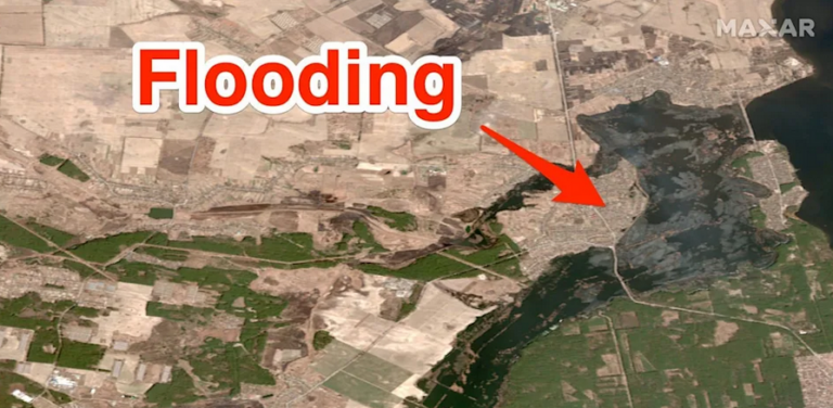
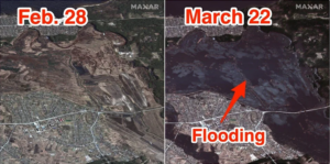
Satellite images show flooding in the Irpin River basin northwest of Kyiv.
It is unclear what caused the flooding, but this could be a strategic move by Ukraine to block the advance of Russian troops on the capital, analysts have said. The basin borders a large reservoir.
It could be an example of “hydraulic warfare” from Ukraine to block the advancing Russian troops targeting the city’s northwest, analysts previously told the Washington Post. If the Russian forces cannot cross the Irpin river, they will not be able to take Kyiv from the west, according to CNN.
Turkish Foreign Minister calls on Muslims of the world to aid the “Turks” in Thrace
According to the UK’s defense intelligence, Russian troops have driven towards Kyiv from the north, west, and east since the war began on February 24. Capturing Kyiv is seen as Russia’s primary goal in its invasion of Ukraine, but it has struggled to make headway facing fierce resistance from Ukrainian forces.
Ask me anything
Explore related questions


