From volcanoes in Iceland to wildfires in California, NASA has made nearly three million images of Earth’s thermal emissions available to the public for free.
The stunning images were captured by Japan’s Advanced Spaceborne Thermal Emission and Reflection Readiometer (Aster) instrument onboard the Terra spacecraft. Aster is used to create detailed maps of land surface temperature, reflectance and elevation.
It takes high-resolution images of the Earth in 14 different wavelengths of the electromagnetic spectrum, as Daily Mail reports.
The database has been described as a ‘multimodal version of Google Earth’ giving the opportunity to everyone to have a look at a region’s environmental changes in incredible detail.
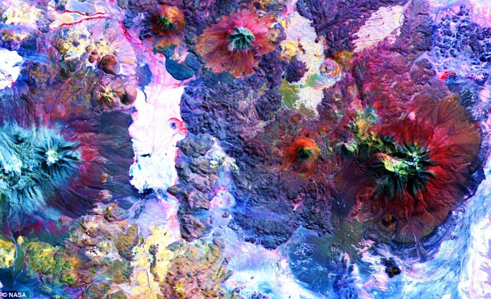
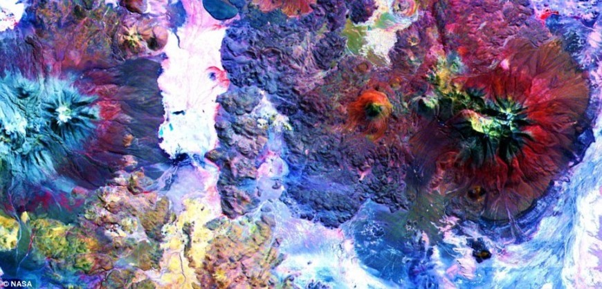
In this image of the Andes along the Chile-Bolivia border, the visible and infrared data have been computer enhanced to exaggerate the differences of the different materials. On the middle left edge of the image are the Olca and Paruma stratovolcanoes (coloured in red in this composite). This image covers an area 37 miles by 37 miles (60 by 60km).
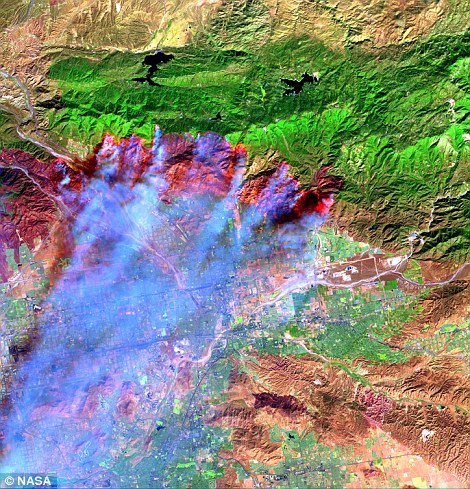
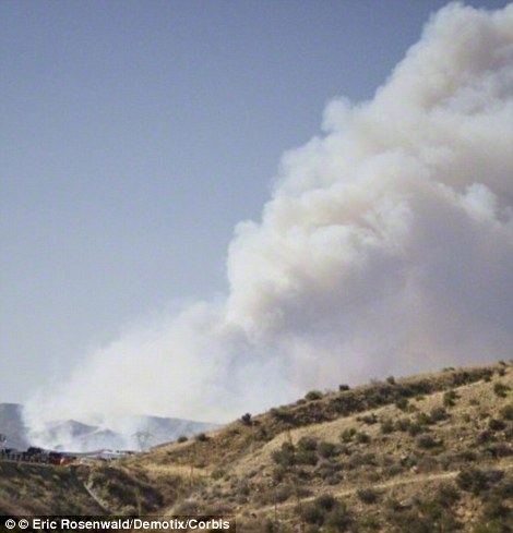
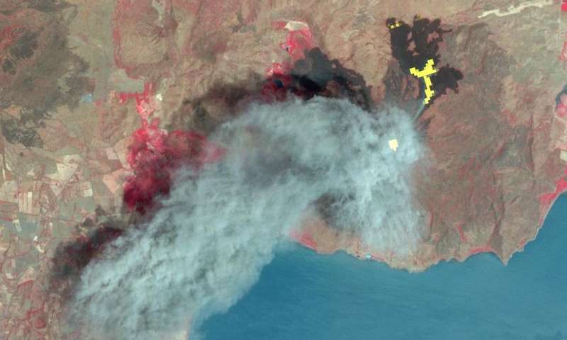
In 2003, Aster captured the first image of the fire burning on either side of Interstate 15 near the Cajon Pass in the San Bernardino Mountains. The smoke is shown in blue When this image was acquired, the fire had burned more than 80,000 acres, consumed 450 structures. The second image what the fire looked like at the time.
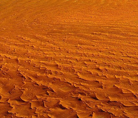

Coastal winds form the tallest sand dunes in the world in the Namib-Naukluft National Park of Namibia. The first image was taken by putting together data on elevation collected by Aster, while the second image shows a photographic aerial view of the dunes.

The Kondyor Massif is located in Eastern Siberia, Russia, north of the city of Khabarovsk. It is a rare form of rock intrusion called alkaline-ultrabasic massif and it is full of rare minerals. Last year 4 tons of platinum were mined there. This 3D perspective was created by draping a simulated natural color Aster composite over an Aster-derived digital elevation model. The image was taken on June 10, 2006.
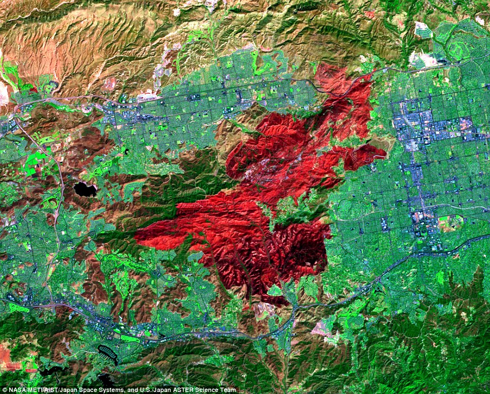
Northwest of Los Angeles, California, a brush fire exploded on September 28. Growing to more than 23,000 acres, the blaze (red) threatened homes, natural resources, power lines, and communications equipment in the Thousand Oaks region north of the Santa Monica Mountains. Hundreds of people were evacuated from their homes.
In March 2016, ASTER captured the eruption of Nicaragua’s Momotombo volcano with its visible and thermal infrared bands. The ash plume is depicted by the visible bands in blue-gray; the thermal infrared bands show hot lava flows in yellow and the active summit crater in white. Vegetation is red.
ASTER data are now available via electronic download from NASA’s Land Processes Distributed Active Archive Center (LP DAAC) at the U.S. Geological Survey’s (USGS) Earth Resources Observation and Science Center in Sioux Falls, South Dakota, and from AIST. To access the data, visit: lpdaac.usgs.gov/dataset_discovery/aster or gbank.gsj.jp/madas/