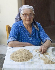
“In the winter, when the lake is covered in snow, it is magical,” Apostolia Papoutsis, the president of the village of Archaia Feneos, tells me – briefly making me think that perhaps I have come at the wrong season.
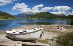
But any doubts are dispelled a short while later when, on the banks of the lake, I meet people who are camping, swimming, fishing, horseback riding or just relaxing.
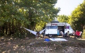
“We are, above all, lovers of the sea. But now that we have discovered Doxa Lake, we wouldn’t change it with anything. The energy you feel here is indescribable.” So says the young couple from Patras, who have parked their camper van next to the water’s edge and have the best view around right at their doorstep.
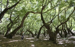
Birdsong, choruses of amphibian croaks, dense fir trees and, on all sides, the slopes of the mountains Oligyrtos, Helmos and Ziria. Peace. A short distance away another couple is sunbathing and swimming, while in a tent pitched in front of fishing rods sleeps a Polish man who comes here every year on holiday.
The highlands of Corinth are just 2-3 hours by car from Athens. At a distance of just 60km from the capital one can see two lakes, golden reed beds, fields where exceptional pulses are cultivated, mountain plains and alpine landscapes. And all of this next door to the Gulf of Corinth which is perfect for the last swims of the year.
Of course, the broader area of Doxa and Feneou are also known as winter destinations thanks to the town of Trikala and the small ski resort of Ziria. But before then one can enjoy other activities not possible in the depths of winter. Another advantage of getting here before the snows are the birds: “In October migratory birds pass through here, some nest and winter here while others stop before moving on,” says Aglaia Kiouktsoglou, the head of the Environment Museum of Stymphalia, which is run by the Piraeus Bank Group Cultural Foundation.
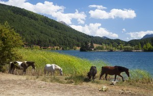
Located 27 km from Doxa, Stymphalia is the ‘other’ lake in the region. Unlike Doxa, which is man-made, Stymphalia is a natural body of water. In myth, the basin was said to be home to the Stymphalian birds – the man-eating beasts that Hercules defeated as his sixth feat.
STYMPHALIA
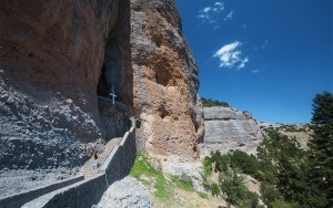
Passing through rapidly changing landscapes, you will turn off from the coastal highway either at Kiato or Derveni. Be sure to stop at Pangahia tou Vrachou (the Virgin of the Rock) – a church literally built into a cave, in Kato Tarso. You can also get turn off at Xylokastro but that route will take you through Trikala. We recommend you exit at Kiato.
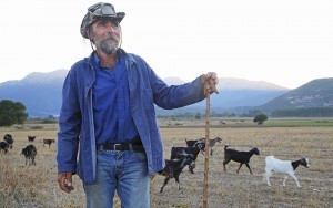
Leaving the Corinthian Gulf behind, the aroma of the grapes that are being harvested accompanies us on our trip and before we know it we are at the edge of the lake of Stymphalia. Despite the fact that it covers an expanse of 3.5 – 7.5 square kilometers (during the rainy period it can reach up to 15 square kilometers), the majority of the lake is covered in reeds. In antiquity, the lake supplied ancient Corinth with 80,000 cubic meters of water per day via the Hadrianic Aqueduct, portions of which have survived in the surrounding area. Visiting the lake you will see flat, cultivated expanses, the pretty view up to the slopes of Ziria, traditional tavernas offering spit-roasted suckling pig (a popular draw on the weekends in the winter) as well as shepherds with their flocks.
The main economic activity in the villages is raising livestock and in Kalliani you will find the “Stymphalia” creamery with exceptional cheeses and dairy products (+30 27470.22420).
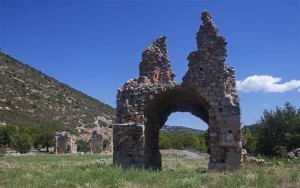
You can also see the ruins of the Zaraka monastery – an abbey that was briefly inhabited in the 13th century by a group of Cistercian Monks, as well as the ruins of ancient Stymphalia. Most of the latter date to the Hellenistic Period, but other finds indicate that the site has been inhabited since the Middle Paleolithic.
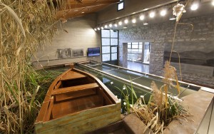
You can explore the history of ancient and modern humans around the lake which is a Natura-protected ecosystem – as well as how they have lived off it – at the Environment Museum of Stymphalia.
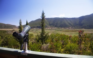
The museum is located a short distance outside of the village of Stymphalia, opposite from the archaeological site. During your visit you can enjoy a view over the water and engage in some birdwatching using telescopes set around the patio of the museum.
Moving on, follow the route that begins from the village of Lafka (where you can also see the Folk Museum of Giorgos Milios) wraps around the lake. As the road winds around the side with the highest elevation, you will be able to see the open stretches of water through the reeds.
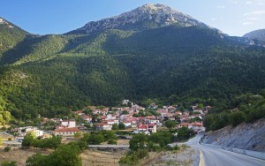
From Lafka, the road continues to climb up the slopes of Mount Ziria, passing through the village of Kastania. After passing the ridge above the village you will be afforded stunning views over the Feneos valley and the surrounding mountains.
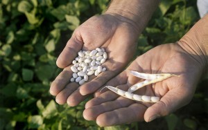
The valley was once filled by another lake, but this was drained in the 19th century. Today, across an expense of 20,000 hectares and at an altitude of 700-800m, PDO pulses are grown including Fasolia Vanilies Feneou (Feneos “Vanilla Beans”), yellow split peas (fava in Greek), lentils and other pulses.
POPULAR DOXA
The undeniable star of the mountain plain of Feneos is the man-made lake of Doxa, which was created in 1996 with the construction of a damn that retains the water of the river of the same name. Its circumference is no more than 5 km, but it is rich in variety. On the end of a strip of land that juts out into the water and reaches the middle of the lake, you will find the church of Aghios Fanourios.
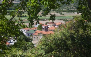
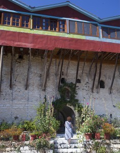
A short distance away is the monastery of Aghios Georgios, which is known for its brilliant views over the water as well as the rose spoon sweet that the monks have been making here for 20 years. Make sure to visit the interior of the church for the impressive gilt templon (icon screen) that dates to 1762.
Near the lake is the archaeological site of ancient Feneos, where a few foundations have survived. The small nearby museum houses some interesting finds, yet is not currently open to the public due to a lack of staff. Several of the surrounding villages such as Mosia and Mesino have views over the plain of Feneos, but the standout is the village of Goura with its beautiful square and which has started developing touristically in recent years.
Here you will find the impressive Taxiarchon church surrounded by old aristocratic dwellings along charming streets.
For a coffee with a view, seek out the cafe-bar Brouklis (tel. +30 27470.51301) or sit with the locals at one of the traditional cafes. From here a dirt road climbs up the slopes of Ziria and leads to the mountain plain of Skafidia at an elevation of 1,400 m, which is inhabited by wild horses and domesticated cows.
If you are a fan of off-road trails, from there you can continue to the mountain plain of Ziria and its small ski resort, as well as the lake of Dasios which only has water in the winter months.
Before the cold sets in (or later in the spring) the area lends itself to hiking the trails and other activities. At Doxa Lake the Patsios family has seven horses (tel. +30 698.861.9915) for rides in the forest and around the lake, while in the village of Feneos the guesthouse “Efharis Filoxenon” organizes a range of activities. Efharis Beka and husband, Vasilis Tambourakis, moved to the area about 20 years ago and offer a full range activities ideal for experiencing the best the area has to offer.
In the autumn, mushroom picking excursions are among the most enjoyable where you can learn to pick a range of wild, edible fungi and watch truffle-hunting dogs unearth the aromatic treasures.
A slew of trails extend through the surrounding mountains and there are plenty of ways to experience them: by foot, mountain bikes, electric bikes, 4x4s or ATVs. You can head from Feneo to the village of Zarouchla and Lake Tsivlou via the slopes of Mount Helmos, (18km along dirt roads and 8 km of asphalt), or to Aghios Nikolaos (2 hours on foot). Alternatively from Goura make your way Skafida (an 11km path, returning by forest road) or from Doxa Lake head to the saddleback of Kynigou in Dourdouvana (a two-hour hike). All are gorgeous and follow quiet forest roads or footpaths.
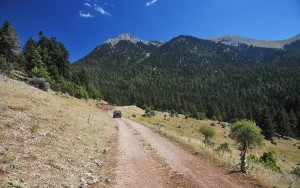
We enjoyed the route to the saddleback of Kynigou which, after 20 km of rocky dirt roads (a 4×4 is essential), led us to Planitero of Achaia next to the tavernas serving local trout. And after having grown accustomed to the firs, black pines and placid waters, we suddenly found ourselves surrounded by the plane trees and the flowing waters of the springs of the Aroanios River.
Source: Olga Charami/greece-is.com
Ask me anything
Explore related questions
