Turkey continues its provocative stance, as it launched a new Navtex for seismic surveys by Oruc Reis in the Eastern Mediterranean on Saturday morning.
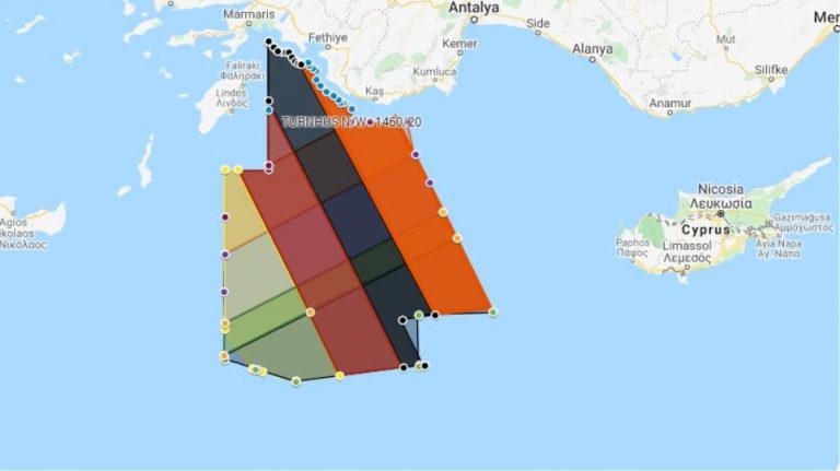
The new Navtex (orange area) is valid until midnight on November 29th.

In this new provocation, Turkey’s Navtex reaches just 6 nautical miles from the Greek island of Kastellorizo, right at the limit of the Greek territorial waters.
Greece reacted with an anti-Navtex. The Heraklion station of the Hellenic Navy’s Hydrographic Service issued a Navtex that characterizes the new Turkish Navtex as “illegal”.
The Greek Navtex reports that the unauthorized Antalya station has issued a Navtex concerning “illegal activity” in an area that covers the Greek continental shelf.
It also emphasizes that Greece has the “exclusive responsibility to issue Navtex for the specific region”.
Ask me anything
Explore related questions


