





The protection and promotion of archaeological sites and monuments throughout Greece, the safeguarding of public property, and improved services for citizens and professionals are being strengthened through the expansion of cooperation between the Ministry of Culture and the Ministry of Digital Governance and Artificial Intelligence.
The collaboration focuses on the further development of the Archaeological Cadastre using the geospatial foundations of the National Cadastre, the promotion and utilization of the real estate assets managed by the Ministry of Culture, and the systematic geospatial mapping of cultural heritage protection zones across the country.
Today, cadastral data has been uploaded and a National Cadastre Identification Number (KAEK) has been assigned for 99% of Greece. This geospatial infrastructure provides a unified reference framework through which the Archaeological Cadastre can more accurately map immovable monuments, archaeological sites, historic locations, their protection zones, and the real estate property of the Ministry of Culture.
The cooperation is being developed along three main axes, with the aim of creating a unified, reliable, and functional framework for geospatial information.
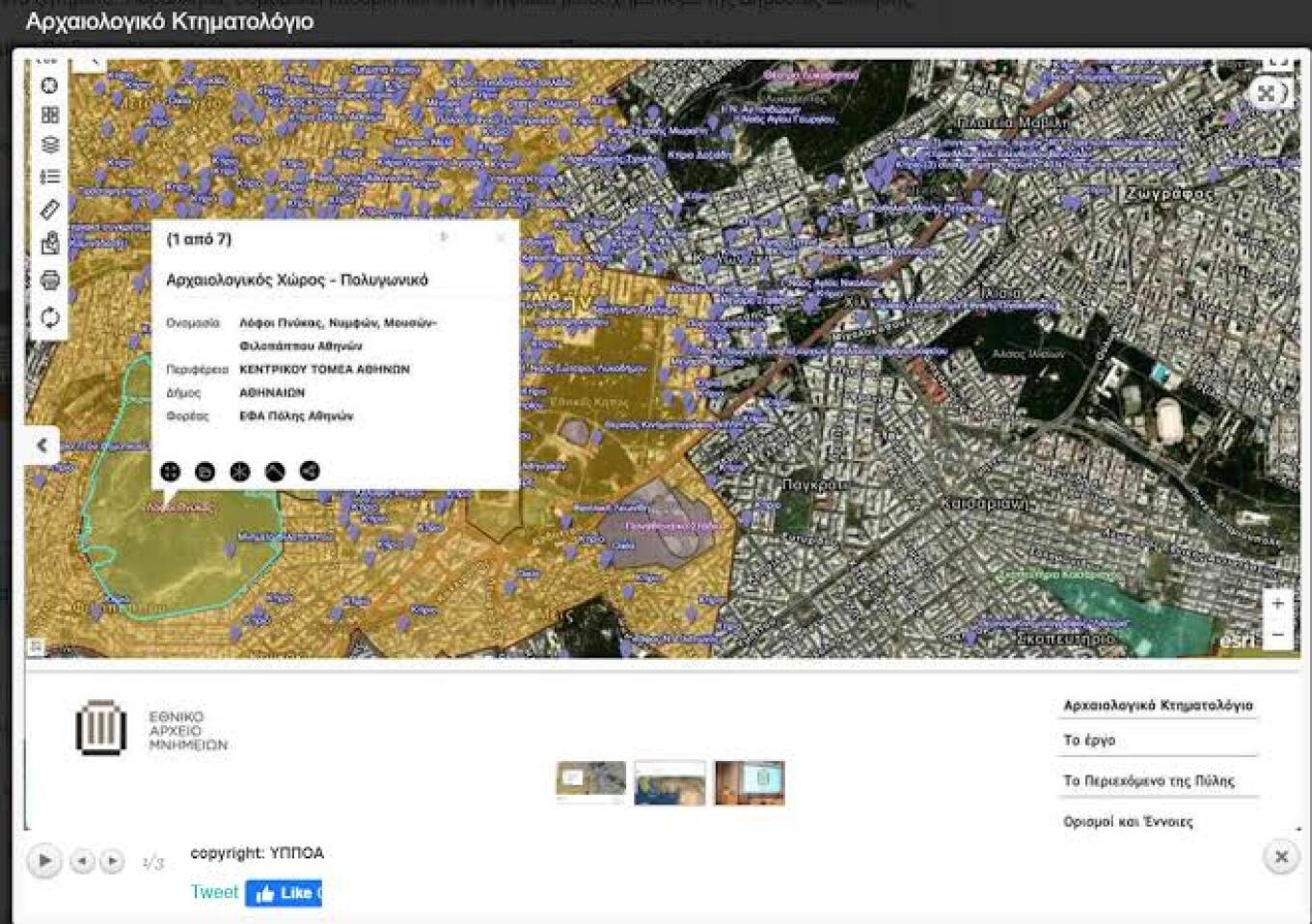
1. Further Development of the Archaeological Cadastre on the National Cadastre Framework
The first axis concerns the further development of the Archaeological Cadastre using National Cadastre resources, including cadastral maps, orthophoto maps, and National Cadastre Identification Numbers (KAEKs).
Through this approach, archaeological, administrative, and geospatial information will be integrated into a common reference system, reducing inconsistencies between different databases and improving the accuracy and interoperability of public administration information systems.
The unified mapping will provide clearer and more consistent information to public authorities, citizens, and professionals involved in procedures concerning real estate.
2. Comprehensive Recording of Ministry of Culture Property
The second axis focuses on the more complete and documented registration of the real estate assets managed by the Ministry of Culture.
Matching properties with cadastral records and their corresponding KAEKs will strengthen protection of public property against illegal occupation, facilitate more effective management, and create better conditions for the protection and promotion of archaeological sites and monuments.
3. Geospatial Mapping of Protected Cultural Heritage Zones
The third axis focuses on the geospatial mapping of officially designated boundaries of archaeological sites, historic locations, buffer zones, monument surroundings, and Protection Zones A and B.
This mapping will provide a clearer picture of each property’s location in relation to protected areas and the restrictions arising from archaeological legislation. It will also contribute to simplifying administrative procedures, such as property transfers and the issuing of building permits.
Joint Technical Teams and New Digital Services
To implement the cooperation, joint technical working groups will be established to harmonize data, define common standards, and expand interoperability.
At the same time, new digital services and information initiatives will be designed, with the goal of making the Archaeological Cadastre more user-friendly and accessible, while connecting it with the Digital Mapping Platform of the Hellenic Cadastre.
Statements from Government Officials
Culture Minister Lina Mendoni stated:
“The protection and promotion of our cultural heritage require modern tools, reliable data, and meaningful cooperation between public institutions. Expanding our cooperation with the Ministry of Digital Governance and Artificial Intelligence and the Hellenic Cadastre significantly strengthens the Archaeological Cadastre, creating a unified and reliable geospatial framework for mapping archaeological sites, monuments, historic locations, and their protection zones. At the same time, we are safeguarding the real estate property of the Ministry of Culture, simplifying administrative procedures, and providing clearer and more complete information to citizens, professionals, and public services. Utilizing the potential of digital transformation is a strategic choice of the Government, so that the protection of our cultural heritage is combined with maximum efficiency, transparency, and better service for citizens.”
Deputy Minister of Digital Governance and Artificial Intelligence Christos Dermentzopoulos emphasized:
“The National Cadastre is no longer simply a system for recording real estate ownership. It is transforming into a unified geospatial infrastructure upon which the State can develop modern and interoperable digital services. Cooperation with the Ministry of Culture is a significant example of this new era. Cadastre geospatial data is being used to protect our cultural heritage, safeguard public property, and improve services for citizens and professionals. Our goal is less uncertainty, less bureaucracy, and greater transparency in every process related to real estate, demonstrating in practice the multiplier value created when public digital infrastructures work together.”
The Director General of the Hellenic Cadastre, Olympia Markellou, added:
“As cadastral mapping enters its final phase, the Hellenic Cadastre is assuming the role of a shared data infrastructure for public administration. Cooperation with the Ministry of Culture demonstrates in practice how the unified geospatial database of the Cadastre can support specialized thematic registries, reduce inconsistencies, and facilitate citizens, professionals, and public services. We are working to ensure that information becomes more unified, clear, updated, and easily accessible.”
Ask me anything
Explore related questions




