





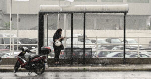
Severe weather has begun sweeping across Attica, with heavy rain and thunderstorms affecting several parts of the Athens metropolitan area around midday on Tuesday (13 October).
According to reports so far, intense rainfall has been recorded in Ano Glyfada, Ano Liosia, Kantza, Mandra, Koropi, Palaio Faliro and Kalyvia, among other areas.
The storms are expected to continue over the coming hours, with the Hellenic National Meteorological Service (EMY) warning of worsening conditions, including heavy rainfall, thunderstorms and possible localised hailstorms across much of Greece.
Weather service upgrades emergency warning
Earlier, EMY upgraded the severe weather bulletin it issued on Monday (12 October) to a dangerous weather warning, forecasting intense conditions throughout Tuesday and Wednesday (14 October).
A red weather warning is in force for Evia, where rainfall and thunderstorms are expected to be particularly severe and prolonged. Amber warnings have also been issued for Attica, Magnesia, the Sporades and several other parts of the country.
For Attica specifically, EMY forecasts locally severe rainfall and thunderstorms from late Tuesday afternoon until the early hours of Wednesday.
Meanwhile, exceptionally strong northeasterly winds are expected to develop across the northern Aegean from Tuesday evening, gradually spreading to the central Aegean. Winds will reach force 8 to 9 on the Beaufort scale, temporarily strengthening to force 10 in some areas, and are expected to persist until late Wednesday night.
Areas facing the most severe weather
According to EMY’s updated emergency bulletin, heavy rain and thunderstorms, potentially accompanied by localised hail, are expected across much of Greece on Tuesday (13 October) and Wednesday (14 October), particularly in coastal and maritime areas.
The weather service has issued the following warnings:
Tuesday, 13 October
- Ionian Islands, western Central Greece and the Peloponnese: Heavy rain and thunderstorms are forecast temporarily across Lefkada, Kefalonia and Zakynthos, western Central Greece and the western and southern Peloponnese until the evening. An amber warning is in force.
- Halkidiki: Severe weather is expected from midday, under an amber warning.
- Sporades and eastern Thessaly: The islands and the Magnesia regional unit will experience heavy and prolonged rainfall and thunderstorms from the afternoon. An amber warning is in force.
- Evia: Severe and prolonged storms are expected from the afternoon, with a red weather warning in effect.
- Northeastern Peloponnese, eastern Central Greece and the Cyclades: Heavy rain and thunderstorms are forecast from late afternoon, affecting Attica and particularly the western and northern Cyclades. An amber warning is in force.
- Dodecanese: Severe weather is expected from late at night, under an amber warning.
- Crete: Heavy rainfall and thunderstorms are forecast from the evening, particularly in the Chania and Rethymno regional units. An amber warning is in effect.
Wednesday, 14 October
- Evia: Severe weather will persist until late afternoon, with the red warning remaining in force.
- Northeastern Peloponnese, eastern Central Greece and the Cyclades: Heavy rain and thunderstorms will continue briefly into the early hours, including in Attica and particularly the western and northern Cyclades. An amber warning remains in effect.
- Halkidiki: Severe weather is expected to continue until the morning, under an amber warning.
- Sporades and eastern Thessaly: Heavy rain and thunderstorms will persist in the Sporades and Magnesia until the afternoon. An amber warning remains in place.
- Dodecanese: Severe conditions will continue until the afternoon, under an amber warning.
- Crete: Heavy rainfall and thunderstorms, particularly in Chania and Rethymno, will persist until late at night. An amber warning remains in force.
EMY also warned that exceptionally strong northeasterly winds, reaching force 8 to 9 and temporarily force 10 on the Beaufort scale in some areas, would affect the northern Aegean initially before gradually spreading to the central Aegean. The winds are expected from Tuesday evening until late Wednesday night.
Attica regional authorities urge residents to limit travel
The Attica regional authority’s Civil Protection services are on full operational alert ahead of the expected deterioration in weather conditions, according to an official announcement.
The authority has urged residents to exercise extreme caution and strongly recommended restricting travel to essential journeys, particularly during periods when the storms are expected to be at their most intense.
Residents have also been advised to closely follow official updates from EMY and the General Secretariat for Civil Protection at the Ministry of Climate Crisis and Civil Protection, and to comply with instructions issued by the relevant authorities.
The regional authority has issued the following safety recommendations:
- Avoid unnecessary travel, particularly during heavy rainfall and thunderstorms.
- Never attempt to cross flooded roads, torrents or streams, whether on foot or in a vehicle.
- Avoid basements and other low-lying areas where water may accumulate if flooding occurs.
- Secure objects on balconies, rooftops and in outdoor areas that could be blown away by strong winds.
- Avoid outdoor activities and do not shelter beneath trees, signs or other structures that could become dislodged.
- Strictly follow instructions issued by traffic police, the fire service and Civil Protection authorities.
A separate warning has been issued to parents, guardians and pupils ahead of Wednesday morning’s journey to school.
Even if weather conditions have eased by then, the authorities stress that particular caution will still be necessary when travelling.
Parents are advised to seek timely updates from the relevant authorities and schools regarding any additional instructions.
Ask me anything
Explore related questions




