




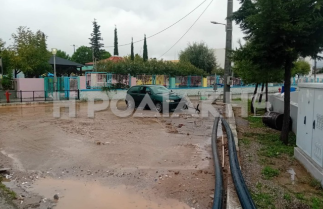
Severe disruption and extensive damage were caused by Storm Agneta, which hit Rhodes in the early hours of Monday, with the heaviest rainfall affecting villages on the island’s eastern side.
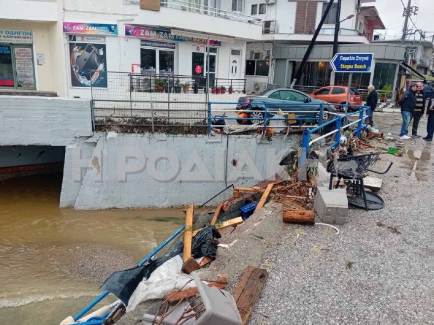
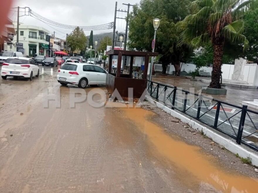
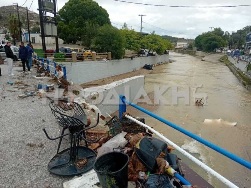
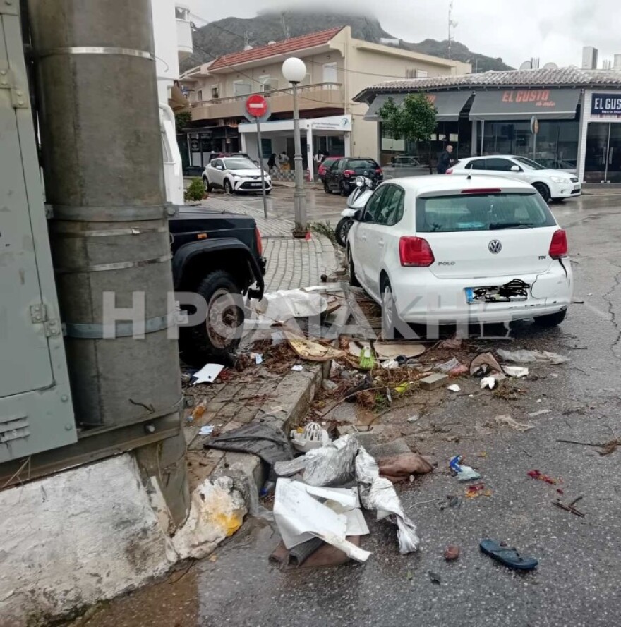
The worst affected area was Archangelos, where an overflowing river turned roads into torrents, swept away cars and caused significant damage to shops and other properties.
According to local news website Rodiaki.gr, conditions in Archangelos after 17 hours of continuous rainfall resembled scenes from January 2011, when the area was also flooded.
Flooding on a smaller scale was also reported in Afantou and villages in southern Rhodes, where heavy rain caused problems on the road network.
The severity of the weather prompted the activation of Greece’s 112 emergency alert system. A warning message was sent to residents and visitors on Rhodes at about 3.30am, urging people to limit their movements and follow instructions from the relevant authorities because of the danger posed by heavy rainfall.
Efforts are focused on removing vehicles swept away by floodwaters, clearing drains and restoring the flow of water in streams and at locations where debris has created obstructions. Work is also under way on the road network to restore traffic and reduce risks to residents.
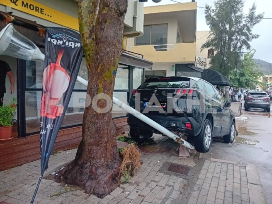
Images from Monday morning reveal the extent of the destruction in the Archangelos area of Rhodes.
Kalymnos: Boulder breaks loose and crashes into garage
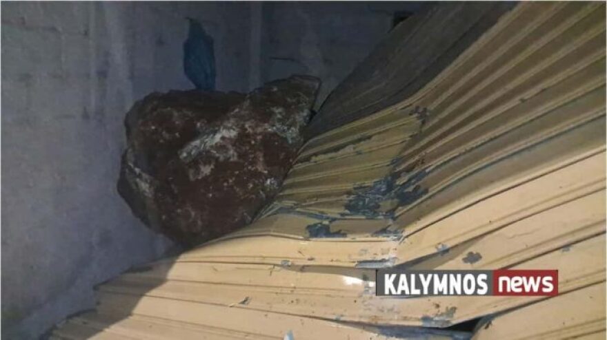
The storm also caused problems on Kalymnos, where heavy rainfall dislodged a large boulder in the Agios Vasileios area, posing a serious threat to homes further down the slope.
Speaking to the Athens-Macedonian News Agency, Kalymnos Mayor Giannis Mastrokoukos said the boulder broke away from the hillside and struck a garage as it fell. A car was parked inside, and the impact caused property damage.
According to the mayor, the fact that the rock stopped at the garage may have prevented far more serious consequences, as a residential complex lies immediately below it.

Where severe thunderstorms are expected today and tomorrow
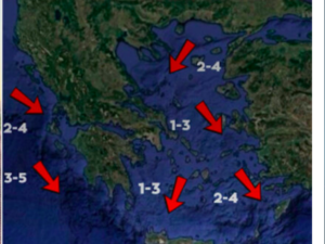
According to the updated version of the Hellenic National Meteorological Service’s emergency weather bulletin 16/2026, locally heavy rain and thunderstorms are forecast in the following areas:
Monday, 2 November:
- In the Ionian Islands, from midday onwards.
- In Epirus, western Central Greece and western and southern Peloponnese, mainly in marine and coastal areas, from the afternoon.
- In the Dodecanese, intermittently until late at night.
Tuesday, 3 November:
- In the Ionian Islands, until midday.
- In Epirus, western Central Greece and western and southern Peloponnese, until the afternoon.
- In Central and Eastern Macedonia, Thrace and the northern and eastern Aegean islands, from the early hours of the morning until late afternoon.
- In the Dodecanese, from the morning until late afternoon.
Tsatrafyllias’s forecast
According to the available forecast data, the heaviest rainfall is expected in western Greece, the northern mainland, the northern and eastern Aegean islands and the Dodecanese.
Particular caution is warranted not only because of the intensity of the thunderstorms, but also because of the possibility of large amounts of rain falling within a relatively short period, as well as persistent rainfall in some areas.
Localised flooding cannot be ruled out in areas where the ground is already saturated, the terrain is steep or drainage infrastructure is vulnerable.
Detailed forecast
For Monday, 2 November 2026, rain and severe thunderstorms are forecast from the morning in the Ionian Islands, the Cyclades and Crete, spreading from the afternoon to Epirus, western Central Greece and western and southern Peloponnese, particularly in marine and coastal areas.
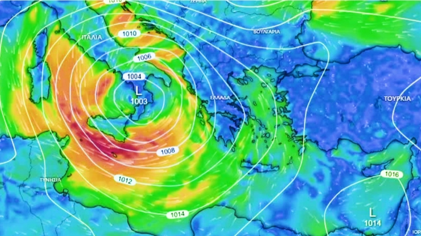
In the Dodecanese and the eastern Aegean, severe thunderstorms will persist intermittently throughout the day.
Temperatures will reach 20–21C in western Greece, Crete and the Dodecanese. It will feel noticeably chilly at night and in the early morning.
Winds in the Ionian Sea will be southerly, reaching force 8 on the Beaufort scale, while southerly winds in the Aegean will locally reach force 7.
In Attica, rain and scattered thunderstorms are expected, particularly around midday. Temperatures will range from 12C to 18C, with southerly winds reaching force 5.
In Thessaloniki, cloudy skies and localised rain are expected, with conditions deteriorating in the evening. Winds in the Thermaic Gulf will be light, while temperatures will reach 19C.
The weather over the coming days
On Tuesday, 3 November, the storm may maintain its intensity, bringing severe thunderstorms to western and northern Greece, as well as the northern and eastern Aegean islands and the Dodecanese. Southerly winds will locally reach force 8.
From Wednesday, 4 November, conditions are expected to improve gradually. However, winds will turn northerly, bringing a noticeable drop in temperatures. The cold will be felt more keenly, particularly at night and in the early morning.
Ask me anything
Explore related questions