
The Ionian Islands, western Greece, and the Peloponnese are expected to be the areas most affected by rain and thunderstorms this weekend, according to forecast maps published by meteorologist Klearchos Marousakis.
Another feature will be strong northerly winds in the Aegean, raising the possibility of sailing bans, while temperatures are forecast to drop by 6 to 8 degrees Celsius.
Marousakis described the situation as “extremely dangerous,” explaining in a post that “in many areas west of the Pindus mountains, long-lasting, continuously feeding thunderstorms will develop, capable of producing exceptionally high rainfall totals.”
Maps show the forecast from 3 a.m. Sunday to 6 p.m. Monday (in 3-hour intervals).
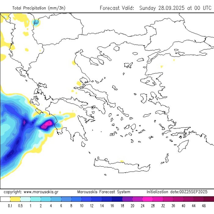
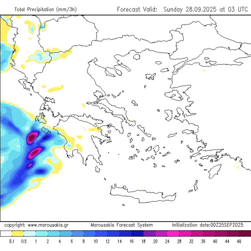
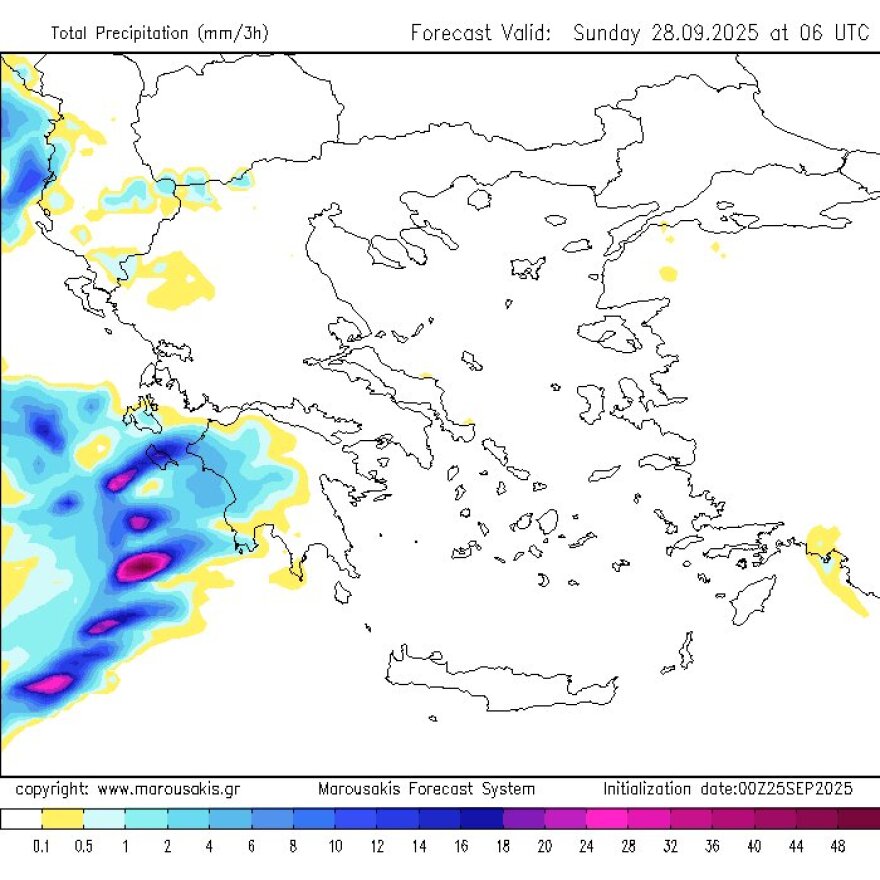
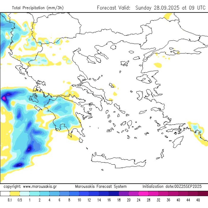
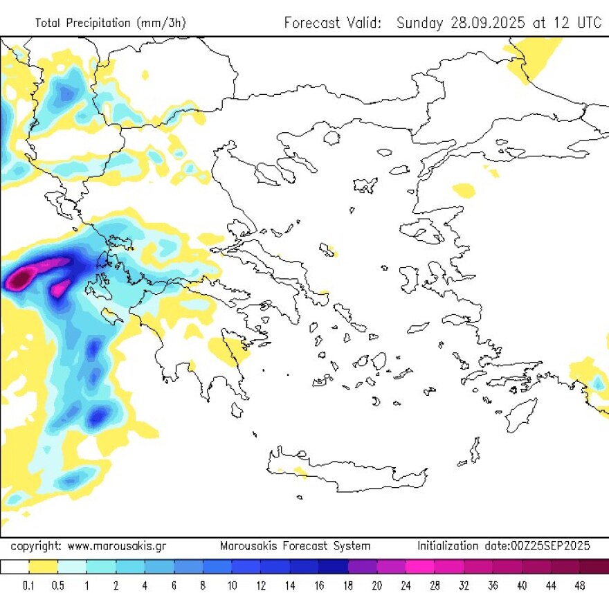
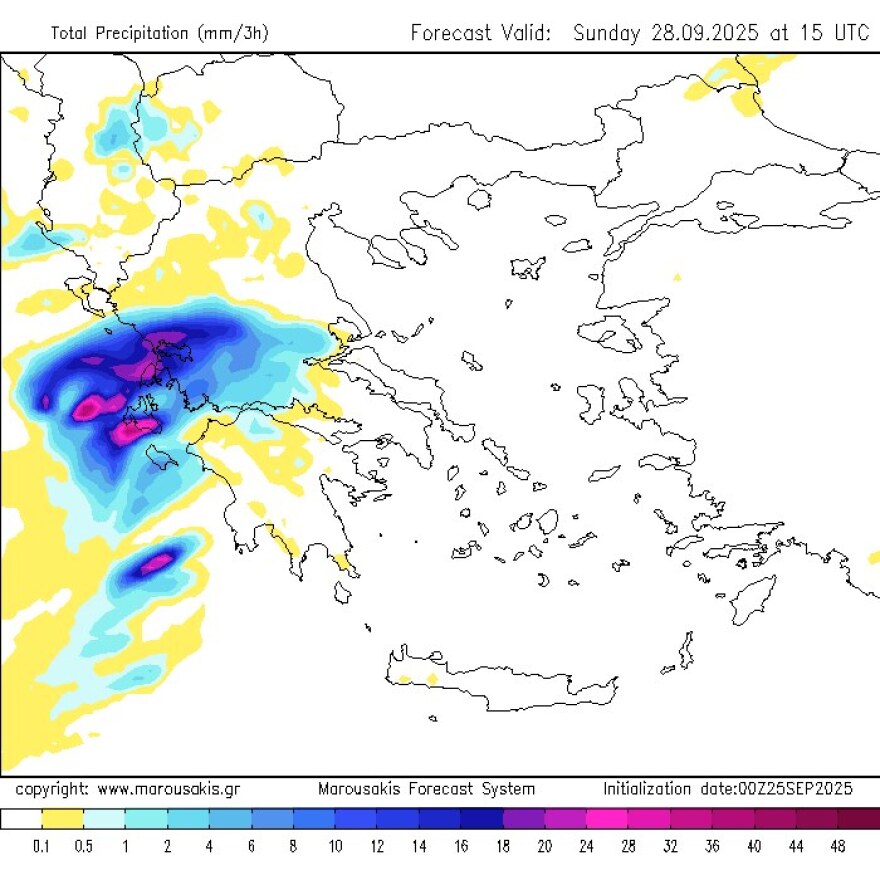
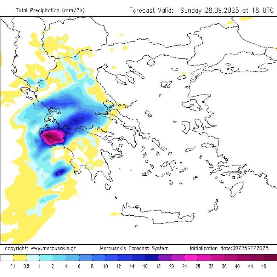
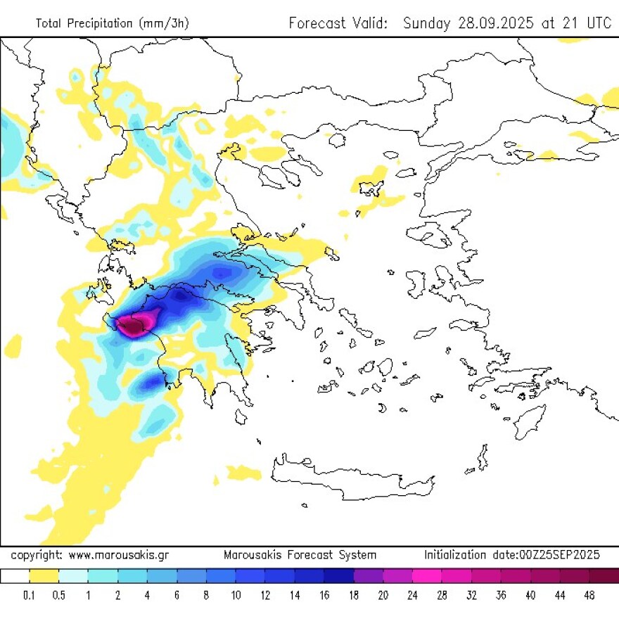
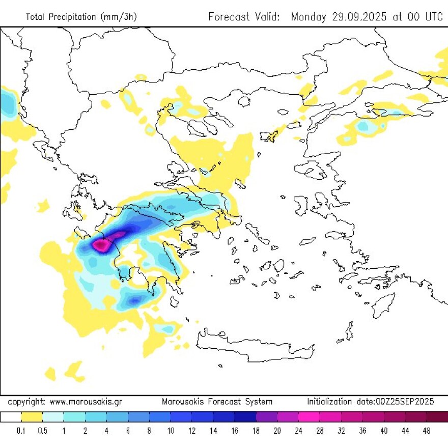
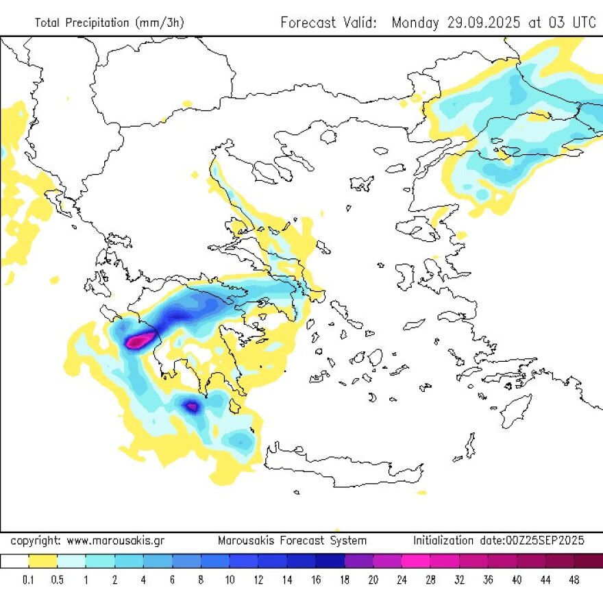
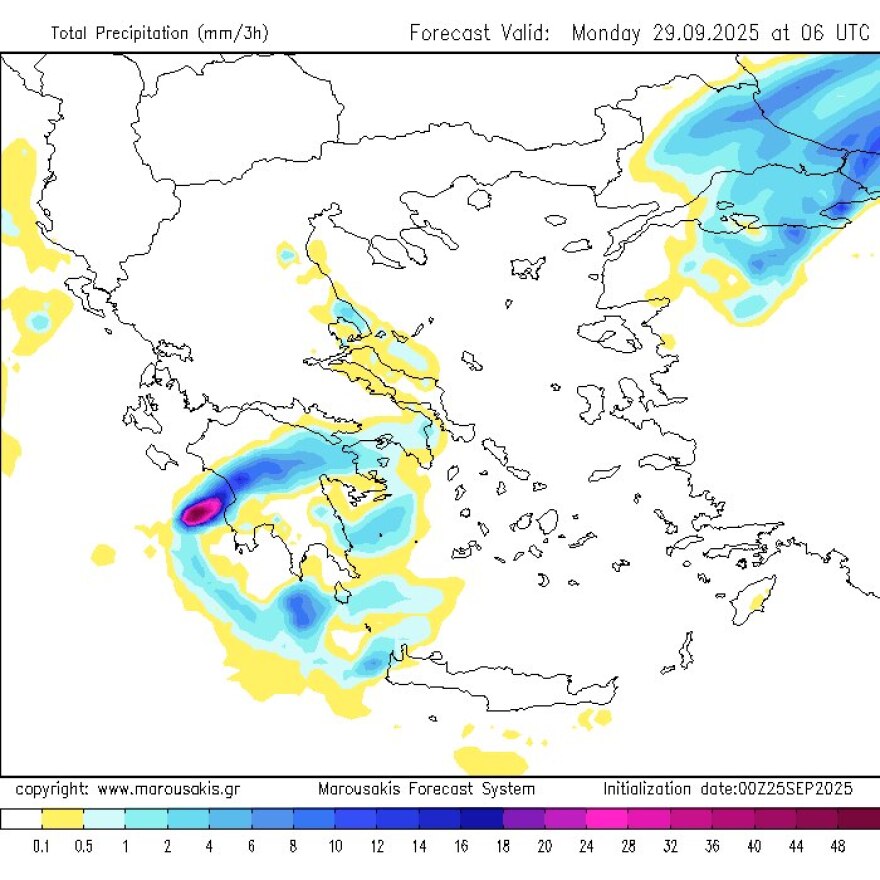
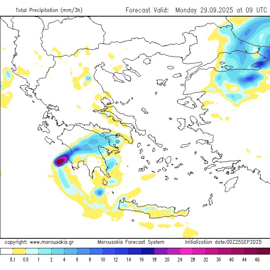
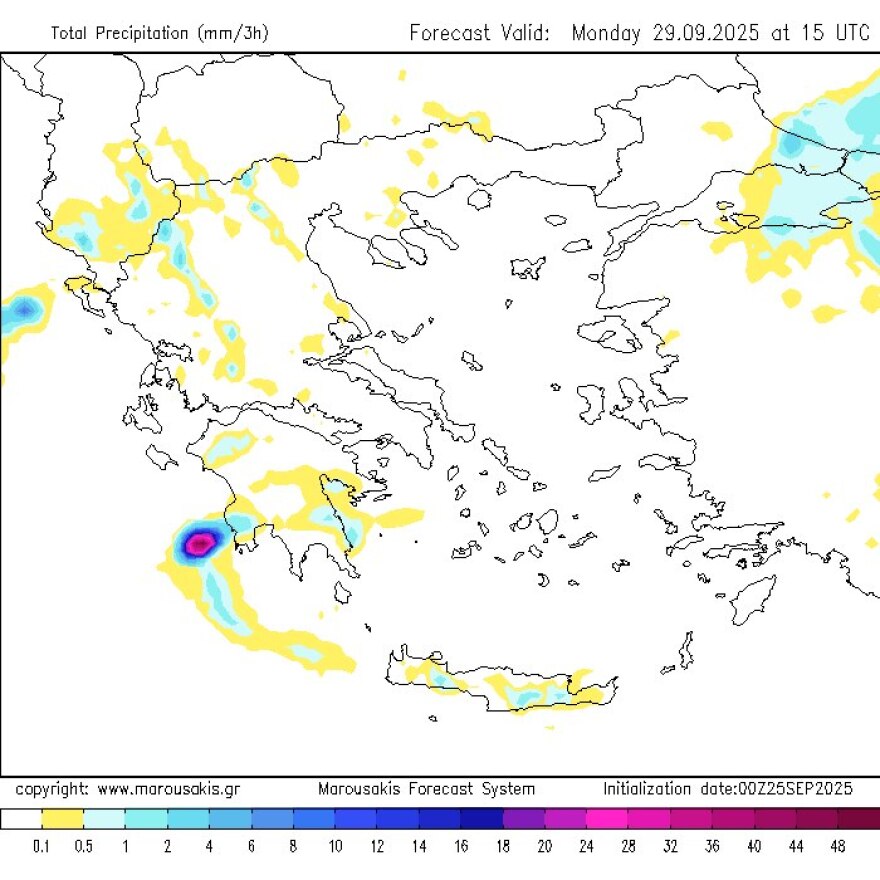
He added that “the worrying factor is that these storms will persist for many hours, continuously fueled by nearby sea surfaces, unable to move eastward due to the expected barometric setup (estimated duration more than 24 hours). This significantly increases the risk of flooding.”
Meteorologist Giorgos Tsatrafilias also warned that there will be two “danger zones” in the coming days:
- First line of risk (from early Sunday morning): Ilia, Achaia, Messinia, Zakynthos
- Second line of risk: Kefalonia–Ithaca, Arcadia, Aetolia-Acarnania
He also noted the likelihood of disruptions to ferry services in the central and northern Aegean on Friday and Saturday, along with a sharp temperature drop of 6–8°C starting Saturday.
Ask me anything
Explore related questions


