The wave of bad weather affecting almost the entire country is in full swing, with the meteo.gr network recording impressive rainfall levels in the Aegean and dense snowfall in the mountainous areas of mainland Greece.
While the calendar shows March 18, the weather resembles a “harsh” winter in many regions. According to the latest data from the automatic weather stations of the National Observatory of Athens, Wednesday’s pattern split in two: strong storms in the southern maritime areas and a “white” landscape on the highest peaks.
Koufonisia in the eye of the storm
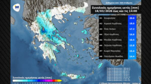
The bad weather hit the Central Aegean with particular intensity. Koufonisia topped the relevant list with 29 mm of rainfall by 14:00, followed by areas of Thessaly and Crete.
The 8 areas with the highest rainfall:
- Koufonisia: 29 mm
- Kerasia, Karditsa: 18.6 mm
- Elos, Chania: 17.2 mm
- Oxya, Karditsa: 16.6 mm
Closing
5. Mouzaki, Karditsa: 16.4 mm
6. Pezoula, Karditsa: 15.8 mm
7. Kofos, Magnesia: 15.4 mm
8. Polydroso, Phocis: 14.4 mm
Snow and in the background… dust
While the Cyclades were receiving the main volume of rainfall, in the mountainous areas of Western Macedonia, Epirus and Central Greece, the rain turned into snowfall. The map confirms widespread instability, as a total of 172 stations recorded significant precipitation, while increased dust concentrations in the atmosphere made conditions even more suffocating in the south.
Temperatures did not show significant change, remaining below normal for the season in the north, while winds in the Aegean locally reached 7 Beaufort.
According to the latest forecast data from meteo.gr / National Observatory of Athens, during the rest of Wednesday 18/03, rain is expected mainly in Central and Western Macedonia, Thessaly, Central and Eastern Central Greece, the Peloponnese, the Ionian, the Central Aegean and Crete. Snowfall is expected in mountainous areas of the aforementioned mainland regions. Storms will occur mainly in the Central and Southern Aegean and in Crete.
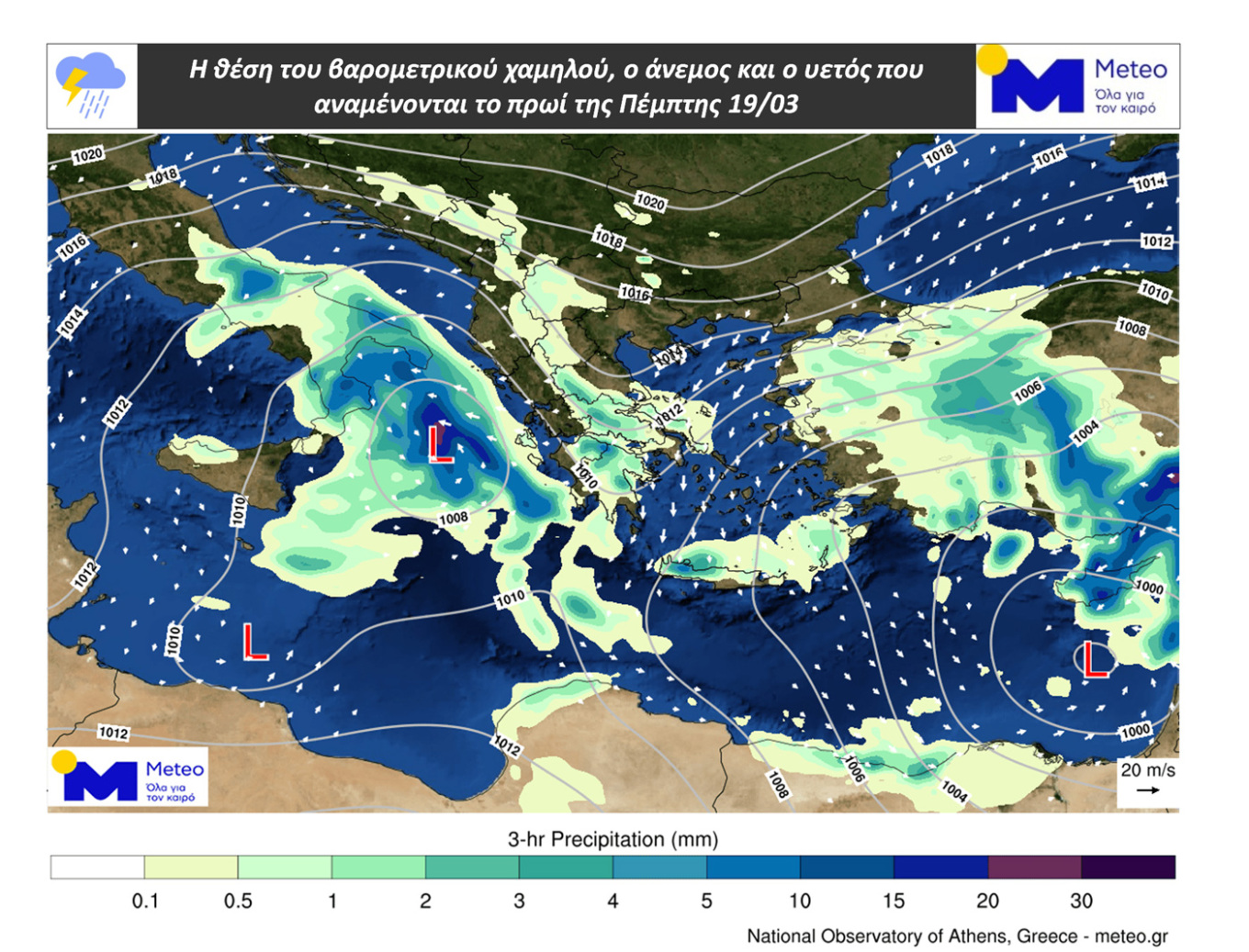
On Thursday 19/03, rain is expected mainly in Western Macedonia, the central and southern mainland, the Ionian, the Aegean and Crete, while there is a chance of storms mainly in the Southern Ionian and western Peloponnese. Snowfall will occur in mountainous areas of the aforementioned mainland regions.
On Friday 20/03, phenomena are expected mainly in the Aegean, Crete and eastern parts of Central Greece and the Peloponnese, but they will gradually weaken.
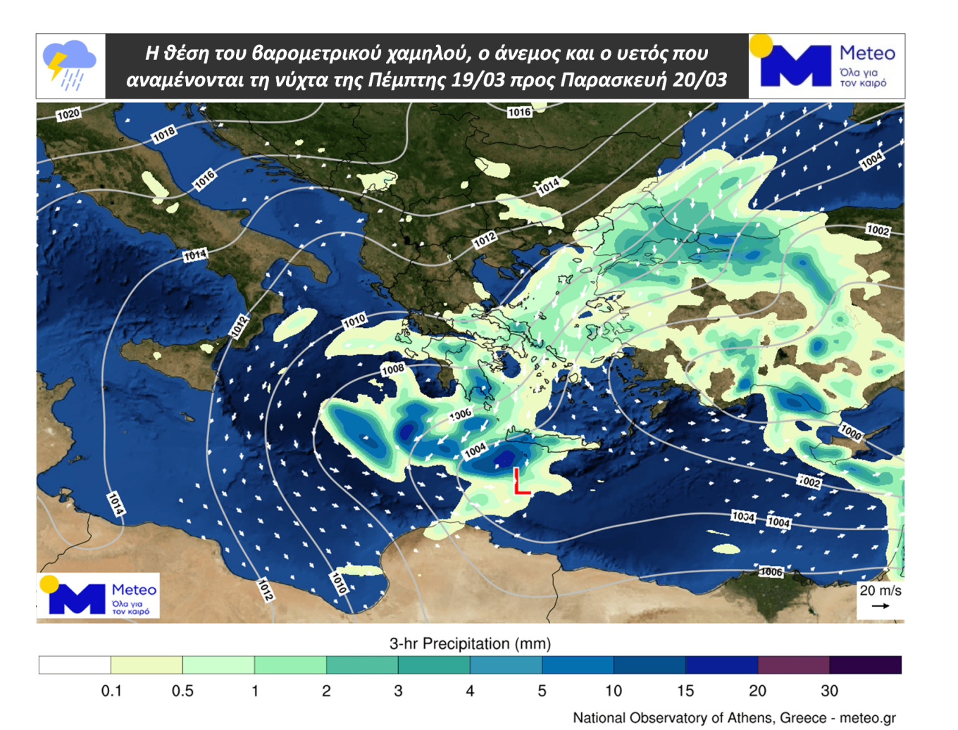
The maps show the position of the low-pressure system, the wind near the ground and the expected precipitation (a) on the morning of Thursday 19/03 and (b) on the night of Thursday 19/03 into Friday 20/03.
African dust and muddy rain in Attica – Intense phenomena in Crete and southern Greece, how long they will last
The rainfall accompanying the phenomenon, as reported by the Atmospheric Composition Information Hub in Greece (AtmoHub), has contributed to reducing dust concentrations near the surface over the country, resulting in air quality not being particularly burdened.
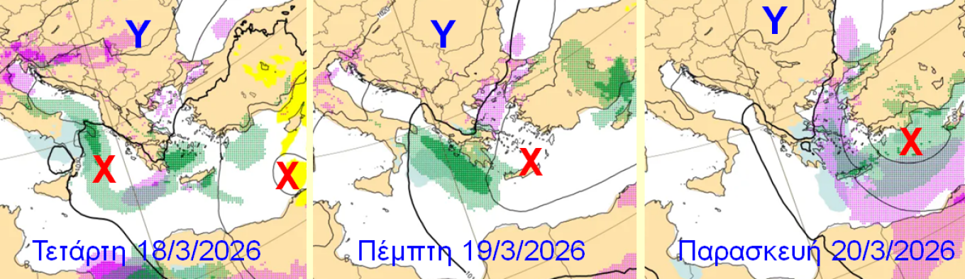
The phenomenon is expected to continue until 20/3, peaking today and tomorrow, March 18 and 19, affecting the entire country. However, according to AtmoHub, the highest dust concentrations are expected mainly in southern Greece and Crete.
The rains accompanying the phenomenon are expected to cause muddy rain:
• Wednesday 18/3: in the Ionian Islands, Western Peloponnese, Crete and the Southern Dodecanese
• Thursday 19/3: in Central Greece, including Attica.
You can follow the forecast and evolution of the phenomenon, according to data from the CAMS Atmospheric Monitoring Service, on AtmoHub’s online portal, HERE.
Ziakovoulos’ detailed forecast: How the weather will evolve in the coming days
Today, Wednesday 18/3, easterly to northeasterly winds will prevail across the country with intensities up to 7 Beaufort, and the most significant rainfall will occur in eastern mainland Greece, the Cyclades, Crete and the Dodecanese.
Additionally, local snowfall will occur in mountainous areas. Temperatures in the north will not exceed 14°C, while in the south they will reach 18°C.
On Thursday (19/3), cloudiness with local rains and storms in the western and southern country are forecast. Snow will fall in the mountainous areas of mainland Greece. Winds will blow: in the west NE to SE at 4 to 6 Beaufort, and in the east N–NE at 6 to 7 and possibly locally in the Aegean up to 8 Beaufort. Temperatures will show a further slight drop.
On Friday (20/3), the main features of the weather will be strengthened N–NE winds and low temperatures. Phenomena will be limited to eastern and southern Greece and will gradually weaken.
Over the weekend (21 & 22/3), generally weak phenomena will occur mainly in eastern and southern windward areas exposed to the N–NE flow. Winds will show slight weakening and temperatures will show a slight rise in their maximum values.
Ask me anything
Explore related questions


