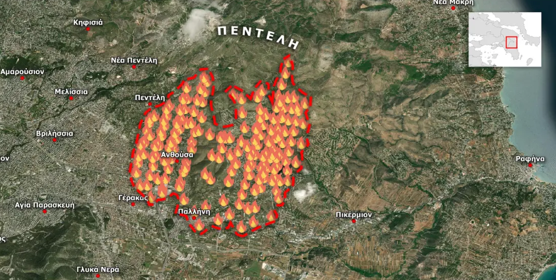
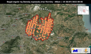
The spread of the fire that started yesterday in Penteli is presented in the maps of the Fire Information for Resource Management System (FIRMS) service of NASA.
Satellite observations from the FIRMS system show the hotspots detected by polar orbiting satellites during the early hours of Wednesday 20.07.2022.
The spread of hot spots from the Penteli massif to the south reveals the large spread of the forest fire which is driven by the strong northerly winds.
Cyprus 1974-2022: 48 years of enduring Turkish occupation & impunity – “Lobby for Cyprus” Analysis
The main feature of the weather until Thursday will be locally stormy northerlies in the Aegean, according to the latest forecast models.
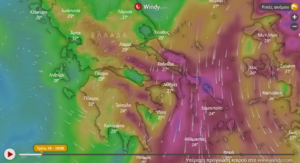
Due to the fire in Penteli the winds have strengthened further in the area, up to seven Beaufort, as it blows much more than the models predict.
The strong winds that continue to blow in the area make it difficult for the firefighters to contain the fire front.
Ask me anything
Explore related questions


