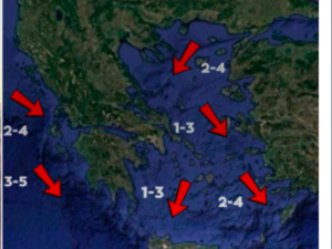
According to the latest forecast data, two cold waves seem to be approaching the whole country in the new week, one of which is certain, while the other is characterized as “possible”.
The first cold wave that will affect Greece will generally be of moderate intensity and not something extreme.
From Tuesday to Wednesday, cold air masses from the central-eastern Balkan regions will visit us and will drop the temperature by about 6°C in relation to the maximum temperatures of Monday.
For example, in Attica, while on Monday the mercury will reach 14°C, on Tuesday it will fall to 11-12°C and on Wednesday to 8°C.
A similar drop in temperature is expected in other parts of the country except the western parts where no significant change in mercury will be observed.
On Tuesday morning, a few local snowfalls will occur in mountainous and semi-mountainous areas of Macedonia, Thrace and the northeastern Aegean. However, it will not be something remarkable since they will leave very fast and the phenomena will be very local. It will snow a little more densely in the mountains of Crete above 1000-1100 meters. On Wednesday, snowfall will affect some parts of the country.
PM Mitsotakis: We are always on the side of the Imbrian Hellenism
For example, it will snow locally in parts of southern Halkidiki (mainly on Mount Athos above 100-200 meters, but for a very short time before dawn), in the northeastern Aegean for a while, in the Sporades (over 200 meters), in Evia (from 400 meters), in Boeotia (over 250 meters) and in Attica (over 400-450 meters), in the Cyclades (from 600 meters) and in Crete (from 700-800 meters).
It is early to tell right now, but severe cold and snow is probably coming by Friday.
Ask me anything
Explore related questions


