The Mediterranean cyclone “Ianos” is in the sea area between Sicily and the Peloponnese where it strengthened.
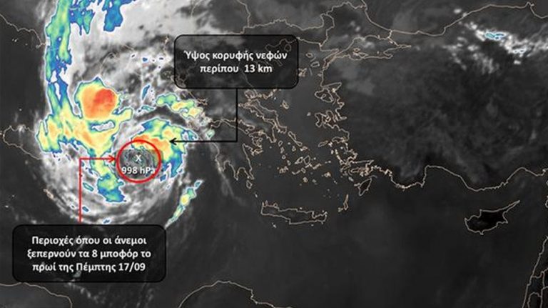
According to meteo.gr, the atmospheric pressure in its center is around 1000 hPa and by nightfall is expected to fall to the levels of 990 hPa, while the winds that accompany it were estimated by satellites at 8 Beaufort.
As the Deputy Minister of Civil Protection Nikos Hardalias announced after the extraordinary meeting that took place on Thursday morning, the regional units of Ilia, Achaia, Messinia, Arcadia, Aetolia-Acarnania, Kefalonia and Zakynthos have already been put in a state of emergency.
According to Mr. Hardalias “by the evening we will have a picture with the second wave of the storm”.
Tension in the Aegean & Eastern Mediterranean: What does Greece want?
Emily Ratajkowski accuses photographer Jonathan Leder of sexual assault, he claims she’s lying
According to the latest forecasts, “Ianos” will move towards the central Ionian and the northwestern Peloponnese where it will be in the early hours of Friday, however, the path that will follow remains uncertain, with the more likely scenario being that it will turn south.
According to meteorologists, in addition to high rainfall, “Ianos” will be accompanied by sporadic storms, winds that in places will blow at very high levels (above 10 Beaufort) and very high waves.
Meanwhile, due to the strong winds, the ferry routes on the Zakynthos-Kyllini line were interrupted, with the Ionian Islands region deciding to close the schools in Zakynthos, Kefalonia and Ithaca on Friday.
Ask me anything
Explore related questions


