
When the devastating Athens earthquake struck in September 1999, scientists were astonished to discover that it originated from an unknown fault, the Parnitha fault. In the years that followed, the country’s top scientific institutions attempted to map Attica’s faults – and they succeeded.
Until yesterday, when seven earthquakes shook the capital, originating from a fault unknown to seismologists.
The micro-fault, with a shallow focal depth of 8.7 kilometers (which explains why the tremors were felt), caused consecutive earthquakes ranging from 2.3 to 2.7 on the Richter scale, with the epicenter in Agia Paraskevi. It was identified as one of Attica’s unknown faults. Is this dangerous? Could other small, unknown faults pose a threat to the capital?
“No,” says Efthymios Lekkas, President of the Earthquake Planning and Protection Organization, speaking to protothema.gr. He explains, “Yesterday, we witnessed the activation of a small fault, approximately one kilometer in length, which does not appear on the map and was not previously recorded.” The emeritus professor of Dynamic, Tectonic, Applied Geology & Natural Disaster Management at the National and Kapodistrian University of Athens further explains that this fault starts near the Ministry of Infrastructure and Transport and extends eastward, ending near the edge of Holargos’ urban area and just before Kifisias Avenue.
Scientists reached this conclusion by mapping the distribution of the earthquake epicenters along the fault, from east to west.
This fault, Lekkas notes, has limited seismic potential. Although small tectonic structures, or “micro-faults” as scientists call them, can theoretically produce earthquakes up to 6–6.5 Richter, it doesn’t necessarily make them dangerous. Many are located underwater, at significant depths, or in other conditions that mitigate risk.
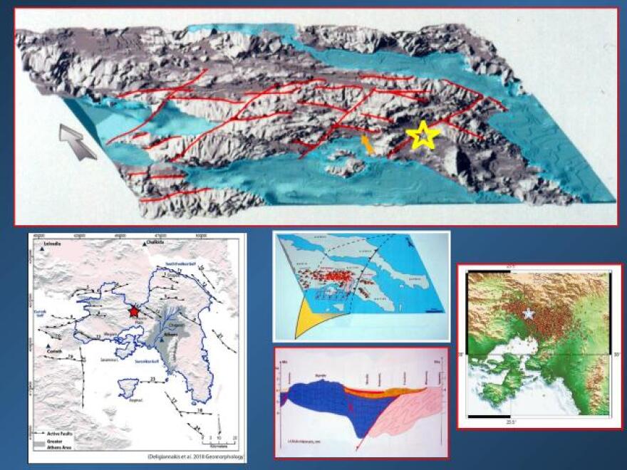
The most extensive information on Attica’s faults comes from a comprehensive study conducted after the 1999 earthquake in a joint effort between the University of Athens and the National Technical University of Athens. Other studies followed, some specialized in regions such as eastern and western Attica.
However, some faults escaped detection. These are faults that do not visibly surface and are identified only through geophysical surveys – which typically focus on larger faults. Additionally, it is nearly impossible to conduct such surveys within urban environments.
So, how many active faults, small or medium-sized, have scientists recorded in Athens’ urban fabric? The answer: “Several dozen.” Most are too small to cause damage due to their limited seismic capacity. However, exceptions exist, as demonstrated by the destructive Parnitha earthquake, where proximity to urban centers increased seismic risk.
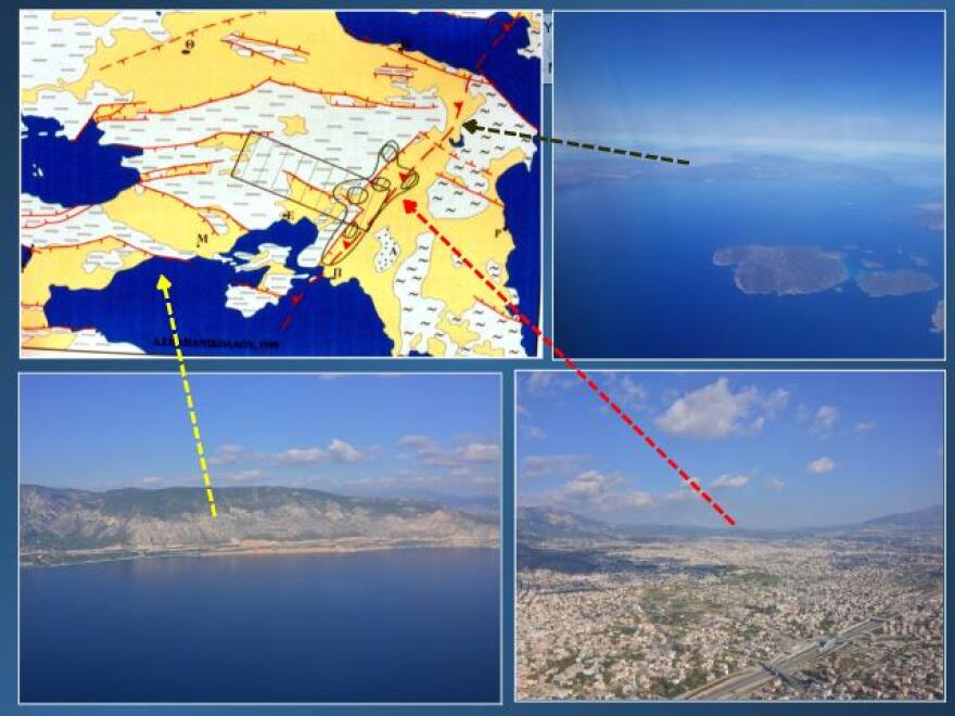
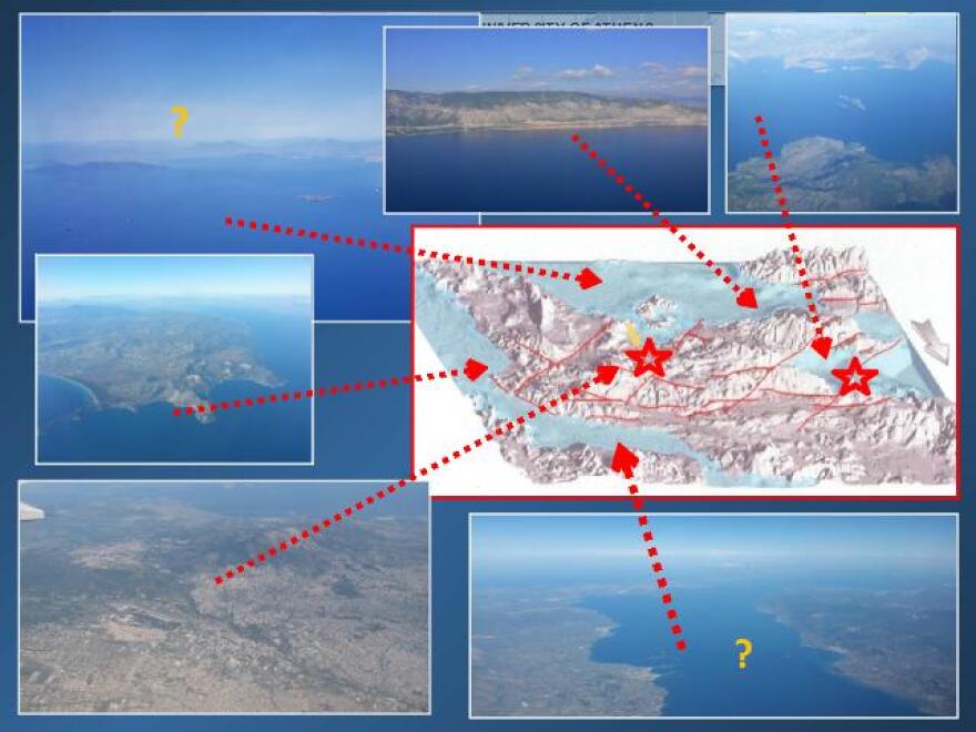
Faults like these were recorded in studies conducted after the 1999 earthquake in regions such as the South Euboean Gulf, Porto Rafti, Nea Makri, Saronic Gulf, Corinthian Gulf, Northern Parnitha, and Kakia Skala, as well as densely populated areas of the capital.
Notable examples include the small/medium faults traversing areas such as Marousi-Melissia-Vrilissia-Gerakas, Salamina-Perama-Keratsini-Moschato, Alimos-Elliniko-Argyroupoli-Glyfada, Chalandri-Agia Paraskevi, Ekali-Nea Erythraia-Drosia-Dionysos, Stamata-Nea Makri, Zephyri-Kamatero, Aspropyrgos, Koropi, Fyli-Ano Liosia, and more.
Faults like those in Penteli, Rafina, and Spata are of unknown potential, identified in older studies. Meanwhile, faults in the Saronic Gulf, which can produce intermediate-depth earthquakes up to 6.5 Richter, have historically caused events like the 6.5 Richter earthquake in August 1962, with minor damages and an epicenter in Acrocorinth.
Geophysical surveys and epicenter records of small and medium-sized earthquakes help map Attica’s faults and the broader region. Using the available data, scientists can project these faults onto three-dimensional maps (as shown in the accompanying photos) to study their dynamics.
The Most Dangerous Faults
Based on scientific data from the past 120 years, the faults and fault systems posing the greatest threat to Attica include the following, as explained by seismologist Gerasimos Papadopoulos:
- The Oropos Fault: Responsible for a significant earthquake on July 20, 1938, causing many casualties and extensive damage.
- The Alkyonides-Skino-Kapareli Faults: Among the country’s most dangerous, these faults caused the February 24, 25, and March 4 earthquakes in 1981. These events led to many casualties and damages in the epicentral area and significant structural damage across Attica.
- The Fyli Fault in Parnitha: This fault caused the devastating September 7, 1999 earthquake, resulting in numerous casualties and building collapses in western Athens and damage throughout Attica. The neotectonic fault in South Parnitha-Fyli was previously unknown to seismologists, as it had not been activated before, leaving no records or history of its existence.
And the….Neighbors
Attica is also threatened by highly dynamic faults in its broader “neighborhood.” The most famous, albeit distant, are those of the Corinthian Gulf, stretching from East Corinthian to Thebes, Avlona, and Oropos. This fault zone has produced deadly earthquakes in the past, ranging from 6 to 6.5 Richter, between 1858 and 1914.
The Atalanti Fault, located approximately 130 kilometers from Athens, caused two seismic tremors in 1894 – measuring 6.7 and 6.4 Richter a week apart – resulting in damage to Athens and Piraeus. Although its total length does not exceed 34 kilometers, if fully activated, it could produce earthquakes up to 7.2 Richter.
However, its individual segments are activated independently, generating earthquakes between 5.5–6.6 Richter, while only the Atalanti segment might be linked to earthquakes around 6.0 Richter.
Ask me anything
Explore related questions


