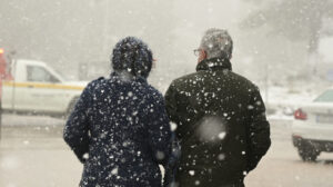
The cold weather has gripped the country for the past few days, with temperatures expected to drop further in the coming days.
Meteorologist Klearchos Marousakis made a post referencing Tsiknopempti (Smoky Thursday) in 2004, when a strong cold front brought snow and freezing temperatures across Greece, including Attica.
In his post, Marousakis wonders if we could see a similar event this year, noting that “our global model ‘Hercules’ has been consistently predicting an exceptionally cold scenario for the upcoming week.”
Marousakis’ Post: Could 2025 Mirror 2004?
“It was Tsiknopempti, February 12, 2004, when a severe cold snap and heavy snowfall hit several parts of our country from the north. Attica was significantly affected at the time.
Will we experience something similar 21 years later?
For days now, our global model ‘Hercules’ has strongly indicated a particularly cold scenario for the upcoming week. This morning’s data continues to support this trend, even suggesting it could extend toward Ash Wednesday.
We are closely monitoring the situation and will provide updates as fresher and more stable data comes in. For now, we treat this as a developing trend.”
Successive Cold Waves from Northern Europe
In a follow-up post on Wednesday afternoon (February 12), Marousakis emphasized that next week’s weather patterns appear particularly intense. “Successive cold waves from northern Europe seem poised to hit Greece with great force,” he noted.
His post included a video illustrating this potential development, while stressing that further data is needed for a clearer forecast.
Weather Forecast for Thursday, February 13
Cloudy conditions with localized showers are expected in the Ionian, parts of the central and southern mainland, and later in western Crete and Evia. Isolated thunderstorms may occur, primarily over the Ionian Sea. Snowfall is likely in mountainous regions, including Evia.
Winds:
- West: Southeast 4-6 Beaufort, locally reaching 7 in the Ionian.
- East: Easterly 3-4 Beaufort, except in the Dodecanese, where they will be northwesterly at 4-6 Beaufort.
Temperatures:
- North: 9-11°C
- West & South Aegean: 13-15°C
- Elsewhere: 11-13°C
- Morning frost in central and northern regions
Regional Forecasts
Macedonia & Thrace:
- Light rain possible in western Macedonia, with snowfall in the mountains.
- Winds: Variable, 2-4 Beaufort.
- Temperature: -3°C to 11°C, lower in western Macedonia (down to 6°C).
Ionian Islands, Epirus, Western Sterea, Western Peloponnese:
- Snowfall in the continental mountains.
- Temperature: 6-14°C (inland Epirus: 0-6°C).
Eastern Sterea, Evia, Eastern Peloponnese:
- Winds: Easterly, 3-4 Beaufort.
- Temperature: 2-13°C.
Cyclades & Crete:
- Cloud cover increasing, with local rain mainly in western Crete.
- Winds: Variable, 3-4 Beaufort.
- Temperature: 8-15°C.
Eastern Aegean Islands & Dodecanese:
- Winds: Northeastern 3-4 Beaufort in the north; northwesterly 4-6 Beaufort in the south, gradually weakening.
- Temperature: 5-14°C.
Thessaly:
- Increasing clouds, with light rain and mountain snowfall.
- Winds: Easterly, 3-4 Beaufort.
- Temperature: 2-11°C.
Attica:
- Partly cloudy.
- Winds: Easterly, 3-4 Beaufort.
- Temperature: 4-13°C (2°C lower in the north).
Thessaloniki:
- Variable cloud cover.
- Winds: Light, 3 Beaufort.
- Temperature: 3-10°C.
Extended Forecast
Friday, February 14:
Increasing cloud cover with rain and occasional thunderstorms, mainly in the Ionian, Evia, and the Aegean. Snowfall possible in northern mountains. Temperatures will rise slightly.
Saturday, February 15 – Monday, February 17:
Unsettled weather continues, with localized rain and thunderstorms, mainly in the Ionian, Crete, the Aegean, and the Dodecanese. Snowfall possible in central and northern mountain regions.
- Winds:
- South, 3-6 Beaufort.
- Later shifting to northerly in the Ionian at 3-5 Beaufort.
- Temperature:
- Gradual increase, particularly in central and northern areas.
- A slight drop is expected by Monday.
Stay Updated
Meteorologists will continue monitoring the situation and provide updates as new data emerges. Stay tuned for further forecasts in the coming days.
Ask me anything
Explore related questions