The health of forests across Greece is being mapped through a project run by Aristotle University of Thessaloniki (AUTH) as part of the National Microsatellite Program. Scientists are collecting data using satellite imagery and producing maps that show forest conditions, biodiversity, fuel loads, and the state of ecosystems after wildfires.
The research project is being implemented by AUTH’s Laboratory of Forest Management and Remote Sensing, in collaboration with the National Observatory of Athens and the companies Geosystems Hellas, Nerco, and MPLegal. It combines modern satellite systems with field data previously gathered by Forest Services. The aim is to develop standardized methodologies that will help protect ecosystems from the destructive impact of wildfires.
“This is a program with a budget of around one million euros, launched in August 2024 and running until July 2026. It has five thematic areas: mapping forest vegetation and fuel types, monitoring forest health, biodiversity, and forest risks and threats,” explained Assistant Professor Dimitris Stavrakoudis of the Department of Forestry and Natural Environment, speaking to the Athens-Macedonian News Agency.
He added: “We are carrying out long-term monitoring of forest vegetation species across the country, something expected to make a significant contribution to protecting ecosystems, preserving habitats, and safeguarding natural landscapes.”
The project also involves mapping fuel loads to aid fire-prevention planning and ecosystem management in the face of climate change. Satellite data are being used to detect areas affected by disease and to monitor biodiversity, with a particular focus on forest plant species. At the same time, potential threats in ecologically sensitive areas—such as Natura 2000 sites and National Parks—are identified to ensure protection from both human and natural hazards.
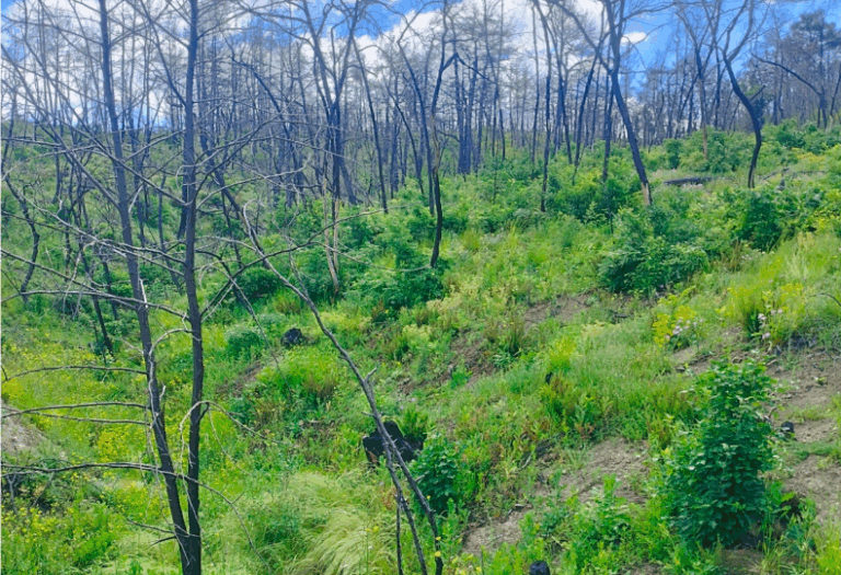
Over the past decade, maps have been created that show forest conditions and fuel types across Greece. “What we’re seeing is that forests have undergone major changes due to wildfires, especially in places like Evia and southern Attica, where vegetation has been degraded to very low levels,” said Stavrakoudis.
According to him, forested areas are not disappearing completely, since they regenerate—provided they are left untouched and do not burn again. However, it takes 15 to 20 years for a forest to become productive again.
He emphasized the importance of mapping vegetation types, since grouping areas by fuel load helps build fire-spread models. “This information is essential for forest management: it allows us to see which areas contain the most flammable materials and apply the right management measures.”
Once the project is complete, the Ministry will be responsible for maintaining and utilizing the platform.
The project is part of the National Microsatellite Program of the Ministry of Digital Governance (through the Hellenic Space Center), with the support of the European Space Agency (ESA) and funding from the Recovery and Resilience Facility.
Details of the Sat4FOREST project will be showcased at the Thessaloniki International Fair (Pavilion 17, Stand 2) on September 11–12.
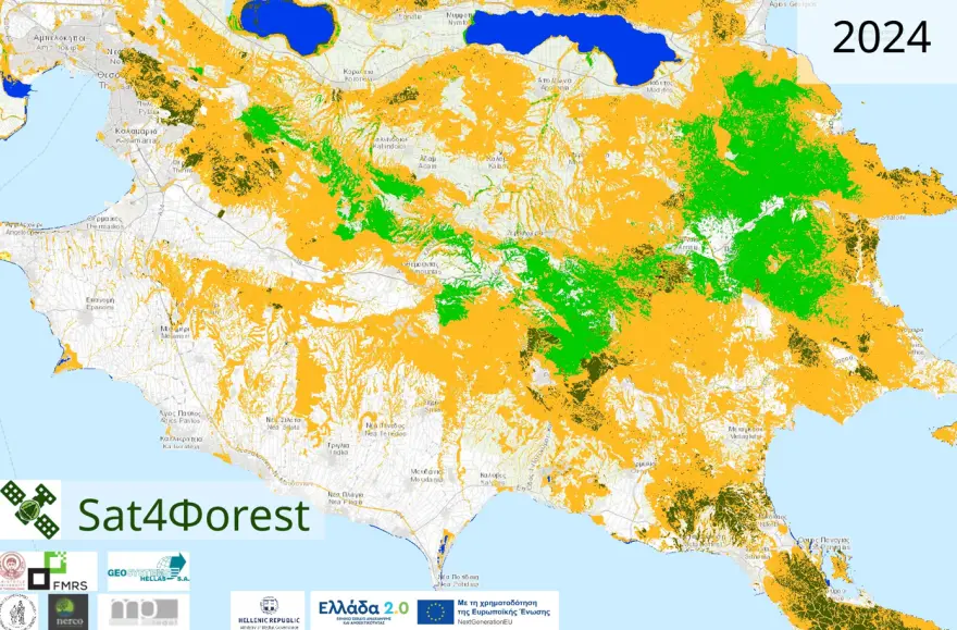
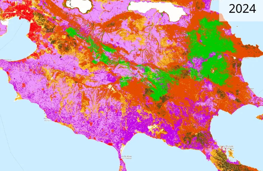
Professor Stavrakoudis also shared forest species and fuel load maps of Chalkidiki from 2024.
Ask me anything
Explore related questions


