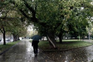
A new cycle of weather deterioration starts today (Tuesday, 2/12), which will gradually affect the Ionian Sea and the rest of the western part of Greece.
According to meteorologist Thodoros Kolydas, the rainfall will be more on Wednesday and Thursday – as a rule watering – but should not be underestimated, especially in areas affected by the previous bad weather.
As he noted in a post, the storms that will occur will be more on Thursday night and Friday in the south, while, the highest rainfall levels this week are predicted mainly in central Macedonia, the islands of the East Aegean and the Dodecanese.
Weather forecast for Wednesday, according to the National Weather Service
In eastern Macedonia, Thrace, the East Aegean islands and the Dodecanese thin clouds that will gradually become thicker and light local rain is likely in the Dodecanese. In the rest of the country increasing clouds with showers in the west and gradually in some places in the remaining areas. Sporadic thunderstorms will mainly occur in the Ionian Sea, the western sea – coastal areas and from the afternoon in the southern Peloponnese and Crete. The phenomena are likely to be locally intense on the Ionian islands and from the afternoon in the southern Peloponnese and southern Crete.
Visibility in the morning hours, mainly on the mainland, will be limited in places. Winds will blow east southeast 3 to 5 Beaufort, in the Ionian Sea 5 to 6 and from the afternoon locally 7 Beaufort.
The temperature will reach 12 to 15 degrees Celsius in the central and northern mainland, in the Ionian, the northern Aegean and the rest of the mainland up to 16 to 18 degrees Celsius and in the rest of the island country up to 19 to 20 degrees Celsius.
Ask me anything
Explore related questions