






Severe weather is moving in, bringing thunderstorms, hail, lightning and a sharp drop in temperatures, with several areas expected to be affected.
A large part of the country is coming under the grip of severe weather from today, Tuesday, for at least 24 hours, with the National Meteorological Service (EMY) having earlier issued a severe weather warning for rain, thunderstorms and lightning, along with a sharp drop in temperatures. According to forecasts, large amounts of rainfall are expected, potentially reaching as much as 60 tonnes per hectare, while northerly winds over the seas will reach up to 7 Beaufort.
According to the EMY’s severe weather warning, “a deterioration in the weather is forecast from the early hours of Tuesday (22-09-2026) until the early morning hours of Wednesday (23-09-2026) in the wider area of the northwestern Aegean, with heavy rainfall and local thunderstorms that will temporarily be accompanied by a high frequency of lightning strikes, while there is a possibility of local hailstorms.”
In the same bulletin, the National Meteorological Service states that four main areas will be affected, with locally heavy rain and thunderstorms forecast:
Tuesday (22-09-2026)
a. In Thessaly (Magnesia, mainly coastal and offshore areas) from the early hours.
b. In the Sporades and Halkidiki from the early hours until the afternoon.
c. In Evia (mainly central and northern parts) from the morning until the afternoon.
Wednesday (23-09-2026)
a. In Thessaly (Magnesia, mainly coastal and offshore areas) until the early morning hours.
At the same time, Attica is expected to be less affected, with significantly lower rainfall totals compared with the main core of the weather system, mainly during the afternoon and evening hours over the same 24-hour period.
Cold front to bring severe thunderstorms and up to 60 tonnes of rain per hectare – See maps showing how the weather system will move
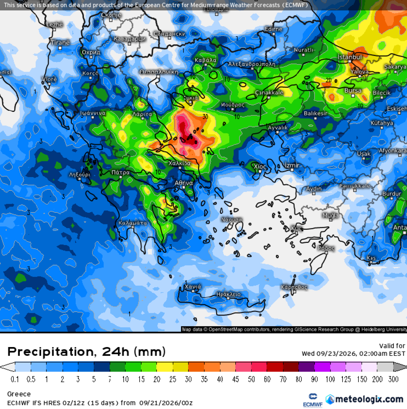
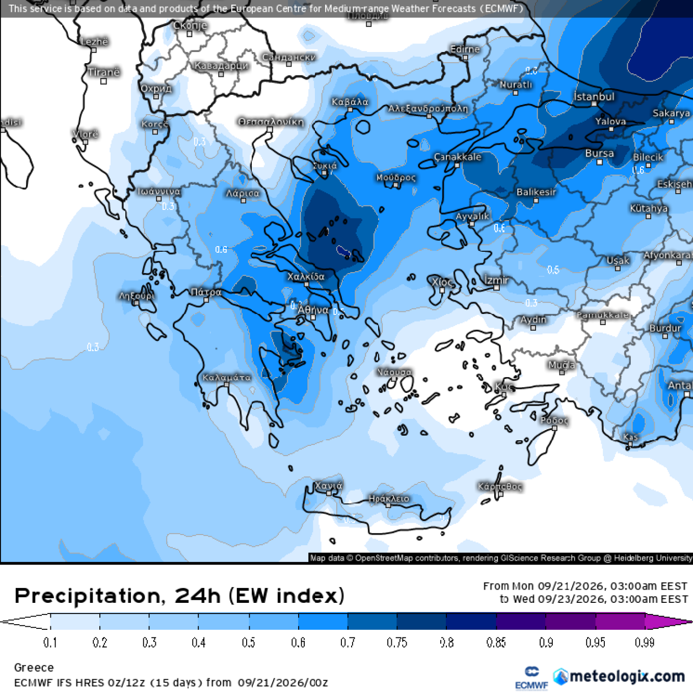
More specifically, this weather change from Tuesday through the early hours of Wednesday (23/9) is expected to mainly affect the northwestern Aegean, Magnesia, the Sporades, Halkidiki and central and northern Evia. The highest rainfall totals are expected mainly in the Sporades and northern/central Evia, locally around 30–60 mm/24 hours (or 30–60 tonnes per hectare), and possibly even higher in some areas, while significant rainfall is also expected in Magnesia, mainly in coastal and offshore areas.
The weather phenomena in the Sporades, Halkidiki and Evia are expected mainly from the early hours of Tuesday until the afternoon, while in Magnesia they will persist locally until the early hours of Wednesday.
Finally, a significant drop in temperatures of up to 8 degrees Celsius is also expected, with temperatures not exceeding 25°C in most areas, while single-digit temperatures are expected in mountainous areas tonight.
Tsatrafyllias: Sharp autumn turn with thunderstorms and an “8-degree plunge” in temperatures
As meteorologist Giorgos Tsatrafyllias noted in his forecast for protothema.gr, the weather will change abruptly from Tuesday, marking a sharp turn towards autumn, with rain, thunderstorms and a noticeable drop in temperatures, locally reaching as much as 8 degrees.
According to him, an atmospheric disturbance from the northwest will initially bring rain and thunderstorms to the Ionian Islands, Epirus, Macedonia and Thessaly, gradually spreading to Central Greece, Evia, the Sporades, the Peloponnese, the Cyclades and Crete. The weather phenomena will be locally severe, particularly in eastern and southern Greece.
At the same time, northerly winds over the seas will strengthen, reaching 7 Beaufort, while temperatures will fall significantly, locally by as much as 8 degrees, and will not exceed 25–26°C. During the evening hours, single-digit temperatures are expected even in mountainous areas.
An improvement in the weather is expected from Thursday onwards.
Ask me anything
Explore related questions




