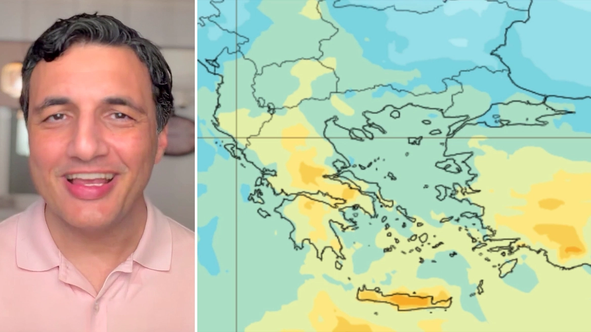
A wave of heat and African dust is currently affecting the region and is expected to continue over the next 24 hours, with temperatures reaching up to 8 degrees above normal seasonal levels, according to protothema.gr meteorologist Giorgos Tsatrafyllias.
More specifically:
For today, Monday, May 11, 2026, increased cloudiness is expected, which after midday will produce localized showers in northern areas, mainly in mountainous regions. At the same time, the transport of African dust is being favored, with the highest concentrations over central and southern Greece, especially Crete.
Temperatures will continue to rise, reaching 30–31°C by midday in eastern mainland regions and the Dodecanese, and up to 32°C in Crete. During the evening, thermometers will remain above 20°C in those same areas, while temperatures in northern and western Greece will range between 16–17°C.
Winds in the Ionian Sea will blow from the west and northwest at up to 4 Beaufort. In the Aegean, winds will be mainly southeasterly, reaching up to 6 Beaufort in southern areas.
In Attica, cloudy conditions and dust are expected. Winds will be light, while temperatures will range from 16°C to 28°C.
In Thessaloniki, there is a slight chance of midday rainfall. Winds in the Thermaic Gulf will remain weak, and temperatures will range between 15°C and 25°C.
On Tuesday, the warm air intrusion will peak, with temperatures exceeding 30°C in many eastern and southern regions. Local temperatures may even reach 33–34°C in Boeotia, Evia, and Argolis, while Attica could see 31–32°C.
In addition, dust concentrations will remain elevated over the eastern and southern island regions.
From Wednesday onward, the heat and dust will gradually subside, opening the way for increased atmospheric instability.
If the latest forecast data remain unchanged, from Thursday onward we can expect considerable rainfall, mainly across northern parts of the country.
Ask me anything
Explore related questions


